TopoQuest Logo
Do you find TopoQuest useful?
Help keep TopoQuest running and adding new maps/features by donating!
Bitcoin:  19c7KJd3qBynnjoSw5npx9KScwjBe4ifkT
Litecoin:  LXs6TkuXGGXo1vDsWCkWVdjQX94eUKd6ui
Home View Maps Find Maps Find Places Resources & Links


Twin Sisters, New Mexico Topographic Map

USGS Map Title: Twin Sisters, NM
USGS Map MRC: 32108H2
DRG (GeoTIFF) Download: o32108h2.tif


Neighboring USGS Topographic Map Quads:


  Granny Mountain, NM  
33108A3
 

  Copperas Peak, NM  
33108A2
 

  North Star Mesa, NM  
33108A1
 

  Reading Mountain, NM  
32108H3
 

  Twin Sisters, NM  
32108H2
 

  Allie Canyon, NM  
32108H1
 

  Silver City, NM  
32108G3
 

  Fort Bayard, NM  
32108G2
 

  Santa Rita Mine, NM  
32108G1


Map MRC Location:

N33°
W109°
N33°
W108°
H8 H7 H6 H5 H4 H3 H2 H1
G8 G7 G6 G5 G4 G3 G2 G1
F8 F7 F6 F5 F4 F3 F2 F1
E8 E7 E6 E5 E4 E3 E2 E1
D8 D7 D6 D5 D4 D3 D2 D1
C8 C7 C6 C5 C4 C3 C2 C1
B8 B7 B6 B5 B4 B3 B2 B1
A8 A7 A6 A5 A4 A3 A2 A1
N32°
W109°
N32°
W108°

Twin Sisters, NM USGS 1:24K Topographic Map Preview:
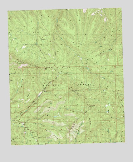
Twin Sisters, NM USGS Topographic Map
Click on map above to begin viewing in our Map Viewer.

This topographic map contains these locations and features:
Feature Name Type Latitude Longitude GNIS ID View Map
00020 Water WellWellN32.9151°W108.1462°919552View Map
Allie Canyon TrailTrailN32.9201°W108.1525°903108View Map
Allie SpringSpringN32.9204°W108.1312°912673View Map
Arrastre Interpretive SiteLocaleN32.8826°W108.2242°900232View Map
Bear Canyon TrailTrailN32.9084°W108.1512°903649View Map
Ben Lilly MemorialLocaleN32.8979°W108.2456°900202View Map
Black PeakSummitN32.9095°W108.1625°903890View Map
Black Peak TrailTrailN32.9173°W108.1695°903892View Map
Cherry Creek CampgroundLocaleN32.9142°W108.2242°905080View Map
Gila Scout CampLocaleN32.9606°W108.1789°906543View Map
Gloden Rule MineMineN32.8779°W108.2117°914970View Map
Jaybird CanyonValleyN32.9795°W108.1975°907333View Map
Little Cherry CreekStreamN32.8926°W108.2375°908003View Map
Little Victor TunnelMineN32.8779°W108.2117°914969View Map
Lookout PointSummitN32.9678°W108.2328°900216View Map
Lookout TrailTrailN32.9304°W108.1892°908183View Map
Masons Mill (historical)Populated PlaceN32.9403°W108.1906°908455View Map
McMillan CampgroundLocaleN32.9240°W108.2137°908539View Map
McMillan SpringSpringN32.9229°W108.1878°912674View Map
Mill CreekStreamN32.8906°W108.2331°908742View Map
No Name TankReservoirN32.9689°W108.1760°912676View Map
Pine Flats CampgroundLocaleN32.9734°W108.2150°909666View Map
Pinos AltosMineN32.8876°W108.2428°914915View Map
Pinos Altos RangeRangeN32.9481°W108.2270°909729View Map
RedstonePopulated PlaceN32.9392°W108.1975°910101View Map
Sapillo TrailTrailN32.9737°W108.1667°910816View Map
Saw Mill Ruins (historical)LocaleN32.9101°W108.1856°910828View Map
Scott PeakSummitN32.9451°W108.2123°910886View Map
Signal PeakSummitN32.9245°W108.1803°911051View Map
Signal Peak TrailTrailN32.9198°W108.1912°900224View Map
Silver City Ranger DistrictForestN32.9259°W108.2450°2038679View Map
Slack Sawmill TankReservoirN32.9742°W108.2442°912675View Map
T X MountainSummitN32.9373°W108.2256°900227View Map
Three Pine TankReservoirN32.9917°W108.1718°912668View Map
Twin SistersSummitN32.8931°W108.1823°911935View Map

Note: Coordinates in the location and feature list above are referenced to NAD83 datum.


Copyright (C) 2008-2025 Ryan Niemi / Sunset Dynamics ... All Rights Reserved