TopoQuest Logo
Do you find TopoQuest useful?
Help keep TopoQuest running and adding new maps/features by donating!
Bitcoin:  19c7KJd3qBynnjoSw5npx9KScwjBe4ifkT
Litecoin:  LXs6TkuXGGXo1vDsWCkWVdjQX94eUKd6ui
Home View Maps Find Maps Find Places Resources & Links


Tygh Valley, Oregon Topographic Map

USGS Map Title: Tygh Valley, OR
USGS Map MRC: 45121B2
DRG (GeoTIFF) Download: o45121b2.tif


Neighboring USGS Topographic Map Quads:


  Friend, OR  
45121C3
 

  Postage Stamp Butte, OR  
45121C2
 

  Sherars Bridge, OR  
45121C1
 

  Wamic, OR  
45121B3
 

  Tygh Valley, OR  
45121B2
 

  Maupin, OR  
45121B1
 

  Wapinitia, OR  
45121A3
 

  Maupin SW, OR  
45121A2
 

  Dant, OR  
45121A1


Map MRC Location:

N46°
W122°
N46°
W121°
H8 H7 H6 H5 H4 H3 H2 H1
G8 G7 G6 G5 G4 G3 G2 G1
F8 F7 F6 F5 F4 F3 F2 F1
E8 E7 E6 E5 E4 E3 E2 E1
D8 D7 D6 D5 D4 D3 D2 D1
C8 C7 C6 C5 C4 C3 C2 C1
B8 B7 B6 B5 B4 B3 B2 B1
A8 A7 A6 A5 A4 A3 A2 A1
N45°
W122°
N45°
W121°

Tygh Valley, OR USGS 1:24K Topographic Map Preview:
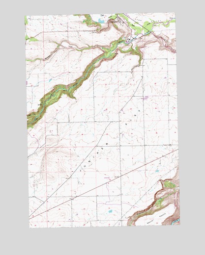
Tygh Valley, OR USGS Topographic Map
Click on map above to begin viewing in our Map Viewer.

This topographic map contains these locations and features:
Feature Name Type Latitude Longitude GNIS ID View Map
Davidson SpringSpringN45.2262°W121.1773°1129586View Map
Dry CreekStreamN45.2240°W121.2378°1153131View Map
Gray ReservoirReservoirN45.1567°W121.1441°1129583View Map
Independent Order of Odd Fellows CemeteryCemeteryN45.2369°W121.1626°1129585View Map
Juniper FlatFlatN45.1665°W121.1831°1144456View Map
Kelly CemeteryCemeteryN45.1512°W121.2095°1129587View Map
Merrell ReservoirReservoirN45.1995°W121.1532°1129524View Map
Mount Hood Post Office (historical)Post OfficeN45.2165°W121.1678°1164524View Map
Pine HollowValleyN45.2323°W121.2226°1153130View Map
Rock CreekStreamN45.1901°W121.2431°1148598View Map
Threemile CreekStreamN45.2282°W121.1792°1151190View Map
Tygh CreekStreamN45.2437°W121.1373°1151627View Map
Tygh ValleyPopulated PlaceN45.2473°W121.1731°1136854View Map
Tygh Valley Census Designated PlaceCensusN45.2418°W121.1693°2409376View Map
Tygh Valley Fire DepartmentBuildingN45.2473°W121.1758°2576603View Map
Tygh Valley Post OfficePost OfficeN45.2469°W121.1721°1166076View Map
Tygh Valley School (historical)SchoolN45.2443°W121.1690°1161805View Map
Tygh Valley Storage DamDamN45.2459°W121.1876°1159140View Map
Tygh Valley Storage PondReservoirN45.2455°W121.1878°1159141View Map
Victor Post Office (historical)Post OfficeN45.1865°W121.2012°1166103View Map
Wapinitia AirportAirportN45.1467°W121.2276°2646042View Map
Wapinitia CanalCanalN45.1540°W121.2192°1153136View Map
Wapinitia CreekStreamN45.1468°W121.1251°1151878View Map
Wasco CountyCivilN45.1600°W121.1678°1155136View Map

Note: Coordinates in the location and feature list above are referenced to NAD83 datum.


Copyright (C) 2008-2024 Ryan Niemi / Sunset Dynamics ... All Rights Reserved