TopoQuest Logo
Do you find TopoQuest useful?
Help keep TopoQuest running and adding new maps/features by donating!
Bitcoin:  19c7KJd3qBynnjoSw5npx9KScwjBe4ifkT
Litecoin:  LXs6TkuXGGXo1vDsWCkWVdjQX94eUKd6ui
Home View Maps Find Maps Find Places Resources & Links


Postage Stamp Butte, Oregon Topographic Map

USGS Map Title: Postage Stamp Butte, OR
USGS Map MRC: 45121C2
DRG (GeoTIFF) Download: o45121c2.tif


Neighboring USGS Topographic Map Quads:


  Wolf Run, OR  
45121D3
 

  Dufur West, OR  
45121D2
 

  Dufur East, OR  
45121D1
 

  Friend, OR  
45121C3
 

  Postage Stamp Butte, OR  
45121C2
 

  Sherars Bridge, OR  
45121C1
 

  Wamic, OR  
45121B3
 

  Tygh Valley, OR  
45121B2
 

  Maupin, OR  
45121B1


Map MRC Location:

N46°
W122°
N46°
W121°
H8 H7 H6 H5 H4 H3 H2 H1
G8 G7 G6 G5 G4 G3 G2 G1
F8 F7 F6 F5 F4 F3 F2 F1
E8 E7 E6 E5 E4 E3 E2 E1
D8 D7 D6 D5 D4 D3 D2 D1
C8 C7 C6 C5 C4 C3 C2 C1
B8 B7 B6 B5 B4 B3 B2 B1
A8 A7 A6 A5 A4 A3 A2 A1
N45°
W122°
N45°
W121°

Postage Stamp Butte, OR USGS 1:24K Topographic Map Preview:
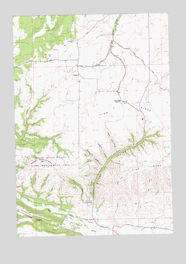
Postage Stamp Butte, OR USGS Topographic Map
Click on map above to begin viewing in our Map Viewer.

This topographic map contains these locations and features:
Feature Name Type Latitude Longitude GNIS ID View Map
Adkisson CreekStreamN45.2926°W121.1767°1116777View Map
Badger CreekStreamN45.2551°W121.1965°1137396View Map
Butler CanyonValleyN45.2593°W121.1909°1118382View Map
Catholic CemeteryCemeteryN45.3663°W121.1894°1129784View Map
Dufur DivisionCivilN45.3007°W121.2181°1938003View Map
Hendricks ReservoirsReservoirN45.3235°W121.1645°1161715View Map
Hicks CreekStreamN45.2957°W121.1698°1121788View Map
Highline DitchCanalN45.2548°W121.1462°1121825View Map
KingsleyPopulated PlaceN45.3412°W121.2006°1122769View Map
Kingsley CemeteryCemeteryN45.3600°W121.2031°1122770View Map
Kingsley Post Office (historical)Post OfficeN45.3412°W121.2006°1165486View Map
Oak CreekStreamN45.2673°W121.1892°1124899View Map
Postage Stamp ButteSummitN45.2923°W121.2287°1125599View Map
Smith PondsLakeN45.3437°W121.2285°1129785View Map
Tooter CreekStreamN45.2882°W121.1806°1128164View Map
Tygh Ridge SummitGapN45.3248°W121.1648°1128393View Map
Tygh Valley CemeteryCemeteryN45.2602°W121.2120°1129786View Map
Tygh Valley FairgroundsLocaleN45.2543°W121.2078°1128395View Map
Wasco County FairgroundsLocaleN45.2541°W121.2078°2699930View Map

Note: Coordinates in the location and feature list above are referenced to NAD83 datum.


Copyright (C) 2008-2025 Ryan Niemi / Sunset Dynamics ... All Rights Reserved