TopoQuest Logo
Do you find TopoQuest useful?
Help keep TopoQuest running and adding new maps/features by donating!
Bitcoin:  19c7KJd3qBynnjoSw5npx9KScwjBe4ifkT
Litecoin:  LXs6TkuXGGXo1vDsWCkWVdjQX94eUKd6ui
Home View Maps Find Maps Find Places Resources & Links


Wamic, Oregon Topographic Map

USGS Map Title: Wamic, OR
USGS Map MRC: 45121B3
DRG (GeoTIFF) Download: o45121b3.tif


Neighboring USGS Topographic Map Quads:


  Flag Point, OR  
45121C4
 

  Friend, OR  
45121C3
 

  Postage Stamp Butte, OR  
45121C2
 

  Rock Creek Reservoir, OR  
45121B4
 

  Wamic, OR  
45121B3
 

  Tygh Valley, OR  
45121B2
 

  Foreman Point, OR  
45121A4
 

  Wapinitia, OR  
45121A3
 

  Maupin SW, OR  
45121A2


Map MRC Location:

N46°
W122°
N46°
W121°
H8 H7 H6 H5 H4 H3 H2 H1
G8 G7 G6 G5 G4 G3 G2 G1
F8 F7 F6 F5 F4 F3 F2 F1
E8 E7 E6 E5 E4 E3 E2 E1
D8 D7 D6 D5 D4 D3 D2 D1
C8 C7 C6 C5 C4 C3 C2 C1
B8 B7 B6 B5 B4 B3 B2 B1
A8 A7 A6 A5 A4 A3 A2 A1
N45°
W122°
N45°
W121°

Wamic, OR USGS 1:24K Topographic Map Preview:
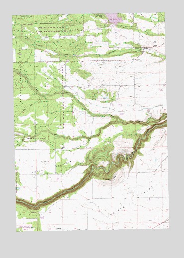
Wamic, OR USGS Topographic Map
Click on map above to begin viewing in our Map Viewer.

This topographic map contains these locations and features:
Feature Name Type Latitude Longitude GNIS ID View Map
Batty School (historical)SchoolN45.1576°W121.2656°1136965View Map
Camp MorrowLocaleN45.2493°W121.3028°1139258View Map
Cody PondsLakeN45.2248°W121.3559°1153174View Map
Gate CreekStreamN45.1876°W121.2890°1142590View Map
Graveyard ButteSummitN45.1535°W121.3002°1142991View Map
Graveyard Butte CemeteryCemeteryN45.1536°W121.2973°1153168View Map
Hazel HollowValleyN45.1798°W121.3681°1143427View Map
Hill BenchBenchN45.1937°W121.3553°1153175View Map
Juniper Flat Rural Fire Protection DistrictBuildingN45.1274°W121.2556°2576831View Map
Miller DamDamN45.1500°W121.3726°1155620View Map
Pine HollowPopulated PlaceN45.2429°W121.2945°1852676View Map
Pine Hollow Census Designated PlaceCensusN45.2420°W121.2910°2409068View Map
Pine Hollow DamDamN45.2430°W121.2903°1155642View Map
Pine Hollow ReservoirReservoirN45.2484°W121.2947°1153173View Map
Pine Hollow Reservoir Boat Ramp SouthLocaleN45.2428°W121.2919°2700087View Map
Pine Hollow Reservoir Lakeside Resort Boat RampLocaleN45.2482°W121.2901°2700105View Map
Pine Hollow Volunteer Fire Department Station 1BuildingN45.2410°W121.2905°2576663View Map
Rock Creek DitchCanalN45.1971°W121.3053°1153170View Map
Smock Post Office (historical)Post OfficeN45.1723°W121.3434°1165962View Map
Smock PrairieFlatN45.1587°W121.3640°1149774View Map
Smock School (historical)SchoolN45.1723°W121.3376°1149775View Map
Threemile DitchCanalN45.2365°W121.3303°1151192View Map
WamicPopulated PlaceN45.2282°W121.2692°1151871View Map
Wamic CemeteryCemeteryN45.2076°W121.2845°1153172View Map
Wamic Census Designated PlaceCensusN45.2256°W121.2927°2409529View Map
Wamic Post OfficePost OfficeN45.2282°W121.2692°1166122View Map
Wamic Water and Sewer AuthorityLocaleN45.2225°W121.2613°2697173View Map

Note: Coordinates in the location and feature list above are referenced to NAD83 datum.


Copyright (C) 2008-2025 Ryan Niemi / Sunset Dynamics ... All Rights Reserved