TopoQuest Logo
Do you find TopoQuest useful?
Help keep TopoQuest running and adding new maps/features by donating!
Bitcoin:  19c7KJd3qBynnjoSw5npx9KScwjBe4ifkT
Litecoin:  LXs6TkuXGGXo1vDsWCkWVdjQX94eUKd6ui
Home View Maps Find Maps Find Places Resources & Links


Union East, Mississippi Topographic Map

USGS Map Title: Union East, MS
USGS Map MRC: 32089E1
DRG (GeoTIFF) Download: o32089e1.tif


Neighboring USGS Topographic Map Quads:


  McDonald, MS  
32089F2
 

  Deemer, MS  
32089F1
 

  House, MS  
32088F8
 

  Union West, MS  
32089E2
 

  Union East, MS  
32089E1
 

  Post, MS  
32088E8
 

  Decatur NW, MS  
32089D2
 

  Decatur, MS  
32089D1
 

  Duffee, MS  
32088D8


Map MRC Location:

N33°
W90°
N33°
W89°
H8 H7 H6 H5 H4 H3 H2 H1
G8 G7 G6 G5 G4 G3 G2 G1
F8 F7 F6 F5 F4 F3 F2 F1
E8 E7 E6 E5 E4 E3 E2 E1
D8 D7 D6 D5 D4 D3 D2 D1
C8 C7 C6 C5 C4 C3 C2 C1
B8 B7 B6 B5 B4 B3 B2 B1
A8 A7 A6 A5 A4 A3 A2 A1
N32°
W90°
N32°
W89°

Union East, MS USGS 1:24K Topographic Map Preview:
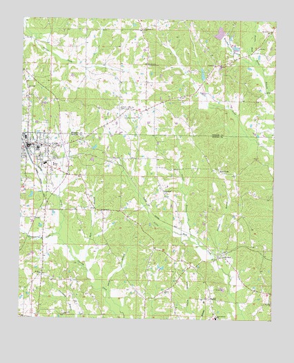
Union East, MS USGS Topographic Map
Click on map above to begin viewing in our Map Viewer.

This topographic map contains these locations and features:
Feature Name Type Latitude Longitude GNIS ID View Map
BeulahPopulated PlaceN32.5085°W89.0301°691702View Map
Beulah-Hubbard School (historical)SchoolN32.5007°W89.0276°667058View Map
Bissaasha (historical)Populated PlaceN32.5224°W89.0389°710455View Map
Chunky Creek Watershed Structure 18 DamDamN32.6085°W89.0167°681531View Map
County Line CemeteryCemeteryN32.5837°W89.0742°668867View Map
County Line ChurchChurchN32.5874°W89.0734°668872View Map
County Line Community ClubBuildingN32.6062°W89.0631°668878View Map
County Line Volunteer Fire Department Station 1 HeadquartersBuildingN32.6067°W89.0632°2665806View Map
Cross Roads CemeteryCemeteryN32.6207°W89.0653°707193View Map
Cross Roads ChurchChurchN32.6207°W89.0651°668970View Map
Dorman BranchStreamN32.5260°W89.0295°669331View Map
Earl Laird Lake DamDamN32.5518°W89.1184°681496View Map
First Baptist ChurchChurchN32.5718°W89.1189°689479View Map
First Presbyterian ChurchChurchN32.5729°W89.1217°689480View Map
First United ChurchChurchN32.5957°W89.1226°669972View Map
GreenlandPopulated PlaceN32.5512°W89.0528°670696View Map
Greenland Baptist ChurchChurchN32.5557°W89.0562°689484View Map
Greenland CemeteryCemeteryN32.5562°W89.0562°1805857View Map
Hardy Lake DamDamN32.5968°W89.0401°681525View Map
Hebron ChurchChurchN32.5113°W89.0528°671069View Map
Hopewell ChurchChurchN32.5076°W89.0003°671423View Map
HubbardPopulated PlaceN32.5076°W89.0126°689493View Map
Huckleberry CreekStreamN32.5349°W89.1056°671551View Map
Hunnicut School (historical)SchoolN32.5493°W89.1231°689494View Map
Jack Winsted Lake DamDamN32.6118°W89.0184°681533View Map
Laird HospitalHospitalN32.5759°W89.1038°710461View Map
Little RockPopulated PlaceN32.5260°W89.0253°672659View Map
Little Rock Post OfficePost OfficeN32.5267°W89.0252°2768815View Map
Memorial ParkCemeteryN32.5674°W89.1106°1805858View Map
Mount Zion ChurchChurchN32.5188°W89.1148°674358View Map
Oka Hullo (historical)Populated PlaceN32.5765°W89.0626°710465View Map
Parker BranchStreamN32.5315°W89.0364°675453View Map
Pine Grove CemeteryCemeteryN32.6196°W89.0045°707225View Map
Pine Grove ChurchChurchN32.6199°W89.0037°675841View Map
Pine Grove School (historical)SchoolN32.5063°W89.0962°689524View Map
Pine Ridge School (historical)SchoolN32.5074°W89.0003°689525View Map
Rock BranchStreamN32.5221°W89.0931°676744View Map
Rock BranchPopulated PlaceN32.5451°W89.0853°689531View Map
Rock Branch ChurchChurchN32.5449°W89.0848°676745View Map
Rock CreekPopulated PlaceN32.5621°W89.0270°676746View Map
Rock Creek ChurchChurchN32.5626°W89.0273°689532View Map
Rogers Stand (historical)LocaleN32.5835°W89.0626°685053View Map
Smith (historical)LocaleN32.6093°W89.0631°685058View Map
Smith BranchStreamN32.5001°W89.0726°677893View Map
Sunny Hill ChurchChurchN32.5021°W89.1026°678423View Map
Town of UnionCivilN32.5711°W89.1152°2406777View Map
UnionPopulated PlaceN32.5715°W89.1214°679032View Map
Union Fire DepartmentBuildingN32.5687°W89.1202°2667795View Map
Union Police DepartmentBuildingN32.5707°W89.1213°2754137View Map
Union Post OfficePost OfficeN32.5704°W89.1206°2768611View Map
Union United Methodist ChurchChurchN32.5729°W89.1181°689551View Map
WilloughbyPopulated PlaceN32.5474°W89.0617°689563View Map
Winstead BranchStreamN32.6087°W89.0101°679788View Map

Note: Coordinates in the location and feature list above are referenced to NAD83 datum.


Copyright (C) 2008-2025 Ryan Niemi / Sunset Dynamics ... All Rights Reserved