TopoQuest Logo
Do you find TopoQuest useful?
Help keep TopoQuest running and adding new maps/features by donating!
Bitcoin:  19c7KJd3qBynnjoSw5npx9KScwjBe4ifkT
Litecoin:  LXs6TkuXGGXo1vDsWCkWVdjQX94eUKd6ui
Home View Maps Find Maps Find Places Resources & Links


Decatur, Mississippi Topographic Map

USGS Map Title: Decatur, MS
USGS Map MRC: 32089D1
DRG (GeoTIFF) Download: o32089d1.tif


Neighboring USGS Topographic Map Quads:


  Union West, MS  
32089E2
 

  Union East, MS  
32089E1
 

  Post, MS  
32088E8
 

  Decatur NW, MS  
32089D2
 

  Decatur, MS  
32089D1
 

  Duffee, MS  
32088D8
 

  Newton, MS  
32089C2
 

  Hickory, MS  
32089C1
 

  Chunky, MS  
32088C8


Map MRC Location:

N33°
W90°
N33°
W89°
H8 H7 H6 H5 H4 H3 H2 H1
G8 G7 G6 G5 G4 G3 G2 G1
F8 F7 F6 F5 F4 F3 F2 F1
E8 E7 E6 E5 E4 E3 E2 E1
D8 D7 D6 D5 D4 D3 D2 D1
C8 C7 C6 C5 C4 C3 C2 C1
B8 B7 B6 B5 B4 B3 B2 B1
A8 A7 A6 A5 A4 A3 A2 A1
N32°
W90°
N32°
W89°

Decatur, MS USGS 1:24K Topographic Map Preview:
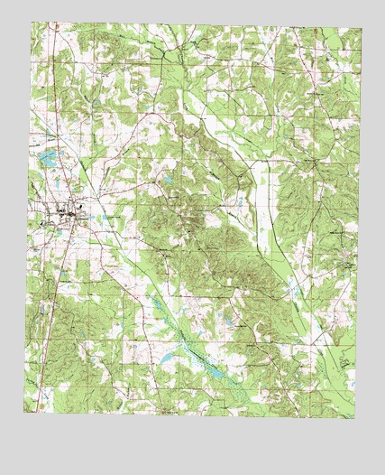
Decatur, MS USGS Topographic Map
Click on map above to begin viewing in our Map Viewer.

This topographic map contains these locations and features:
Feature Name Type Latitude Longitude GNIS ID View Map
B L Griffin Lake DamDamN32.4018°W89.1201°681318View Map
Beulah ChurchChurchN32.4788°W89.0167°667045View Map
Beulah School (historical)SchoolN32.4754°W89.0153°689450View Map
Blounts StorePopulated PlaceN32.4074°W89.0445°689452View Map
Brand CemeteryCemeteryN32.4896°W89.0134°667518View Map
C Loper Catfish Pond DamDamN32.4451°W89.0734°681372View Map
C M Blount Lake DamDamN32.4035°W89.0484°681323View Map
Carlton BranchStreamN32.4451°W89.0992°668062View Map
Chaney Store (historical)LocaleN32.4693°W89.0370°689459View Map
Chapel Hill School (historical)SchoolN32.4418°W89.0684°689460View Map
Chunky CanalCanalN32.4476°W89.0339°668442View Map
Chunky Watershed Structure 5 DamDamN32.3985°W89.0501°681312View Map
Cleveland BranchStreamN32.4965°W89.0953°668602View Map
Concobona CreekStreamN32.3851°W89.1231°668733View Map
DecaturPopulated PlaceN32.4390°W89.1084°669185View Map
Decatur Attendance Center (historical)SchoolN32.4396°W89.1123°710459View Map
Decatur BranchStreamN32.4282°W89.0895°689470View Map
Decatur CemeteryCemeteryN32.4279°W89.1217°669186View Map
Decatur Police DepartmentBuildingN32.4382°W89.1084°2754195View Map
Decatur Post OfficePost OfficeN32.4394°W89.1077°2768759View Map
Decatur Volunteer Fire DepartmentBuildingN32.4381°W89.1085°2667952View Map
Dry BranchStreamN32.4626°W89.1128°669405View Map
East Central Community CollegeSchoolN32.4402°W89.1122°2630554View Map
Ecjc Lake DamDamN32.4518°W89.1201°681382View Map
Good Hope ChurchChurchN32.4574°W89.0167°670478View Map
GoodhopePopulated PlaceN32.4574°W89.0167°689481View Map
Graham Store (historical)LocaleN32.4551°W89.0237°689482View Map
Greenwood ChurchChurchN32.4446°W89.0717°670721View Map
Hale BranchStreamN32.4876°W89.0676°670827View Map
Hallman BranchStreamN32.4946°W89.0370°670843View Map
High Heel School (historical)SchoolN32.4113°W89.1195°689491View Map
John Cook BranchStreamN32.4124°W89.0198°689496View Map
Johnson CemeteryCemeteryN32.4268°W89.0175°671922View Map
Laird BranchStreamN32.4946°W89.0370°672247View Map
LebanonPopulated PlaceN32.3988°W89.0376°689498View Map
Lebanon ChurchChurchN32.3979°W89.0381°672355View Map
Liberty Hill School (historical)SchoolN32.4790°W89.0862°689499View Map
Little Rock (historical)Populated PlaceN32.3774°W89.0723°689501View Map
Little Rock ChurchChurchN32.3763°W89.0714°672667View Map
Majure ChurchChurchN32.4282°W89.0753°673094View Map
McMullan BranchStreamN32.4326°W89.0381°673408View Map
Midway ChurchChurchN32.4940°W89.0626°673548View Map
Newton CountyCivilN32.4002°W89.1188°695773View Map
Newton County Sheriff's OfficeBuildingN32.4233°W89.1067°2754220View Map
Oakland ChurchChurchN32.4243°W89.0034°675121View Map
Okahatta CanalCanalN32.4418°W89.0973°689517View Map
Osborn Lake DamDamN32.4535°W89.1184°681387View Map
Ozborn LakeLakeN32.4565°W89.1176°675315View Map
Reeves BranchStreamN32.4529°W89.1037°676583View Map
Roman Hill ChurchChurchN32.4040°W89.0420°676832View Map
Roscoe (historical)Populated PlaceN32.4510°W89.0131°710470View Map
Shady Grove ChurchChurchN32.4346°W89.0059°677568View Map
Storys Store (historical)LocaleN32.4990°W89.0089°689543View Map
Supervisor District 1CivilN32.4210°W89.1148°712002View Map
Supervisor District 2CivilN32.4866°W89.0050°712003View Map
Tallashua CreekStreamN32.3943°W89.0003°666120View Map
Tommy Graham Pond DamDamN32.3918°W89.0701°681291View Map
Town of DecaturCivilN32.4338°W89.1092°2406366View Map
Williams Store (historical)LocaleN32.4729°W89.0434°689562View Map
Witt CreekStreamN32.4585°W89.0356°679798View Map
Witts School (historical)SchoolN32.4868°W89.0420°689564View Map

Note: Coordinates in the location and feature list above are referenced to NAD83 datum.


Copyright (C) 2008-2024 Ryan Niemi / Sunset Dynamics ... All Rights Reserved