TopoQuest Logo
Do you find TopoQuest useful?
Help keep TopoQuest running and adding new maps/features by donating!
Bitcoin:  19c7KJd3qBynnjoSw5npx9KScwjBe4ifkT
Litecoin:  LXs6TkuXGGXo1vDsWCkWVdjQX94eUKd6ui
Home View Maps Find Maps Find Places Resources & Links


Union Furnace, Ohio Topographic Map

USGS Map Title: Union Furnace, OH
USGS Map MRC: 39082D3
DRG (GeoTIFF) Download: o39082d3.tif


Neighboring USGS Topographic Map Quads:


  Logan, OH  
39082E4
 

  Gore, OH  
39082E3
 

  New Straitsville, OH  
39082E2
 

  New Plymouth, OH  
39082D4
 

  Union Furnace, OH  
39082D3
 

  Nelsonville, OH  
39082D2
 

  Zaleski, OH  
39082C4
 

  Mineral, OH  
39082C3
 

  The Plains, OH  
39082C2


Map MRC Location:

N40°
W83°
N40°
W82°
H8 H7 H6 H5 H4 H3 H2 H1
G8 G7 G6 G5 G4 G3 G2 G1
F8 F7 F6 F5 F4 F3 F2 F1
E8 E7 E6 E5 E4 E3 E2 E1
D8 D7 D6 D5 D4 D3 D2 D1
C8 C7 C6 C5 C4 C3 C2 C1
B8 B7 B6 B5 B4 B3 B2 B1
A8 A7 A6 A5 A4 A3 A2 A1
N39°
W83°
N39°
W82°

Union Furnace, OH USGS 1:24K Topographic Map Preview:
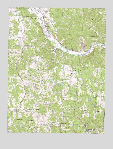
Union Furnace, OH USGS Topographic Map
Click on map above to begin viewing in our Map Viewer.

This topographic map contains these locations and features:
Feature Name Type Latitude Longitude GNIS ID View Map
Asbury CemeteryCemeteryN39.3912°W82.3021°1963566View Map
Asbury ChurchChurchN39.3917°W82.3024°1075283View Map
Asbury RidgeRidgeN39.4053°W82.3065°1075285View Map
Athens - Hocking Reclamation CenterLocaleN39.4647°W82.2772°2635461View Map
Camp Otterbein Lake DamDamN39.4951°W82.3715°1078048View Map
CarbondalePopulated PlaceN39.3778°W82.2710°1075523View Map
Carbondale CreekStreamN39.3759°W82.2679°1075524View Map
Carbondale Post OfficePost OfficeN39.3778°W82.2707°1958892View Map
Church of GodChurchN39.4642°W82.3110°1075573View Map
Community ChurchChurchN39.4487°W82.3149°1080289View Map
ConnettPopulated PlaceN39.4115°W82.2546°1075618View Map
Connett CemeteryCemeteryN39.4156°W82.2565°1075619View Map
CoonvillePopulated PlaceN39.3984°W82.3393°1075625View Map
Croy CemeteryCemeteryN39.4670°W82.3563°1963574View Map
East ClaytonPopulated PlaceN39.4545°W82.2704°1075768View Map
Green Elementary SchoolSchoolN39.4956°W82.3299°1081383View Map
Groves CemeteryCemeteryN39.4178°W82.3182°1075972View Map
HaydenvillePopulated PlaceN39.4820°W82.3282°1076028View Map
Haydenville CemeteryCemeteryN39.4761°W82.3207°1076029View Map
Haydenville Census Designated PlaceCensusN39.4808°W82.3238°2628899View Map
Haydenville Historic TownParkN39.4806°W82.3271°1069154View Map
Haydenville Post OfficePost OfficeN39.4820°W82.3277°2009841View Map
Haydenville Station (historical)LocaleN39.4765°W82.3260°1067396View Map
Morris ChapelChurchN39.4187°W82.3257°1076434View Map
Morris Chapel CemeteryCemeteryN39.4184°W82.3251°1963588View Map
Morse - Lewis CemeteryCemeteryN39.4023°W82.3417°1076437View Map
Mount Zion CemeteryCemeteryN39.4217°W82.2982°1963591View Map
Mount Zion ChurchChurchN39.4217°W82.2979°1076467View Map
StarrPopulated PlaceN39.3970°W82.3610°1076959View Map
Starr CemeteryCemeteryN39.3928°W82.3662°1076960View Map
Starr Post Office (historical)Post OfficeN39.3973°W82.3610°2009835View Map
Starr Township Volunteer Fire DepartmentBuildingN39.4529°W82.3572°2549589View Map
Summit (historical)Populated PlaceN39.4290°W82.3582°1067407View Map
Township of StarrCivilN39.4314°W82.3412°1086324View Map
Union FurnacePopulated PlaceN39.4617°W82.3563°1077103View Map
Union Furnace Elementary SchoolSchoolN39.4623°W82.3554°1050485View Map
Union Furnace Post OfficePost OfficeN39.4612°W82.3568°2009844View Map
Wolf Basin (historical)ReservoirN39.4620°W82.3024°1050486View Map
Wolf CemeteryCemeteryN39.4712°W82.3158°1048031View Map
Wolfkiln RunStreamN39.4756°W82.3149°1077268View Map
Zion RidgeRidgeN39.4292°W82.2938°1077256View Map

Note: Coordinates in the location and feature list above are referenced to NAD83 datum.


Copyright (C) 2008-2024 Ryan Niemi / Sunset Dynamics ... All Rights Reserved