TopoQuest Logo
Do you find TopoQuest useful?
Help keep TopoQuest running and adding new maps/features by donating!
Bitcoin:  19c7KJd3qBynnjoSw5npx9KScwjBe4ifkT
Litecoin:  LXs6TkuXGGXo1vDsWCkWVdjQX94eUKd6ui
Home View Maps Find Maps Find Places Resources & Links


Union Star, Missouri Topographic Map

USGS Map Title: Union Star, MO
USGS Map MRC: 39094H5
DRG (GeoTIFF) Download: o39094h5.tif


Neighboring USGS Topographic Map Quads:


  Whitesville, MO  
40094A6
 

  King City, MO  
40094A5
 

  Ford City, MO  
40094A4
 

  Helena, MO  
39094H6
 

  Union Star, MO  
39094H5
 

  Wood, MO  
39094H4
 

  Cosby, MO  
39094G6
 

  Clarksdale, MO  
39094G5
 

  Amity, MO  
39094G4


Map MRC Location:

N40°
W95°
N40°
W94°
H8 H7 H6 H5 H4 H3 H2 H1
G8 G7 G6 G5 G4 G3 G2 G1
F8 F7 F6 F5 F4 F3 F2 F1
E8 E7 E6 E5 E4 E3 E2 E1
D8 D7 D6 D5 D4 D3 D2 D1
C8 C7 C6 C5 C4 C3 C2 C1
B8 B7 B6 B5 B4 B3 B2 B1
A8 A7 A6 A5 A4 A3 A2 A1
N39°
W95°
N39°
W94°

Union Star, MO USGS 1:24K Topographic Map Preview:
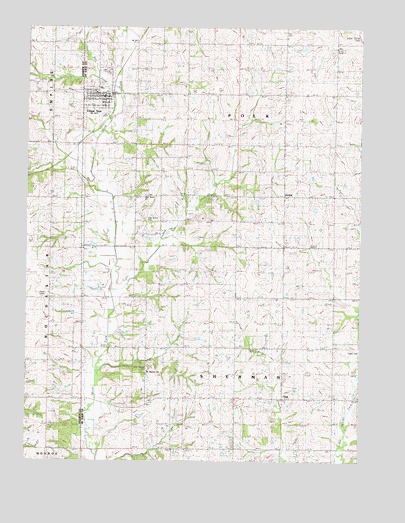
Union Star, MO USGS Topographic Map
Click on map above to begin viewing in our Map Viewer.

This topographic map contains these locations and features:
Feature Name Type Latitude Longitude GNIS ID View Map
Bowen SchoolSchoolN39.8942°W94.5436°736280View Map
Bull CreekStreamN39.9833°W94.5925°729451View Map
Center School (historical)SchoolN39.9892°W94.5300°747037View Map
Crooked CreekStreamN39.9258°W94.5911°729465View Map
Franklin School (historical)SchoolN39.8939°W94.6250°718176View Map
Glenwood School (historical)SchoolN39.9256°W94.5752°729499View Map
Mount Moriah ChurchChurchN39.9014°W94.5808°729677View Map
OakPopulated PlaceN39.8936°W94.5297°729583View Map
Oak Grove CemeteryCemeteryN39.9514°W94.5817°2702104View Map
Oak Grove ChurchChurchN39.9517°W94.5813°741982View Map
Oak Grove School (historical)SchoolN39.9522°W94.5855°729586View Map
Ogle Grove CemeteryCemeteryN39.9450°W94.5811°741983View Map
OrchidPopulated PlaceN39.9517°W94.5297°748426View Map
Orchid School (historical)SchoolN39.9447°W94.5291°729596View Map
Sharp School (historical)SchoolN39.9000°W94.5097°747038View Map
Taylor School (historical)SchoolN39.9819°W94.5669°729669View Map
Town of Union StarCivilN39.9794°W94.5988°2397704View Map
Township of PolkCivilN39.9880°W94.5291°766597View Map
Township of ShermanCivilN39.8860°W94.5286°766598View Map
Union Chapel CemeteryCemeteryN39.9017°W94.5800°741981View Map
Union Chapel School (historical)SchoolN39.9000°W94.5800°747039View Map
Union StarPopulated PlaceN39.9806°W94.5944°729678View Map
Union Star CemeteryCemeteryN39.9871°W94.5946°2702101View Map
Union Star Elementary SchoolSchoolN39.9822°W94.5979°2545416View Map
Union Star Fire Protection DistrictBuildingN39.9802°W94.6042°2621374View Map
Union Star High SchoolSchoolN39.9822°W94.5979°2545420View Map
Union Star Post OfficePost OfficeN39.9800°W94.5969°2782638View Map

Note: Coordinates in the location and feature list above are referenced to NAD83 datum.


Copyright (C) 2008-2024 Ryan Niemi / Sunset Dynamics ... All Rights Reserved