TopoQuest Logo
Do you find TopoQuest useful?
Help keep TopoQuest running and adding new maps/features by donating!
Bitcoin:  19c7KJd3qBynnjoSw5npx9KScwjBe4ifkT
Litecoin:  LXs6TkuXGGXo1vDsWCkWVdjQX94eUKd6ui
Home View Maps Find Maps Find Places Resources & Links


Cosby, Missouri Topographic Map

USGS Map Title: Cosby, MO
USGS Map MRC: 39094G6
DRG (GeoTIFF) Download: o39094g6.tif


Neighboring USGS Topographic Map Quads:


  Savannah, MO  
39094H7
 

  Helena, MO  
39094H6
 

  Union Star, MO  
39094H5
 

  Saint Joseph North, MO  
39094G7
 

  Cosby, MO  
39094G6
 

  Clarksdale, MO  
39094G5
 

  Saint Joseph South, MO  
39094F7
 

  Agency, MO  
39094F6
 

  Hemple, MO  
39094F5


Map MRC Location:

N40°
W95°
N40°
W94°
H8 H7 H6 H5 H4 H3 H2 H1
G8 G7 G6 G5 G4 G3 G2 G1
F8 F7 F6 F5 F4 F3 F2 F1
E8 E7 E6 E5 E4 E3 E2 E1
D8 D7 D6 D5 D4 D3 D2 D1
C8 C7 C6 C5 C4 C3 C2 C1
B8 B7 B6 B5 B4 B3 B2 B1
A8 A7 A6 A5 A4 A3 A2 A1
N39°
W95°
N39°
W94°

Cosby, MO USGS 1:24K Topographic Map Preview:
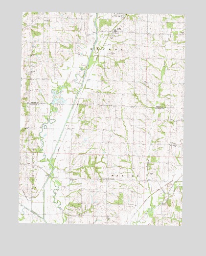
Cosby, MO USGS Topographic Map
Click on map above to begin viewing in our Map Viewer.

This topographic map contains these locations and features:
Feature Name Type Latitude Longitude GNIS ID View Map
Bermond School (historical)SchoolN39.8058°W94.6833°713987View Map
Bessie Ellison Elementary SchoolSchoolN39.7762°W94.7109°741965View Map
Bethel School (historical)SchoolN39.8669°W94.6263°747062View Map
Bowen CemeteryCemeteryN39.7811°W94.6511°714570View Map
Brown CemeteryCemeteryN39.8605°W94.6808°741962View Map
Carnegie School (historical)SchoolN39.7781°W94.7122°715407View Map
ClairPopulated PlaceN39.7850°W94.7444°740744View Map
Concord CemeteryCemeteryN39.8511°W94.6825°741961View Map
CosbyPopulated PlaceN39.8642°W94.6783°716334View Map
Cosby Post OfficePost OfficeN39.8634°W94.6801°2782929View Map
Cosby School (historical)SchoolN39.8656°W94.6836°747063View Map
Courtney CemeteryCemeteryN39.7722°W94.7138°741964View Map
Eminence SchoolSchoolN39.8606°W94.7197°717577View Map
Fankhauser SchoolSchoolN39.8075°W94.7430°717837View Map
Freeman Park (historical)LocaleN39.7733°W94.6411°718211View Map
Frogge SchoolSchoolN39.7842°W94.7464°718263View Map
High Prairie CemeteryCemeteryN39.8708°W94.7305°741970View Map
High Prairie Church (historical)ChurchN39.8711°W94.7305°719553View Map
HurlingenPopulated PlaceN39.7983°W94.6366°740951View Map
Little Third ForkStreamN39.7708°W94.6350°729538View Map
Minor CemeteryCemeteryN39.7533°W94.6827°741963View Map
Muddy CreekStreamN39.7644°W94.6502°723035View Map
Northwestern Loess HillsAreaN39.8747°W94.7500°754096View Map
Oak Ridge CemeteryCemeteryN39.8394°W94.7447°741969View Map
Oak Ridge SchoolSchoolN39.8364°W94.7433°723648View Map
Ozenberger CemeteryCemeteryN39.8050°W94.7463°741968View Map
Pleasant Hill School (historical)SchoolN39.7967°W94.6350°747064View Map
Saint Marys CemeteryCemeteryN39.7972°W94.6305°741966View Map
San AntonioPopulated PlaceN39.7769°W94.6836°725995View Map
San Antonio Fire DepartmentBuildingN39.7765°W94.7099°2620773View Map
Seven Dolors ChurchChurchN39.7978°W94.6308°741967View Map
Spring Hollow SchoolSchoolN39.7553°W94.6277°726943View Map
Stockbridge (historical)Populated PlaceN39.7514°W94.6666°741294View Map
Township of MarionCivilN39.7635°W94.6594°766342View Map
Township of MonroeCivilN39.8498°W94.6834°766226View Map
Village of CosbyCivilN39.8638°W94.6798°2398633View Map
Wales LakeReservoirN39.7976°W94.7029°761044View Map
Wales Lake DamDamN39.7983°W94.7019°761043View Map
Zimmerman SchoolSchoolN39.8339°W94.6800°730257View Map
Zion ChurchChurchN39.8347°W94.6538°729249View Map

Note: Coordinates in the location and feature list above are referenced to NAD83 datum.


Copyright (C) 2008-2024 Ryan Niemi / Sunset Dynamics ... All Rights Reserved