TopoQuest Logo
Do you find TopoQuest useful?
Help keep TopoQuest running and adding new maps/features by donating!
Bitcoin:  19c7KJd3qBynnjoSw5npx9KScwjBe4ifkT
Litecoin:  LXs6TkuXGGXo1vDsWCkWVdjQX94eUKd6ui
Home View Maps Find Maps Find Places Resources & Links


Upper Tract, West Virginia Topographic Map

USGS Map Title: Upper Tract, WV
USGS Map MRC: 38079G3
DRG (GeoTIFF) Download: o38079g3.tif


Neighboring USGS Topographic Map Quads:


  Laneville, WV  
38079H4
 

  Hopeville, WV  
38079H3
 

  Petersburg West, WV  
38079H2
 

  Onego, WV  
38079G4
 

  Upper Tract, WV  
38079G3
 

  Mozer, WV  
38079G2
 

  Circleville, WV  
38079F4
 

  Franklin, WV  
38079F3
 

  Fort Seybert, WV  
38079F2


Map MRC Location:

N39°
W80°
N39°
W79°
H8 H7 H6 H5 H4 H3 H2 H1
G8 G7 G6 G5 G4 G3 G2 G1
F8 F7 F6 F5 F4 F3 F2 F1
E8 E7 E6 E5 E4 E3 E2 E1
D8 D7 D6 D5 D4 D3 D2 D1
C8 C7 C6 C5 C4 C3 C2 C1
B8 B7 B6 B5 B4 B3 B2 B1
A8 A7 A6 A5 A4 A3 A2 A1
N38°
W80°
N38°
W79°

Upper Tract, WV USGS 1:24K Topographic Map Preview:
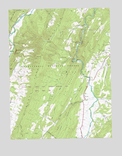
Upper Tract, WV USGS Topographic Map
Click on map above to begin viewing in our Map Viewer.

This topographic map contains these locations and features:
Feature Name Type Latitude Longitude GNIS ID View Map
Alt Farm SpringSpringN38.8279°W79.2956°1677820View Map
Big MountainSummitN38.7912°W79.3078°1550300View Map
Big SpringSpringN38.8251°W79.2845°1677824View Map
Briggs RunStreamN38.8234°W79.2956°1550468View Map
Cave MountainSummitN38.8473°W79.2709°1550656View Map
Deer RunStreamN38.7851°W79.2681°1550903View Map
Dry HollowValleyN38.8271°W79.2950°1550965View Map
Dry RunStreamN38.7579°W79.3309°1550981View Map
Eagle RockCliffN38.8268°W79.2914°1551005View Map
Eagle Rock SpringSpringN38.8251°W79.2873°1677823View Map
Eliza HollowValleyN38.7657°W79.3214°1551026View Map
Evergreen Church (historical)ChurchN38.8715°W79.3542°1677597View Map
Harper KnobSummitN38.8187°W79.3745°1554655View Map
Hermit Island SpringSpringN38.8543°W79.2831°1677819View Map
High KnobSummitN38.8293°W79.3362°1554704View Map
Kyle School (historical)SchoolN38.8223°W79.2731°1677604View Map
Little MountainSummitN38.7904°W79.2917°1554968View Map
Long HollowValleyN38.7821°W79.2978°1551920View Map
Mill RunStreamN38.7879°W79.2670°1552133View Map
Mount Hope ChurchChurchN38.7712°W79.2598°1552205View Map
North Fork MountainRidgeN38.7809°W79.3545°1552337View Map
North Fork Mountain Lookout TowerTowerN38.8437°W79.3278°1557872View Map
North Mountain TrailTrailN38.7990°W79.3456°1552344View Map
Pretty RidgeRidgeN38.7976°W79.3181°1552556View Map
Pretty Ridge School (historical)SchoolN38.8057°W79.3145°1677609View Map
Reeds CreekStreamN38.7948°W79.2739°1552629View Map
Reeds Creek Church (historical)ChurchN38.7509°W79.3367°1677610View Map
Reeds Creek School (historical)SchoolN38.7626°W79.3228°1677611View Map
Roy GapGapN38.8329°W79.3673°1552750View Map
Saint Georges ChurchChurchN38.8587°W79.2798°1552768View Map
Seneca CreekStreamN38.8343°W79.3717°1552830View Map
Seneca Rock Elementary School (historical)SchoolN38.8407°W79.3723°1552833View Map
Seneca RocksCliffN38.8354°W79.3667°1552832View Map
Seneca Rocks Recreation SiteLocaleN38.8432°W79.3700°1553638View Map
Seneca Rocks Visitor CenterLocaleN38.8359°W79.3656°1553637View Map
Seneca School (historical)SchoolN38.8432°W79.3745°1677614View Map
Shuckleford RunStreamN38.8704°W79.3545°1552886View Map
Smoke Hole CampgroundLocaleN38.8551°W79.2823°1553632View Map
Smoke Hole ChurchChurchN38.8573°W79.2834°1547011View Map
South Branch TrailTrailN38.8562°W79.2767°1553633View Map
Timber RidgeRidgeN38.7584°W79.3159°1553242View Map
Twin RunStreamN38.8023°W79.3092°1553298View Map
Upper TractPopulated PlaceN38.7873°W79.2825°1555861View Map
Upper Tract BridgeBridgeN38.8055°W79.2762°2647557View Map
Upper Tract Post OfficePost OfficeN38.7896°W79.2837°2774618View Map
Upper Tract Volunteer Fire Department Company 3BuildingN38.7871°W79.2806°2577841View Map
Upper Tract Volunteer Fire Department Regional Training CenterBuildingN38.7876°W79.2818°2578012View Map
Waggy Farm SpringSpringN38.7509°W79.3381°1677821View Map
Wilson ChurchChurchN38.8362°W79.2520°1553478View Map

Note: Coordinates in the location and feature list above are referenced to NAD83 datum.


Copyright (C) 2008-2024 Ryan Niemi / Sunset Dynamics ... All Rights Reserved