TopoQuest Logo
Do you find TopoQuest useful?
Help keep TopoQuest running and adding new maps/features by donating!
Bitcoin:  19c7KJd3qBynnjoSw5npx9KScwjBe4ifkT
Litecoin:  LXs6TkuXGGXo1vDsWCkWVdjQX94eUKd6ui
Home View Maps Find Maps Find Places Resources & Links


Circleville, West Virginia Topographic Map

USGS Map Title: Circleville, WV
USGS Map MRC: 38079F4
DRG (GeoTIFF) Download: o38079f4.tif


Neighboring USGS Topographic Map Quads:


  Whitmer, WV  
38079G5
 

  Onego, WV  
38079G4
 

  Upper Tract, WV  
38079G3
 

  Spruce Knob, WV  
38079F5
 

  Circleville, WV  
38079F4
 

  Franklin, WV  
38079F3
 

  Snowy Mountain, WV  
38079E5
 

  Moatstown, WV  
38079E4
 

  Sugar Grove, WV  
38079E3


Map MRC Location:

N39°
W80°
N39°
W79°
H8 H7 H6 H5 H4 H3 H2 H1
G8 G7 G6 G5 G4 G3 G2 G1
F8 F7 F6 F5 F4 F3 F2 F1
E8 E7 E6 E5 E4 E3 E2 E1
D8 D7 D6 D5 D4 D3 D2 D1
C8 C7 C6 C5 C4 C3 C2 C1
B8 B7 B6 B5 B4 B3 B2 B1
A8 A7 A6 A5 A4 A3 A2 A1
N38°
W80°
N38°
W79°

Circleville, WV USGS 1:24K Topographic Map Preview:
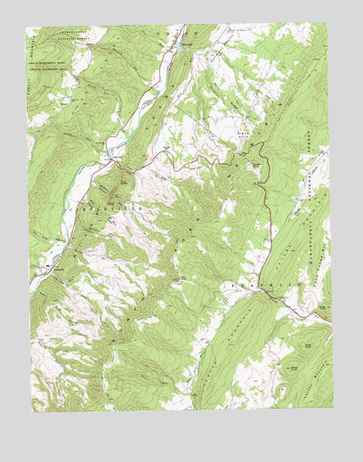
Circleville, WV USGS Topographic Map
Click on map above to begin viewing in our Map Viewer.

This topographic map contains these locations and features:
Feature Name Type Latitude Longitude GNIS ID View Map
Bible KnobSummitN38.6451°W79.3864°1553888View Map
Bland HillsSummitN38.7143°W79.4106°1553924View Map
Blizzard RunStreamN38.7273°W79.4464°1550389View Map
Bouses RunStreamN38.6690°W79.4942°1550431View Map
Briery Gap RunStreamN38.7143°W79.4573°1550462View Map
Burns CemeteryCemeteryN38.7032°W79.4300°2586264View Map
Castle MountainSummitN38.6459°W79.4181°1550650View Map
Cedar KnobSummitN38.6576°W79.3773°1550664View Map
CirclevillePopulated PlaceN38.6709°W79.4912°1554138View Map
Circleville Post OfficePost OfficeN38.6721°W79.4904°2774617View Map
Circleville Volunteer Fire DepartmentBuildingN38.6714°W79.4929°2577948View Map
Dice RunStreamN38.7434°W79.4356°1550919View Map
Dolly RidgeRidgeN38.7271°W79.4175°1550938View Map
Fairview ChurchChurchN38.7262°W79.4812°1551083View Map
False GapGapN38.6893°W79.4695°1551098View Map
Friends Run ChurchChurchN38.6601°W79.3970°1551186View Map
Harmon RocksSummitN38.7040°W79.4084°1554651View Map
Harper RunStreamN38.6793°W79.4837°1551369View Map
Judy GapGapN38.7037°W79.4600°1551613View Map
Judy GapPopulated PlaceN38.7068°W79.4645°1551614View Map
Judy RocksSummitN38.6993°W79.4620°1554835View Map
Judy RunStreamN38.7071°W79.4650°1551615View Map
Kile RunStreamN38.6951°W79.4767°1551647View Map
Lambert GapGapN38.6840°W79.4748°1551687View Map
Laurel RunStreamN38.7093°W79.4662°1551742View Map
Lynn Lick HollowValleyN38.6668°W79.4848°1551975View Map
MonkeytownPopulated PlaceN38.7050°W79.4322°2634635View Map
Morgan RunStreamN38.6871°W79.4800°1552187View Map
Moser KnobSummitN38.6382°W79.3925°1552189View Map
Nelson GapGapN38.6957°W79.4648°1552285View Map
Nelson RocksSummitN38.6923°W79.4673°1555198View Map
Nelson RunStreamN38.7048°W79.4739°1552286View Map
Noah Teter HollowValleyN38.6643°W79.4970°1552312View Map
North Fork ChurchChurchN38.7121°W79.4675°1552329View Map
North Fork Elementary SchoolSchoolN38.6732°W79.4931°2088294View Map
North Fork Memorial CemeteryCemeteryN38.7482°W79.4156°1552336View Map
Pendleton County Emergency Rescue North ForkBuildingN38.7458°W79.4363°2581216View Map
Peters MountainSummitN38.6762°W79.3917°1555330View Map
Pike Gap RunStreamN38.6707°W79.4900°1552476View Map
Pike KnobSummitN38.6676°W79.4378°1555348View Map
Pond Range MountainSummitN38.6740°W79.3767°1555390View Map
Red Lick RunStreamN38.6798°W79.4834°1552607View Map
River KnobsRidgeN38.7371°W79.4345°1552670View Map
RivertonPopulated PlaceN38.7440°W79.4359°1555491View Map
Riverton GapGapN38.7418°W79.4331°1553557View Map
Riverton Post OfficePost OfficeN38.7460°W79.4359°2774614View Map
Roaring SpringsSpringN38.6737°W79.4900°1677619View Map
Root RunStreamN38.7429°W79.4356°1552728View Map
Simmons CemeteryCemeteryN38.7324°W79.4471°2586263View Map
SimodaPopulated PlaceN38.7271°W79.4831°1552896View Map
Solomans ChapelChurchN38.7096°W79.4425°1552962View Map
Stringtown RunStreamN38.7407°W79.4309°1553099View Map
Twin RunStreamN38.6307°W79.4353°1553297View Map
Wilkins SpringSpringN38.6779°W79.4831°1677618View Map

Note: Coordinates in the location and feature list above are referenced to NAD83 datum.


Copyright (C) 2008-2025 Ryan Niemi / Sunset Dynamics ... All Rights Reserved