TopoQuest Logo
Do you find TopoQuest useful?
Help keep TopoQuest running and adding new maps/features by donating!
Bitcoin:  19c7KJd3qBynnjoSw5npx9KScwjBe4ifkT
Litecoin:  LXs6TkuXGGXo1vDsWCkWVdjQX94eUKd6ui
Home View Maps Find Maps Find Places Resources & Links


Bobs Mountain, Washington Topographic Map

USGS Map Title: Bobs Mountain, WA
USGS Map MRC: 45122F2
DRG (GeoTIFF) Download: o45122f2.tif


Neighboring USGS Topographic Map Quads:


  Dole, WA  
45122G3
 

  Gumboot Mountain, WA  
45122G2
 

  Lookout Mountain, WA  
45122G1
 

  Larch Mountain, WA  
45122F3
 

  Bobs Mountain, WA  
45122F2
 

  Beacon Rock, WA  
45122F1
 

  Washougal, WA  
45122E3
 

  Bridal Veil, OR  
45122E2
 

  Multnomah Falls, OR  
45122E1


Map MRC Location:

N46°
W123°
N46°
W122°
H8 H7 H6 H5 H4 H3 H2 H1
G8 G7 G6 G5 G4 G3 G2 G1
F8 F7 F6 F5 F4 F3 F2 F1
E8 E7 E6 E5 E4 E3 E2 E1
D8 D7 D6 D5 D4 D3 D2 D1
C8 C7 C6 C5 C4 C3 C2 C1
B8 B7 B6 B5 B4 B3 B2 B1
A8 A7 A6 A5 A4 A3 A2 A1
N45°
W123°
N45°
W122°

Bobs Mountain, WA USGS 1:24K Topographic Map Preview:
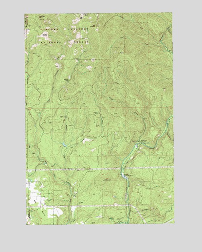
Bobs Mountain, WA USGS Topographic Map
Click on map above to begin viewing in our Map Viewer.

This topographic map contains these locations and features:
Feature Name Type Latitude Longitude GNIS ID View Map
Bear PrairieFlatN45.6351°W122.2404°1516291View Map
Bluebird CreekStreamN45.7326°W122.1365°1531614View Map
Bluff MountainSummitN45.7423°W122.1901°1516726View Map
Bobs MountainSummitN45.6510°W122.1851°1516741View Map
Boyles CreekStreamN45.6568°W122.1706°1528787View Map
Caldwell DamDamN45.6515°W122.2479°1532651View Map
Camp Kwoneesum DamLakeN45.6722°W122.2186°1532106View Map
Camp MelacomaLocaleN45.6276°W122.1790°1529005View Map
Dougan CreekStreamN45.6712°W122.1548°1518891View Map
Dougan Creek CampgroundLocaleN45.6734°W122.1559°1528786View Map
Dougan Creek Picnic AreaLocaleN45.6732°W122.1543°1528785View Map
Dougan FallsFallsN45.6727°W122.1528°1528784View Map
East County Fire and Rescue Station 96BuildingN45.6374°W122.2379°2643869View Map
Hagen CreekStreamN45.6840°W122.2431°1520440View Map
Hard Scramble CreekStreamN45.6796°W122.1329°1528793View Map
Jackson CreekStreamN45.6659°W122.2404°1521314View Map
Last Chance MineMineN45.7232°W122.2051°1521919View Map
Little BaldySummitN45.7465°W122.2043°1522154View Map
McCloskey CreekStreamN45.6326°W122.1640°1522869View Map
Pohls HillSummitN45.6385°W122.2298°1524530View Map
Prospector CreekStreamN45.7404°W122.1284°1524664View Map
Silver CreekStreamN45.7268°W122.1298°1525752View Map
Silver Star Indian PitsLocaleN45.7371°W122.2365°1528783View Map
Silver Star MountainSummitN45.7479°W122.2390°1525797View Map
Silver Star Mountain LookoutLocaleN45.7462°W122.2387°1530256View Map
Skamania MineMineN45.7109°W122.2137°1525854View Map
Sky River Ranch AirportAirportN45.6292°W122.1894°2443385View Map
Sturgeon RockSummitN45.7483°W122.2478°1526653View Map
Texas CreekStreamN45.6632°W122.2179°1527019View Map
Washougal PondsLakeN45.6528°W122.1670°1530500View Map
Washougal Radio Fan Marker BeaconLocaleN45.6529°W122.2429°1533258View Map
Washougal Ranger StationLocaleN45.6715°W122.1370°1527837View Map
Washougal State Salmon HatcheryLocaleN45.6532°W122.1690°1528791View Map
Wildboy CreekStreamN45.6487°W122.2156°1528128View Map

Note: Coordinates in the location and feature list above are referenced to NAD83 datum.


Copyright (C) 2008-2025 Ryan Niemi / Sunset Dynamics ... All Rights Reserved