TopoQuest Logo
Do you find TopoQuest useful?
Help keep TopoQuest running and adding new maps/features by donating!
Bitcoin:  19c7KJd3qBynnjoSw5npx9KScwjBe4ifkT
Litecoin:  LXs6TkuXGGXo1vDsWCkWVdjQX94eUKd6ui
Home View Maps Find Maps Find Places Resources & Links


Van Buren South, Missouri Topographic Map

USGS Map Title: Van Buren South, MO
USGS Map MRC: 36091H1
DRG (GeoTIFF) Download: o36091h1.tif


Neighboring USGS Topographic Map Quads:


  Stegall Mountain, MO  
37091A2
 

  Van Buren North, MO  
37091A1
 

  Garwood, MO  
37090A8
 

  Fremont, MO  
36091H2
 

  Van Buren South, MO  
36091H1
 

  Big Spring, MO  
36090H8
 

  Wilderness, MO  
36091G2
 

  Handy, MO  
36091G1
 

  Grandin SW, MO  
36090G8


Map MRC Location:

N37°
W92°
N37°
W91°
H8 H7 H6 H5 H4 H3 H2 H1
G8 G7 G6 G5 G4 G3 G2 G1
F8 F7 F6 F5 F4 F3 F2 F1
E8 E7 E6 E5 E4 E3 E2 E1
D8 D7 D6 D5 D4 D3 D2 D1
C8 C7 C6 C5 C4 C3 C2 C1
B8 B7 B6 B5 B4 B3 B2 B1
A8 A7 A6 A5 A4 A3 A2 A1
N36°
W92°
N36°
W91°

Van Buren South, MO USGS 1:24K Topographic Map Preview:
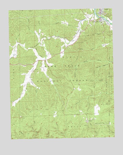
Van Buren South, MO USGS Topographic Map
Click on map above to begin viewing in our Map Viewer.

This topographic map contains these locations and features:
Feature Name Type Latitude Longitude GNIS ID View Map
Big Spring Lookout TowerTowerN36.9339°W91.0026°755001View Map
Blue Ridge Corral Picnic AreaLocaleN36.9609°W91.0368°748931View Map
Brushy HollowValleyN36.9748°W91.0904°749073View Map
Carter County Sheriff's OfficeBuildingN36.9945°W91.0136°2752104View Map
ChicopeePopulated PlaceN36.9851°W91.0057°749344View Map
Cummings (historical)LocaleN36.9737°W91.0751°740579View Map
Dry ValleyValleyN36.9526°W91.0907°749736View Map
Dry Valley ChurchChurchN36.9423°W91.0949°749738View Map
Dry Valley School (historical)SchoolN36.9420°W91.0960°747643View Map
Eagle Lookout TowerTowerN36.9676°W91.0371°755169View Map
EastwoodPopulated PlaceN36.8909°W91.0329°749789View Map
Eastwood CemeteryCemeteryN36.8877°W91.0328°749790View Map
Eastwood Fire Protection DistrictBuildingN36.8892°W91.0328°2621703View Map
Eastwood Lookout TowerTowerN36.8887°W91.0235°755170View Map
Kinnard School (historical)SchoolN36.9795°W91.0429°747644View Map
Lee HollowValleyN36.9689°W91.1160°750676View Map
Long HollowValleyN36.9648°W91.0840°750849View Map
Mint SpringSpringN36.9953°W91.0976°739867View Map
Missouri Department of Conservation Forestry Ozark Regional Field Fire Office Van BurenBuildingN36.9999°W91.0150°2621598View Map
Ozark National Scenic River Fire CacheBuildingN36.9999°W91.0150°2620683View Map
Ozark Trail TrialheadLocaleN36.9570°W91.0640°753979View Map
Pike CreekStreamN36.9945°W91.0212°751585View Map
Poca CemeteryCemeteryN36.9442°W91.0871°751679View Map
Poca HollowValleyN36.9509°W91.0840°751680View Map
Secesh HollowValleyN36.9331°W91.1015°752071View Map
South Van BurenPopulated PlaceN36.9881°W91.0137°726793View Map
Tie Broom StretchChannelN36.9923°W91.0179°753142View Map
Township of KellyCivilN36.8837°W91.0245°766429View Map
Turley CemeteryCemeteryN36.9567°W91.1173°752615View Map
Van BurenPopulated PlaceN36.9956°W91.0146°752687View Map
Van Buren Post OfficePost OfficeN36.9953°W91.0155°2782750View Map
Walker HollowValleyN36.9951°W91.0121°752733View Map
Wayside CarterLocaleN36.9776°W91.0112°754959View Map
Wilburn BranchStreamN36.9892°W91.0362°752882View Map
Wildhorse HollowValleyN36.9442°W91.0443°752900View Map

Note: Coordinates in the location and feature list above are referenced to NAD83 datum.


Copyright (C) 2008-2025 Ryan Niemi / Sunset Dynamics ... All Rights Reserved