TopoQuest Logo
Do you find TopoQuest useful?
Help keep TopoQuest running and adding new maps/features by donating!
Bitcoin:  19c7KJd3qBynnjoSw5npx9KScwjBe4ifkT
Litecoin:  LXs6TkuXGGXo1vDsWCkWVdjQX94eUKd6ui
Home View Maps Find Maps Find Places Resources & Links


Fremont, Missouri Topographic Map

USGS Map Title: Fremont, MO
USGS Map MRC: 36091H2
DRG (GeoTIFF) Download: o36091h2.tif


Neighboring USGS Topographic Map Quads:


  Winona, MO  
37091A3
 

  Stegall Mountain, MO  
37091A2
 

  Van Buren North, MO  
37091A1
 

  Low Wassie, MO  
36091H3
 

  Fremont, MO  
36091H2
 

  Van Buren South, MO  
36091H1
 

  Greer, MO  
36091G3
 

  Wilderness, MO  
36091G2
 

  Handy, MO  
36091G1


Map MRC Location:

N37°
W92°
N37°
W91°
H8 H7 H6 H5 H4 H3 H2 H1
G8 G7 G6 G5 G4 G3 G2 G1
F8 F7 F6 F5 F4 F3 F2 F1
E8 E7 E6 E5 E4 E3 E2 E1
D8 D7 D6 D5 D4 D3 D2 D1
C8 C7 C6 C5 C4 C3 C2 C1
B8 B7 B6 B5 B4 B3 B2 B1
A8 A7 A6 A5 A4 A3 A2 A1
N36°
W92°
N36°
W91°

Fremont, MO USGS 1:24K Topographic Map Preview:
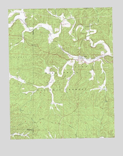
Fremont, MO USGS Topographic Map
Click on map above to begin viewing in our Map Viewer.

This topographic map contains these locations and features:
Feature Name Type Latitude Longitude GNIS ID View Map
Clark CemeteryCemeteryN36.9903°W91.2301°749365View Map
Curve Bridge Picnic AreaParkN36.9026°W91.2379°749556View Map
Dry ForkStreamN36.9004°W91.2493°749720View Map
Evaline CemeteryCemeteryN36.9289°W91.2035°749859View Map
Evans HollowValleyN36.9506°W91.1424°749864View Map
Evans PondLakeN36.9098°W91.1353°749867View Map
FremontPopulated PlaceN36.9523°W91.1643°749997View Map
Fremont Census Designated PlaceCensusN36.9523°W91.1623°2587071View Map
Fremont Fire Protection DistrictBuildingN36.9522°W91.1633°2621210View Map
Fremont Lookout TowerTowerN36.9648°W91.2201°755186View Map
Fremont Picnic AreaLocaleN36.9656°W91.2215°754950View Map
Fremont Post OfficePost OfficeN36.9522°W91.1638°2783148View Map
Fremont Tower Picnic AreaLocaleN36.9648°W91.2212°754427View Map
Green MountainSummitN36.9217°W91.1910°750143View Map
Hay HollowValleyN36.9451°W91.1737°750263View Map
Little Pike CreekStreamN36.9545°W91.1276°750789View Map
Midco CemeteryCemeteryN36.9814°W91.1429°751028View Map
Midco HollowValleyN36.9798°W91.1526°751029View Map
New Hope CemeteryCemeteryN36.9606°W91.1385°751293View Map
Nordic HollowValleyN36.9937°W91.1921°751326View Map
Pleasant Site CemeteryCemeteryN36.9848°W91.1832°751670View Map
Pleasant Site SchoolSchoolN36.9945°W91.1926°747642View Map
Retort HillSummitN36.9776°W91.1501°751855View Map
Site of Old Midco Iron WorksLocaleN36.9823°W91.1521°752184View Map
Snider CemeteryCemeteryN36.9373°W91.1529°752234View Map
Snider HollowValleyN36.9473°W91.1482°752235View Map
Springfield HollowValleyN36.9534°W91.1724°752327View Map
Township of PikeCivilN36.9883°W91.1586°766430View Map
Turley HollowValleyN36.9676°W91.1251°752616View Map
Vermillion HollowValleyN36.9926°W91.1885°752702View Map
Windes CreekStreamN36.9798°W91.2265°752933View Map
Windes HillSummitN36.9834°W91.1696°752934View Map
Young HollowValleyN36.9248°W91.2165°753007View Map

Note: Coordinates in the location and feature list above are referenced to NAD83 datum.


Copyright (C) 2008-2024 Ryan Niemi / Sunset Dynamics ... All Rights Reserved