TopoQuest Logo
Do you find TopoQuest useful?
Help keep TopoQuest running and adding new maps/features by donating!
Bitcoin:  19c7KJd3qBynnjoSw5npx9KScwjBe4ifkT
Litecoin:  LXs6TkuXGGXo1vDsWCkWVdjQX94eUKd6ui
Home View Maps Find Maps Find Places Resources & Links


Grandin SW, Missouri Topographic Map

USGS Map Title: Grandin SW, MO
USGS Map MRC: 36090G8
DRG (GeoTIFF) Download: o36090g8.tif


Neighboring USGS Topographic Map Quads:


  Van Buren South, MO  
36091H1
 

  Big Spring, MO  
36090H8
 

  Hunter, MO  
36090H7
 

  Handy, MO  
36091G1
 

  Grandin SW, MO  
36090G8
 

  Grandin, MO  
36090G7
 

  Bardley, MO  
36091F1
 

  Briar, MO  
36090F8
 

  Doniphan North, MO  
36090F7


Map MRC Location:

N37°
W91°
N37°
W90°
H8 H7 H6 H5 H4 H3 H2 H1
G8 G7 G6 G5 G4 G3 G2 G1
F8 F7 F6 F5 F4 F3 F2 F1
E8 E7 E6 E5 E4 E3 E2 E1
D8 D7 D6 D5 D4 D3 D2 D1
C8 C7 C6 C5 C4 C3 C2 C1
B8 B7 B6 B5 B4 B3 B2 B1
A8 A7 A6 A5 A4 A3 A2 A1
N36°
W91°
N36°
W90°

Grandin SW, MO USGS 1:24K Topographic Map Preview:
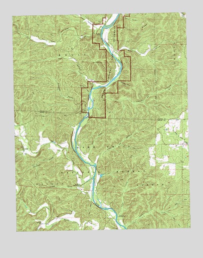
Grandin SW, MO USGS Topographic Map
Click on map above to begin viewing in our Map Viewer.

This topographic map contains these locations and features:
Feature Name Type Latitude Longitude GNIS ID View Map
Battleaxe RidgeRidgeN36.8691°W90.9217°748713View Map
Bay Nothing (historical)BayN36.8087°W90.9523°739872View Map
Bay Nothing Boat AccessLocaleN36.7937°W90.9540°754016View Map
Bear Camp CreekStreamN36.8670°W90.9343°748727View Map
Bear Camp SchoolSchoolN36.8548°W90.9560°747656View Map
Bedell HollowValleyN36.8526°W90.9250°748756View Map
Big Barren CreekStreamN36.7803°W90.9443°748815View Map
Big Barren School (historical)SchoolN36.8003°W90.9748°747658View Map
Bradford Chapel (historical)ChurchN36.8709°W90.9371°747655View Map
Cedar CreekStreamN36.7503°W90.9204°749283View Map
Cedar Creek Recreation AreaLocaleN36.7576°W90.9265°749291View Map
Colvin Bay (historical)BayN36.7537°W90.9235°739874View Map
Colvin CreekStreamN36.7518°W90.9217°749433View Map
Conway HollowValleyN36.7717°W90.9481°749449View Map
Crosswhite Club (historical)LocaleN36.8606°W90.9351°747661View Map
Good Hope ChurchChurchN36.7992°W90.8754°750069View Map
Good Hope SchoolSchoolN36.7981°W90.8807°747663View Map
Gooseneck HollowValleyN36.8209°W90.9470°750085View Map
Gooseneck River AccessLocaleN36.8212°W90.9468°753145View Map
Gooseneck River CampgroundLocaleN36.8212°W90.9468°753146View Map
Gum HollowValleyN36.7926°W90.9487°750175View Map
Gun Bay (historical)BayN36.8473°W90.9232°739871View Map
Hall HollowValleyN36.8344°W90.9415°750195View Map
Hannars GraveyardCemeteryN36.7806°W90.9554°735230View Map
Hawes Recreation AreaLocaleN36.8195°W90.9471°754219View Map
Hooper HollowValleyN36.8667°W90.9386°750382View Map
Hufstedler CemeteryCemeteryN36.7545°W90.9821°750415View Map
Jakes BayBayN36.7884°W90.9429°739873View Map
Jakes ValleyValleyN36.7878°W90.9426°750493View Map
Kelley BaySwampN36.8356°W90.9273°753098View Map
Kelley BluffCliffN36.8323°W90.9365°753143View Map
Kelley HollowValleyN36.8327°W90.9327°750573View Map
Kelly BayBayN36.8334°W90.9329°754960View Map
Lewis CemeteryCemeteryN36.7948°W90.9935°750688View Map
Little Barren School (historical)SchoolN36.7581°W90.9723°747660View Map
Mabrey MillsLocaleN36.7764°W90.9540°735229View Map
Marlboro DamDamN36.7801°W90.9385°764058View Map
Marlboro LakeReservoirN36.7815°W90.9383°764059View Map
Mayberry BayBayN36.7817°W90.9462°739869View Map
McDowell Place (historical)LocaleN36.8476°W90.9265°747662View Map
Old Short PlaceLocaleN36.8112°W90.9582°747657View Map
Panther Lookout TowerTowerN36.8470°W90.9401°755355View Map
Panther SpringSpringN36.8631°W90.9354°751490View Map
Phillips BayBayN36.8270°W90.9454°753144View Map
Pinneys CampLocaleN36.7942°W90.9532°747659View Map
Ponder CemeteryCemeteryN36.7964°W90.9673°751702View Map
Racetrack HollowValleyN36.7960°W90.9674°751787View Map
Spring CreekStreamN36.8287°W90.9454°752299View Map
Stillhouse HollowValleyN36.8364°W90.9251°752367View Map
TuckerPopulated PlaceN36.7617°W90.9368°735228View Map
Tucker BayBayN36.7659°W90.9398°739870View Map
Tuckers MillLocaleN36.7659°W90.9437°735227View Map
Tunnel BluffCliffN36.8150°W90.9456°754534View Map
Twin SpringsSpringN36.7762°W90.9548°752648View Map

Note: Coordinates in the location and feature list above are referenced to NAD83 datum.


Copyright (C) 2008-2025 Ryan Niemi / Sunset Dynamics ... All Rights Reserved