TopoQuest Logo
Do you find TopoQuest useful?
Help keep TopoQuest running and adding new maps/features by donating!
Bitcoin:  19c7KJd3qBynnjoSw5npx9KScwjBe4ifkT
Litecoin:  LXs6TkuXGGXo1vDsWCkWVdjQX94eUKd6ui
Home View Maps Find Maps Find Places Resources & Links


Van Dyne, Wisconsin Topographic Map

USGS Map Title: Van Dyne, WI
USGS Map MRC: 43088H5
DRG (GeoTIFF) Download: o43088h5.tif


Neighboring USGS Topographic Map Quads:


  Omro, WI  
44088A6
 

  Oshkosh, WI  
44088A5
 

  Indian Point, WI  
44088A4
 

  Pickett, WI  
43088H6
 

  Van Dyne, WI  
43088H5
 

  Fahrney Point, WI  
43088H4
 

  Rosendale, WI  
43088G6
 

  Eldorado, WI  
43088G5
 

  Fond du Lac, WI  
43088G4


Map MRC Location:

N44°
W89°
N44°
W88°
H8 H7 H6 H5 H4 H3 H2 H1
G8 G7 G6 G5 G4 G3 G2 G1
F8 F7 F6 F5 F4 F3 F2 F1
E8 E7 E6 E5 E4 E3 E2 E1
D8 D7 D6 D5 D4 D3 D2 D1
C8 C7 C6 C5 C4 C3 C2 C1
B8 B7 B6 B5 B4 B3 B2 B1
A8 A7 A6 A5 A4 A3 A2 A1
N43°
W89°
N43°
W88°

Van Dyne, WI USGS 1:24K Topographic Map Preview:
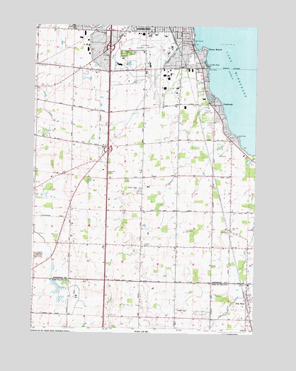
Van Dyne, WI USGS Topographic Map
Click on map above to begin viewing in our Map Viewer.

This topographic map contains these locations and features:
Feature Name Type Latitude Longitude GNIS ID View Map
Airborn Friesian FarmLocaleN43.9539°W88.6219°2711649View Map
Animal Hospital of OshkoshBuildingN43.9981°W88.5853°2711661View Map
Bethany United Church of ChristChurchN43.9917°W88.5401°1843485View Map
Black Oak School (historical)SchoolN43.9447°W88.5812°1561875View Map
Black WolfPopulated PlaceN43.9378°W88.5237°1577518View Map
Boyd CemeteryCemeteryN43.9814°W88.5426°1562109View Map
Boyd School (historical)SchoolN43.9808°W88.5421°1562111View Map
Bradley Egg FarmLocaleN43.9400°W88.5644°2711653View Map
Brennand FarmLocaleN43.9656°W88.5453°2711641View Map
Brick School (historical)SchoolN43.9639°W88.6209°1562190View Map
Clairville School (historical)SchoolN43.9964°W88.6157°1563100View Map
Cowham School (historical)SchoolN43.8805°W88.6240°1563463View Map
Ellinwood CemeteryCemeteryN43.9955°W88.5821°1564539View Map
Evangelical CemeteryCemeteryN43.9144°W88.5140°1843516View Map
FitzgeraldPopulated PlaceN43.9822°W88.6212°1577597View Map
Fox Valley Technical College FABTECH Education CenterSchoolN43.9706°W88.5446°2635488View Map
Fox Valley Technical College S. J. Spanbauer Aviation & Industrial CenterSchoolN43.9709°W88.5448°2635493View Map
Fugelberg ParkParkN43.9964°W88.5382°1843540View Map
Fun-Air AirportAirportN43.8828°W88.5414°2444169View Map
Glatz Nature ParkParkN43.9908°W88.5379°1843545View Map
Goldenrod School (historical)SchoolN43.9080°W88.5632°1565615View Map
Green Meadow Elementary SchoolSchoolN43.9366°W88.6146°1843550View Map
Interchange 113CrossingN43.9508°W88.5833°2356975View Map
Interchange 116CrossingN43.9903°W88.5828°2356974View Map
Lake Aire Shopping CenterLocaleN43.9933°W88.5429°1843568View Map
Lakeside Green Meadow Elementary SchoolSchoolN43.9457°W88.5066°1567787View Map
Lincoln School (historical)SchoolN43.9667°W88.5659°1568105View Map
Manufacturers Marketplace of Oshkosh Shopping CenterLocaleN43.9622°W88.5837°1843573View Map
Nekimi Volunteer Fire DepartmentBuildingN43.9455°W88.5874°2697668View Map
New Bethel ChurchChurchN43.9219°W88.5426°1570205View Map
New Elm CemeteryCemeteryN43.9161°W88.5132°1843590View Map
New Elm ChurchChurchN43.9150°W88.5129°1570210View Map
Oshkosh Country ClubLocaleN43.9650°W88.5232°1843606View Map
Oshkosh Fire Department Station 14 - Aircraft Rescue and Fire Fighting StationBuildingN43.9939°W88.5622°2698087View Map
PaukotukPopulated PlaceN43.9680°W88.5209°1571088View Map
Peace Lutheran CemeteryCemeteryN43.9818°W88.5369°1843623View Map
Pioneer AirportAirportN43.9860°W88.5772°1582136View Map
Radtke FarmLocaleN43.9108°W88.5722°2711691View Map
Red School (historical)SchoolN43.9092°W88.6029°1572157View Map
Roe NurseriesBuildingN43.9817°W88.5333°2629054View Map
Roe PointCapeN43.9825°W88.5257°1572525View Map
Sacred Heart CemeteryCemeteryN43.9878°W88.5690°1572782View Map
Saint Johns ChurchChurchN43.9075°W88.5434°1573092View Map
Saint Johns Lutheran CemeteryCemeteryN43.9064°W88.5434°1964385View Map
Salem CemeteryCemeteryN43.9286°W88.6229°1573615View Map
Schellers CemeteryCemeteryN43.9089°W88.5620°1573777View Map
Smith Elementary SchoolSchoolN43.9998°W88.5431°1574317View Map
Stony BeachPopulated PlaceN43.9880°W88.5279°1574938View Map
Town of NekimiCivilN43.9359°W88.5955°1583787View Map
Traeger Elementary SchoolSchoolN43.9988°W88.6099°2716584View Map
Traeger Middle SchoolSchoolN43.9977°W88.6100°2716894View Map
Twenty-Fourth Avenue Boat RampLocaleN43.9919°W88.5359°1843687View Map
Van DynePopulated PlaceN43.8875°W88.5043°1584511View Map
Van Dyne Census Designated PlaceCensusN43.8862°W88.5012°2586565View Map
Van Dyne Volunteer Fire DepartmentBuildingN43.8867°W88.5025°2697850View Map
Widmer School (historical)SchoolN43.9083°W88.5243°1576715View Map
Wil - Dale FarmsLocaleN43.9678°W88.5908°2711701View Map
Wilhelmina CemeteryCemeteryN43.9147°W88.5384°1576753View Map
Wittman Regional AirportAirportN43.9943°W88.5533°1582131View Map
Wood School (historical)SchoolN43.9886°W88.5815°1576978View Map
Zwicky FarmLocaleN43.9339°W88.5483°2711697View Map

Note: Coordinates in the location and feature list above are referenced to NAD83 datum.


Copyright (C) 2008-2024 Ryan Niemi / Sunset Dynamics ... All Rights Reserved