TopoQuest Logo
Do you find TopoQuest useful?
Help keep TopoQuest running and adding new maps/features by donating!
Bitcoin:  19c7KJd3qBynnjoSw5npx9KScwjBe4ifkT
Litecoin:  LXs6TkuXGGXo1vDsWCkWVdjQX94eUKd6ui
Home View Maps Find Maps Find Places Resources & Links


Pickett, Wisconsin Topographic Map

USGS Map Title: Pickett, WI
USGS Map MRC: 43088H6
DRG (GeoTIFF) Download: o43088h6.tif


Neighboring USGS Topographic Map Quads:


  Eureka, WI  
44088A7
 

  Omro, WI  
44088A6
 

  Oshkosh, WI  
44088A5
 

  Rush Lake, WI  
43088H7
 

  Pickett, WI  
43088H6
 

  Van Dyne, WI  
43088H5
 

  Ripon, WI  
43088G7
 

  Rosendale, WI  
43088G6
 

  Eldorado, WI  
43088G5


Map MRC Location:

N44°
W89°
N44°
W88°
H8 H7 H6 H5 H4 H3 H2 H1
G8 G7 G6 G5 G4 G3 G2 G1
F8 F7 F6 F5 F4 F3 F2 F1
E8 E7 E6 E5 E4 E3 E2 E1
D8 D7 D6 D5 D4 D3 D2 D1
C8 C7 C6 C5 C4 C3 C2 C1
B8 B7 B6 B5 B4 B3 B2 B1
A8 A7 A6 A5 A4 A3 A2 A1
N43°
W89°
N43°
W88°

Pickett, WI USGS 1:24K Topographic Map Preview:
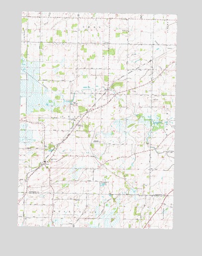
Pickett, WI USGS Topographic Map
Click on map above to begin viewing in our Map Viewer.

This topographic map contains these locations and features:
Feature Name Type Latitude Longitude GNIS ID View Map
Bethesda CemeteryCemeteryN43.9094°W88.6429°1964381View Map
Bradbo FarmLocaleN43.9589°W88.7203°2712117View Map
Bradley FarmLocaleN43.9589°W88.7269°2712115View Map
Buehring FarmLocaleN43.9133°W88.6350°2711656View Map
Davis FarmsLocaleN43.9861°W88.7367°2712119View Map
Dencar FarmsLocaleN43.9769°W88.6419°2711643View Map
Do - Da DairyLocaleN43.9514°W88.6389°2711644View Map
EloPopulated PlaceN43.9383°W88.7062°1577588View Map
Fisher FarmsLocaleN43.9628°W88.7025°2712121View Map
FiskPopulated PlaceN43.9558°W88.6782°1565028View Map
Fletcher School (historical)SchoolN43.8800°W88.7440°1565070View Map
Fritz FarmLocaleN43.9517°W88.6981°2711658View Map
Gizmo FarmLocaleN43.9611°W88.6661°2711659View Map
Hawley School (historical)SchoolN43.9128°W88.6837°1566165View Map
Hilltop AcresLocaleN43.9686°W88.6817°2711645View Map
Jackson School (historical)SchoolN43.9219°W88.6373°1567075View Map
Knott SchoolSchoolN43.9816°W88.6632°1567579View Map
Liberty Prairie CemeteryCemeteryN43.9136°W88.7254°1843571View Map
Maple Lane FarmLocaleN43.9344°W88.7056°2712123View Map
Maple SchoolSchoolN43.9966°W88.7046°1568999View Map
Minckler CemeteryCemeteryN43.9900°W88.6620°1569546View Map
Oak Grove School (historical)SchoolN43.8955°W88.6484°1570628View Map
Peace CemeteryCemeteryN43.8911°W88.7040°1571110View Map
Peniel ChurchChurchN43.8944°W88.6398°1571171View Map
Pfaffenroth Private Airport (historical)AirportN43.9250°W88.6676°1581024View Map
PickettPopulated PlaceN43.9114°W88.7298°1571335View Map
Pickett Post OfficePost OfficeN43.9111°W88.7311°2712124View Map
Plainview SchoolSchoolN43.9828°W88.6784°1571581View Map
Planeacres AirportAirportN43.9498°W88.6737°2444166View Map
R and D Aqua FarmLocaleN43.9550°W88.6406°2711703View Map
Radloff Dairy FarmLocaleN43.9661°W88.6456°2711648View Map
RingPopulated PlaceN43.9092°W88.6404°1577791View Map
Tice CemeteryCemeteryN43.9891°W88.7040°1575435View Map
Tice SchoolSchoolN43.9825°W88.7046°1575436View Map
Town of UticaCivilN43.9379°W88.7039°1584323View Map
Triangle School (historical)SchoolN43.8805°W88.6996°1575605View Map
Utica Center SchoolSchoolN43.9378°W88.7071°1843691View Map
Utica Volunteer Fire Department and First RespondersBuildingN43.9538°W88.6789°2697878View Map
Williams AirportAirportN43.9341°W88.7055°1582132View Map
Wind Ridge FarmLocaleN43.9939°W88.6458°2711699View Map
ZionPopulated PlaceN43.9969°W88.6621°1577899View Map
Zoar CemeteryCemeteryN43.8941°W88.6482°1577184View Map

Note: Coordinates in the location and feature list above are referenced to NAD83 datum.


Copyright (C) 2008-2024 Ryan Niemi / Sunset Dynamics ... All Rights Reserved