TopoQuest Logo
Do you find TopoQuest useful?
Help keep TopoQuest running and adding new maps/features by donating!
Bitcoin:  19c7KJd3qBynnjoSw5npx9KScwjBe4ifkT
Litecoin:  LXs6TkuXGGXo1vDsWCkWVdjQX94eUKd6ui
Home View Maps Find Maps Find Places Resources & Links


Rosendale, Wisconsin Topographic Map

USGS Map Title: Rosendale, WI
USGS Map MRC: 43088G6
DRG (GeoTIFF) Download: o43088g6.tif


Neighboring USGS Topographic Map Quads:


  Rush Lake, WI  
43088H7
 

  Pickett, WI  
43088H6
 

  Van Dyne, WI  
43088H5
 

  Ripon, WI  
43088G7
 

  Rosendale, WI  
43088G6
 

  Eldorado, WI  
43088G5
 

  Brandon, WI  
43088F7
 

  Waupun North, WI  
43088F6
 

  Oakfield, WI  
43088F5


Map MRC Location:

N44°
W89°
N44°
W88°
H8 H7 H6 H5 H4 H3 H2 H1
G8 G7 G6 G5 G4 G3 G2 G1
F8 F7 F6 F5 F4 F3 F2 F1
E8 E7 E6 E5 E4 E3 E2 E1
D8 D7 D6 D5 D4 D3 D2 D1
C8 C7 C6 C5 C4 C3 C2 C1
B8 B7 B6 B5 B4 B3 B2 B1
A8 A7 A6 A5 A4 A3 A2 A1
N43°
W89°
N43°
W88°

Rosendale, WI USGS 1:24K Topographic Map Preview:
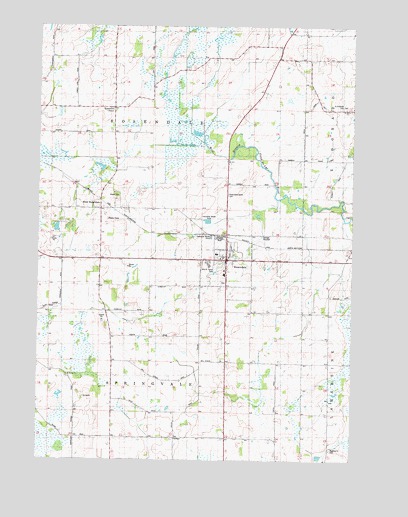
Rosendale, WI USGS Topographic Map
Click on map above to begin viewing in our Map Viewer.

This topographic map contains these locations and features:
Feature Name Type Latitude Longitude GNIS ID View Map
Bell SchoolSchoolN43.7789°W88.6854°1561528View Map
Coehoorn FarmsLocaleN43.7550°W88.6356°2727158View Map
Coles Corner SchoolSchoolN43.7567°W88.6754°1563257View Map
Dodd SchoolSchoolN43.8694°W88.6532°1564017View Map
Emerson SchoolSchoolN43.7594°W88.7196°1564616View Map
Fremont SchoolSchoolN43.8294°W88.6748°1565301View Map
Goeden FarmLocaleN43.8503°W88.7439°2726871View Map
Guenzel FarmLocaleN43.7947°W88.6631°2727160View Map
Laconia High SchoolSchoolN43.8062°W88.6819°1845839View Map
North Eldorado CemeteryCemeteryN43.8516°W88.6307°1845866View Map
North Rosendale CemeteryCemeteryN43.8265°W88.6747°1572612View Map
Orvis FarmsLocaleN43.7772°W88.6353°2727161View Map
Perry SchoolSchoolN43.7828°W88.6332°1571235View Map
Pinch FarmsLocaleN43.7742°W88.6972°2727155View Map
Rogersville CemeteryCemeteryN43.7528°W88.6329°1572541View Map
Rose - Eld FarmsLocaleN43.8164°W88.6486°2727162View Map
Roselle FarmsLocaleN43.8133°W88.6544°2727159View Map
RosendalePopulated PlaceN43.8078°W88.6748°1572611View Map
Rosendale CemeteryCemeteryN43.8016°W88.6759°1845896View Map
Rosendale CenterPopulated PlaceN43.8517°W88.7204°1577797View Map
Rosendale Fire DepartmentBuildingN43.8084°W88.6689°2698167View Map
Rosendale Intermediate SchoolSchoolN43.8037°W88.6761°1845898View Map
Rosendale Police DepartmentBuildingN43.8092°W88.6805°2759869View Map
Rosendale Primary SchoolSchoolN43.8094°W88.6789°1845897View Map
Rosendale Wastewater Treatment FacilityLocaleN43.8147°W88.6614°2711510View Map
Royal Crest FarmsLocaleN43.7553°W88.6319°2727163View Map
Saint Marys CemeteryCemeteryN43.8516°W88.6287°1845928View Map
Saint Marys ChurchChurchN43.7744°W88.7382°1573316View Map
Saint Marys ChurchChurchN43.8514°W88.6282°1845929View Map
Shafer's AcresLocaleN43.7661°W88.6767°2727184View Map
Stoney Hill FarmsLocaleN43.8211°W88.7153°2727164View Map
Town of RosendaleCivilN43.8519°W88.7056°1584065View Map
Town of SpringvaleCivilN43.7633°W88.7054°1584202View Map
Townline SchoolSchoolN43.8075°W88.7368°1575554View Map
Village of RosendaleCivilN43.8079°W88.6732°1584064View Map
West RosendalePopulated PlaceN43.8225°W88.7251°1577880View Map
William N Taylor ParkParkN43.8055°W88.6796°1845975View Map
WYUR-FM (Ripon)TowerN43.8194°W88.7223°1582451View Map

Note: Coordinates in the location and feature list above are referenced to NAD83 datum.


Copyright (C) 2008-2025 Ryan Niemi / Sunset Dynamics ... All Rights Reserved