TopoQuest Logo
Do you find TopoQuest useful?
Help keep TopoQuest running and adding new maps/features by donating!
Bitcoin:  19c7KJd3qBynnjoSw5npx9KScwjBe4ifkT
Litecoin:  LXs6TkuXGGXo1vDsWCkWVdjQX94eUKd6ui
Home View Maps Find Maps Find Places Resources & Links


Westley, California Topographic Map

USGS Map Title: Westley, CA
USGS Map MRC: 37121E2
DRG (GeoTIFF) Download: o37121e2.tif


Neighboring USGS Topographic Map Quads:


  Vernalis, CA  
37121F3
 

  Ripon, CA  
37121F2
 

  Salida, CA  
37121F1
 

  Solyo, CA  
37121E3
 

  Westley, CA  
37121E2
 

  Brush Lake, CA  
37121E1
 

  Copper Mountain, CA  
37121D3
 

  Patterson, CA  
37121D2
 

  Crows Landing, CA  
37121D1


Map MRC Location:

N38°
W122°
N38°
W121°
H8 H7 H6 H5 H4 H3 H2 H1
G8 G7 G6 G5 G4 G3 G2 G1
F8 F7 F6 F5 F4 F3 F2 F1
E8 E7 E6 E5 E4 E3 E2 E1
D8 D7 D6 D5 D4 D3 D2 D1
C8 C7 C6 C5 C4 C3 C2 C1
B8 B7 B6 B5 B4 B3 B2 B1
A8 A7 A6 A5 A4 A3 A2 A1
N37°
W122°
N37°
W121°

Westley, CA USGS 1:24K Topographic Map Preview:
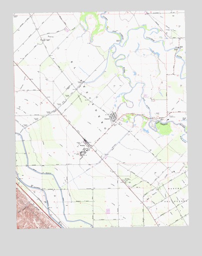
Westley, CA USGS Topographic Map
Click on map above to begin viewing in our Map Viewer.

This topographic map contains these locations and features:
Feature Name Type Latitude Longitude GNIS ID View Map
Bizzini FarmLocaleN37.6094°W121.1314°2703413View Map
Del Mar Farms AirportAirportN37.5487°W121.1616°2770475View Map
Del Puerto and Saint Marys CemeteryCemeteryN37.5267°W121.1728°222235View Map
El Solyo RanchLocaleN37.6091°W121.2277°223061View Map
Finnegan CutChannelN37.6241°W121.1833°223511View Map
Flying Bull AirportAirportN37.6184°W121.1676°2650962View Map
GraysonPopulated PlaceN37.5638°W121.1794°1658661View Map
Grayson CemeteryCemeteryN37.5598°W121.1799°224525View Map
Grayson Census Designated PlaceCensusN37.5650°W121.1795°2408324View Map
Grayson Charter SchoolSchoolN37.5448°W121.1990°224527View Map
Grider IslandAreaN37.5569°W121.1347°1662132View Map
Halley (historical)Populated PlaceN37.5947°W121.2483°1702960View Map
Hidden Valley DairyLocaleN37.5739°W121.1519°2703318View Map
Honor Farm Sheriff's DepartmentBuildingN37.5613°W121.1407°2755809View Map
Hospital CreekStreamN37.6185°W121.2016°234041View Map
Ingram CreekStreamN37.6144°W121.2066°225931View Map
Kern CanyonValleyN37.5160°W121.2394°226531View Map
Laird ParkParkN37.5619°W121.1466°226792View Map
Laird SloughGutN37.5713°W121.1560°226793View Map
Lateral Four SouthCanalN37.5369°W121.2052°254872View Map
Lateral Three SouthCanalN37.5527°W121.2016°254871View Map
Lateral Two SouthCanalN37.5585°W121.1924°254869View Map
Lower White Lake (historical)LakeN37.6055°W121.2065°1662141View Map
Richie SloughLakeN37.5491°W121.1273°231549View Map
Shiloh BridgeBridgeN37.6033°W121.1316°252054View Map
Tuolumne City (historical)Populated PlaceN37.6041°W121.1310°1662163View Map
Tuolumne RiverStreamN37.6058°W121.1735°255171View Map
Upper White Lake (historical)LakeN37.5833°W121.1966°1662164View Map
Valley Crop Dusters, Inc AirportAirportN37.5497°W121.2026°1654114View Map
West Stanislaus County Fire Protection District El Solyo Station 4BuildingN37.6091°W121.2297°2624379View Map
West Stanislaus County Fire Protection District Westley Station 3BuildingN37.5500°W121.2015°2624377View Map
West Stanislaus Main CanalCanalN37.5744°W121.2133°237529View Map
WestleyPopulated PlaceN37.5494°W121.1991°237554View Map
Westley Census Designated PlaceCensusN37.5444°W121.2035°2409574View Map
Westley Post OfficePost OfficeN37.5493°W121.1999°2760181View Map
Westley WastewayCanalN37.5408°W121.1866°237555View Map

Note: Coordinates in the location and feature list above are referenced to NAD83 datum.


Copyright (C) 2008-2025 Ryan Niemi / Sunset Dynamics ... All Rights Reserved