TopoQuest Logo
Do you find TopoQuest useful?
Help keep TopoQuest running and adding new maps/features by donating!
Bitcoin:  19c7KJd3qBynnjoSw5npx9KScwjBe4ifkT
Litecoin:  LXs6TkuXGGXo1vDsWCkWVdjQX94eUKd6ui
Home View Maps Find Maps Find Places Resources & Links


Vernon, Louisiana Topographic Map

USGS Map Title: Vernon, LA
USGS Map MRC: 32092D5
DRG (GeoTIFF) Download: o32092d5.tif


Neighboring USGS Topographic Map Quads:


  Ruston West, LA  
32092E6
 

  Ruston East, LA  
32092E5
 

  Downsville South, LA  
32092E4
 

  Clay, LA  
32092D6
 

  Vernon, LA  
32092D5
 

  Eros, LA  
32092D4
 

  Jonesboro North, LA  
32092C6
 

  Curr Creek, LA  
32092C5
 

  Chatham, LA  
32092C4


Map MRC Location:

N33°
W93°
N33°
W92°
H8 H7 H6 H5 H4 H3 H2 H1
G8 G7 G6 G5 G4 G3 G2 G1
F8 F7 F6 F5 F4 F3 F2 F1
E8 E7 E6 E5 E4 E3 E2 E1
D8 D7 D6 D5 D4 D3 D2 D1
C8 C7 C6 C5 C4 C3 C2 C1
B8 B7 B6 B5 B4 B3 B2 B1
A8 A7 A6 A5 A4 A3 A2 A1
N32°
W93°
N32°
W92°

Vernon, LA USGS 1:24K Topographic Map Preview:
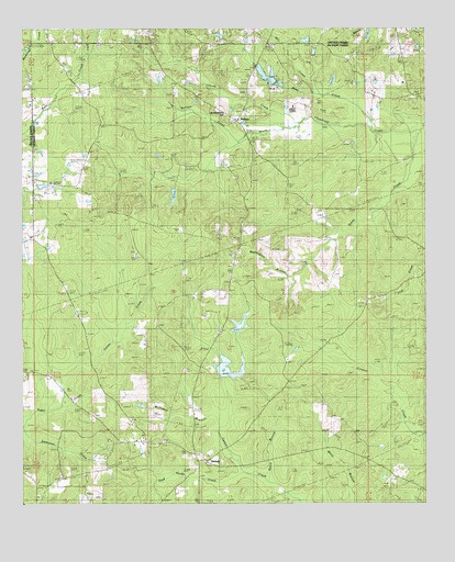
Vernon, LA USGS Topographic Map
Click on map above to begin viewing in our Map Viewer.

This topographic map contains these locations and features:
Feature Name Type Latitude Longitude GNIS ID View Map
Buckenham HillSummitN32.4790°W92.5632°543037View Map
Chunk CreekStreamN32.4746°W92.5446°533951View Map
Colon CreekStreamN32.4010°W92.6124°534052View Map
County Line ChurchChurchN32.4488°W92.5563°534187View Map
Ebenezer Baptist Church (historical)ChurchN32.4454°W92.5635°542287View Map
Ebenezer CemeteryCemeteryN32.4454°W92.5637°534754View Map
EbenzerPopulated PlaceN32.4463°W92.5574°542286View Map
Guice BranchStreamN32.3788°W92.5438°535440View Map
Jackson Ward 2 Fire DistrictBuildingN32.3861°W92.5671°2673108View Map
KelleysPopulated PlaceN32.4760°W92.5585°554916View Map
Kelleys CreekStreamN32.4721°W92.5560°536159View Map
Kelleys Gas FieldOilfieldN32.4738°W92.5710°542318View Map
Kelly Pond DamDamN32.4218°W92.5568°556900View Map
Lamkin PondLakeN32.3949°W92.5888°554991View Map
LongstrawPopulated PlaceN32.4960°W92.5490°542320View Map
Longstraw Baptist ChurchChurchN32.4954°W92.5482°555161View Map
McDowell BranchStreamN32.3954°W92.5638°558266View Map
Mill CreekStreamN32.4832°W92.5326°537105View Map
Mount Pisgah Baptist ChurchChurchN32.4960°W92.6049°555405View Map
Mount Zion (historical)Populated PlaceN32.3818°W92.6126°542329View Map
Mount Zion / Saint Rest CemeteryCemeteryN32.3827°W92.6132°542330View Map
Mount Zion Baptist ChurchChurchN32.3821°W92.6135°555421View Map
Oak RidgePopulated PlaceN32.3821°W92.5093°542335View Map
Oak Ridge CemeteryCemeteryN32.3824°W92.5085°537797View Map
Oak Ridge Church (historical)ChurchN32.3821°W92.5096°542336View Map
Sandy CreekStreamN32.4732°W92.5021°539159View Map
Shaw CreekStreamN32.4743°W92.5165°539306View Map
Stud Horse CreekStreamN32.3832°W92.5563°539698View Map
VernonPopulated PlaceN32.3888°W92.5715°541206View Map
Vernon Baptist ChurchChurchN32.3857°W92.5685°542361View Map
Vernon CemeteryCemeteryN32.3833°W92.5666°542362View Map
Vernon Gas FieldOilfieldN32.3935°W92.5765°542364View Map
Washington BranchStreamN32.4338°W92.5410°540241View Map

Note: Coordinates in the location and feature list above are referenced to NAD83 datum.


Copyright (C) 2008-2024 Ryan Niemi / Sunset Dynamics ... All Rights Reserved