TopoQuest Logo
Do you find TopoQuest useful?
Help keep TopoQuest running and adding new maps/features by donating!
Bitcoin:  19c7KJd3qBynnjoSw5npx9KScwjBe4ifkT
Litecoin:  LXs6TkuXGGXo1vDsWCkWVdjQX94eUKd6ui
Home View Maps Find Maps Find Places Resources & Links


Vernon, New York Topographic Map

USGS Map Title: Vernon, NY
USGS Map MRC: 43075A5
DRG (GeoTIFF) Download: o43075a5.tif


Neighboring USGS Topographic Map Quads:


  Sylvan Beach, NY  
43075B6
 

  Verona, NY  
43075B5
 

  Rome, NY  
43075B4
 

  Oneida, NY  
43075A6
 

  Vernon, NY  
43075A5
 

  Clinton, NY  
43075A4
 

  Morrisville, NY  
42075H6
 

  Munnsville, NY  
42075H5
 

  Oriskany Falls, NY  
42075H4


Map MRC Location:

N44°
W76°
N44°
W75°
H8 H7 H6 H5 H4 H3 H2 H1
G8 G7 G6 G5 G4 G3 G2 G1
F8 F7 F6 F5 F4 F3 F2 F1
E8 E7 E6 E5 E4 E3 E2 E1
D8 D7 D6 D5 D4 D3 D2 D1
C8 C7 C6 C5 C4 C3 C2 C1
B8 B7 B6 B5 B4 B3 B2 B1
A8 A7 A6 A5 A4 A3 A2 A1
N43°
W76°
N43°
W75°

Vernon, NY USGS 1:24K Topographic Map Preview:
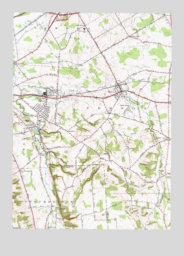
Vernon, NY USGS Topographic Map
Click on map above to begin viewing in our Map Viewer.

This topographic map contains these locations and features:
Feature Name Type Latitude Longitude GNIS ID View Map
Beacon Light Baptist ChurchChurchN43.1072°W75.5589°2436583View Map
Beaver Meadow CreekStreamN43.0831°W75.5393°943409View Map
Bennetts CornersPopulated PlaceN43.0434°W75.6032°943685View Map
Brewers CornerPopulated PlaceN43.1115°W75.5341°972257View Map
Christ United Methodist ChurchChurchN43.0683°W75.5998°2615724View Map
City of SherrillCivilN43.0704°W75.5992°979493View Map
E A McAllister Elementary SchoolSchoolN43.0722°W75.6019°2436814View Map
Eaton HillSummitN43.0267°W75.5491°949320View Map
Five Chimneys CornerPopulated PlaceN43.0334°W75.6191°972475View Map
Gethsemane Episcopal ChurchChurchN43.0689°W75.5983°2616074View Map
Green Acres Mobile Home ParkPopulated PlaceN43.0115°W75.5962°2598893View Map
Holy Family ChurchChurchN43.0731°W75.5431°2436584View Map
Indian ChurchChurchN43.0562°W75.5813°953634View Map
Interchange 33CrossingN43.1234°W75.5860°975725View Map
KenwoodPopulated PlaceN43.0581°W75.6121°954540View Map
Mount Vernon Presbyterian ChurchChurchN43.0775°W75.5428°2436585View Map
Mud CreekStreamN43.0503°W75.6063°957996View Map
Oneida Castle Volunteer Fire DepartmentBuildingN43.0827°W75.6238°2734844View Map
Oneida Community CemeteryCemeteryN43.0615°W75.6111°959366View Map
Oneida Community Golf ClubLocaleN43.0637°W75.6080°2598908View Map
Oneida Community Mansion HouseBuildingN43.0603°W75.6047°2598919View Map
Oneida Nation ReservationCivilN43.0407°W75.6190°2390692View Map
Oneida Nation ReservationCivilN43.0407°W75.6190°2419043View Map
Our Lady of Good Counsel ChurchChurchN43.1170°W75.5706°2616186View Map
Plymouth Alliance ChurchChurchN43.0724°W75.6007°2616793View Map
Porter BrookStreamN43.0201°W75.5068°960984View Map
Quiet Valley Trailer ParkPopulated PlaceN43.0228°W75.5072°2485839View Map
Saint Helena's ChurchChurchN43.0709°W75.5980°2616918View Map
SconondoaPopulated PlaceN43.0959°W75.6235°964658View Map
SherrillPopulated PlaceN43.0737°W75.5982°965089View Map
Sherrill - Kenwood Free LibraryBuildingN43.0696°W75.6016°2617425View Map
Sherrill - Kenwood Volunteer Fire DepartmentBuildingN43.0723°W75.5994°2718481View Map
Sherrill City Sewage Treatment PlantLocaleN43.0702°W75.6152°2617761View Map
Sherrill Post OfficePost OfficeN43.0696°W75.6007°2618121View Map
Sherrill ReservoirReservoirN43.0609°W75.5918°965090View Map
Skinner CemeteryCemeteryN43.0339°W75.5044°965355View Map
Stockbridge CemeteryCemeteryN43.0010°W75.5973°966462View Map
Stockbridge CemeteryCemeteryN43.0009°W75.5974°970661View Map
Stockbridge ValleyValleyN43.0681°W75.6096°966466View Map
Sunset LakeLakeN43.0573°W75.6066°966842View Map
Sweet Grass FarmLocaleN43.0947°W75.5244°2542349View Map
Taylor CreekStreamN43.0740°W75.6216°967086View Map
The Church of Jesus Christ of Latter Day SaintsChurchN43.0640°W75.6204°2597880View Map
Town of VernonCivilN43.0658°W75.5318°979580View Map
Valley MillsPopulated PlaceN43.0120°W75.5896°968360View Map
Valley View CemeteryCemeteryN43.0601°W75.6166°968371View Map
VernonPopulated PlaceN43.0795°W75.5393°968495View Map
Vernon Baptist ChurchChurchN43.0797°W75.5417°2436586View Map
Vernon CenterPopulated PlaceN43.0523°W75.5016°968496View Map
Vernon Center Methodist ChurchChurchN43.0532°W75.5021°2617150View Map
Vernon Center Post OfficePost OfficeN43.0515°W75.5024°2618165View Map
Vernon Center Volunteer Fire DepartmentBuildingN43.0537°W75.5043°2734848View Map
Vernon DownsLocaleN43.0681°W75.5310°975712View Map
Vernon Downs Mobile Home ParkPopulated PlaceN43.0692°W75.5358°2485848View Map
Vernon Post OfficePost OfficeN43.0795°W75.5383°2618166View Map
Vernon Public LibraryBuildingN43.0786°W75.5397°2617449View Map
Vernon Sewage Treatment PlantLocaleN43.0814°W75.5469°2436572View Map
Vernon-Verona-Sherrill Senior High SchoolSchoolN43.1156°W75.5683°2436813View Map
Village of VernonCivilN43.0794°W75.5387°2391184View Map
Volunteer Fire Company of VernonBuildingN43.0793°W75.5412°2734849View Map
VVS Central SchoolSchoolN43.1156°W75.5693°968335View Map
W A Wettel Elementary SchoolSchoolN43.0722°W75.5458°2436579View Map
Willow PlacePopulated PlaceN43.1175°W75.5972°2485844View Map
Windex FarmsLocaleN43.1025°W75.5003°2559392View Map

Note: Coordinates in the location and feature list above are referenced to NAD83 datum.


Copyright (C) 2008-2024 Ryan Niemi / Sunset Dynamics ... All Rights Reserved