TopoQuest Logo
Do you find TopoQuest useful?
Help keep TopoQuest running and adding new maps/features by donating!
Bitcoin:  19c7KJd3qBynnjoSw5npx9KScwjBe4ifkT
Litecoin:  LXs6TkuXGGXo1vDsWCkWVdjQX94eUKd6ui
Home View Maps Find Maps Find Places Resources & Links


Munnsville, New York Topographic Map

USGS Map Title: Munnsville, NY
USGS Map MRC: 42075H5
DRG (GeoTIFF) Download: o42075h5.tif


Neighboring USGS Topographic Map Quads:


  Oneida, NY  
43075A6
 

  Vernon, NY  
43075A5
 

  Clinton, NY  
43075A4
 

  Morrisville, NY  
42075H6
 

  Munnsville, NY  
42075H5
 

  Oriskany Falls, NY  
42075H4
 

  West Eaton, NY  
42075G6
 

  Hamilton, NY  
42075G5
 

  Hubbardsville, NY  
42075G4


Map MRC Location:

N43°
W76°
N43°
W75°
H8 H7 H6 H5 H4 H3 H2 H1
G8 G7 G6 G5 G4 G3 G2 G1
F8 F7 F6 F5 F4 F3 F2 F1
E8 E7 E6 E5 E4 E3 E2 E1
D8 D7 D6 D5 D4 D3 D2 D1
C8 C7 C6 C5 C4 C3 C2 C1
B8 B7 B6 B5 B4 B3 B2 B1
A8 A7 A6 A5 A4 A3 A2 A1
N42°
W76°
N42°
W75°

Munnsville, NY USGS 1:24K Topographic Map Preview:
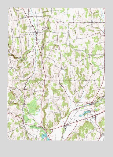
Munnsville, NY USGS Topographic Map
Click on map above to begin viewing in our Map Viewer.

This topographic map contains these locations and features:
Feature Name Type Latitude Longitude GNIS ID View Map
AugustaPopulated PlaceN42.9748°W75.5013°942699View Map
Barber CemeteryCemeteryN42.9604°W75.5393°942980View Map
Blue CreekStreamN42.9634°W75.5924°944302View Map
BouckvillePopulated PlaceN42.8892°W75.5513°944488View Map
Bouckville Post OfficePost OfficeN42.8898°W75.5499°2599206View Map
Bridges CornersLocaleN42.9426°W75.5560°944723View Map
Church of the ResurrectionChurchN42.8754°W75.5854°2597847View Map
Crow HillSummitN42.9156°W75.5610°947839View Map
Cummings CemeteryCemeteryN42.9481°W75.5647°947932View Map
Fairview CemeteryCemeteryN42.9215°W75.5785°949835View Map
Hillcrest Spring CemeteryCemeteryN42.9242°W75.6180°952817View Map
Indian Opening CemeteryCemeteryN42.9053°W75.5186°2353132View Map
Johnnycake HillSummitN42.8845°W75.5235°954092View Map
Kingdom Hall of Jehovahs WitnessesChurchN42.8768°W75.5764°2597862View Map
KnoxboroPopulated PlaceN42.9865°W75.5171°954798View Map
Knoxboro - Augusta CemeteryCemeteryN42.9783°W75.5160°954799View Map
Knoxboro Post OfficePost OfficeN42.9864°W75.5175°2617992View Map
Lloyds CornersLocaleN42.9559°W75.5196°955767View Map
MadisonPopulated PlaceN42.8990°W75.5121°956252View Map
Madison Baptist ChurchChurchN42.9014°W75.5129°2597864View Map
Madison Central SchoolSchoolN42.8995°W75.5160°2597232View Map
Madison Fire DepartmentBuildingN42.8993°W75.5101°2718221View Map
Madison LakeLakeN42.9016°W75.5241°956259View Map
Madison Lake Estates Mobile Home ParkPopulated PlaceN42.8964°W75.5245°2598894View Map
Madison Post OfficePost OfficeN42.8987°W75.5126°2599210View Map
Madison United Methodist ChurchChurchN42.8990°W75.5113°2597865View Map
Madison Village CemeteryCemeteryN42.8980°W75.5106°2542869View Map
Morrisville StationPopulated PlaceN42.8915°W75.6041°957707View Map
Mosquito PointSummitN42.9792°W75.5735°957753View Map
MunnsPopulated PlaceN42.9812°W75.5777°972826View Map
MunnsvillePopulated PlaceN42.9770°W75.5868°958162View Map
Munnsville Post OfficePost OfficeN42.9768°W75.5876°2599211View Map
Munnsville QuarryMineN42.9619°W75.5792°2712453View Map
Munnsville Village CemeteryCemeteryN42.9788°W75.5925°2542868View Map
Munnsville Volunteer Fire DepartmentBuildingN42.9746°W75.5875°2735039View Map
Munnsville West HillSummitN42.9784°W75.6205°958163View Map
Newell CornersLocaleN42.9442°W75.5005°958507View Map
Oak HillSummitN42.9631°W75.5632°959111View Map
Old Meeting House Hill CemeteryCemeteryN42.8804°W75.5009°2542870View Map
Pine WoodsPopulated PlaceN42.8870°W75.5791°960565View Map
Pine Woods CemeteryCemeteryN42.8775°W75.5699°960566View Map
PrattsPopulated PlaceN42.9215°W75.5902°972970View Map
Pratts HollowPopulated PlaceN42.9228°W75.6027°961101View Map
Prospect HillSummitN42.9506°W75.5368°961172View Map
Saint Theresa Catholic ChurchChurchN42.9739°W75.5883°2597879View Map
School Number 1 (historical)SchoolN42.9725°W75.5019°2357009View Map
School Number 10 (historical)SchoolN42.9236°W75.6033°2353135View Map
School Number 11 (historical)SchoolN42.9162°W75.5121°974992View Map
School Number 11 (historical)SchoolN42.9865°W75.5410°974995View Map
School Number 3 (historical)SchoolN42.9419°W75.5561°2353134View Map
School Number 5 (historical)SchoolN42.9553°W75.5203°2357010View Map
School Number 8 (historical)SchoolN42.9423°W75.5010°975598View Map
SolsvillePopulated PlaceN42.9106°W75.5177°965630View Map
State of New YorkCivilN42.9212°W75.5965°1779796View Map
StockbridgePopulated PlaceN42.9912°W75.5993°966463View Map
Stockbridge FallsFallsN42.9512°W75.6077°966464View Map
Stockbridge Valley Central SchoolSchoolN42.9803°W75.5978°2597171View Map
Stockbridge Valley High SchoolSchoolN42.9826°W75.5938°966467View Map
Strip Road CemeteryCemeteryN42.9429°W75.5539°2542927View Map
The OxbowLocaleN42.9886°W75.5733°2353133View Map
Town of AugustaCivilN42.9772°W75.5022°978696View Map
Town of MadisonCivilN42.8845°W75.5020°979182View Map
Town of StockbridgeCivilN42.9861°W75.5914°979527View Map
Village of MadisonCivilN42.8977°W75.5123°2390956View Map
Village of Madison AmbulanceBuildingN42.8990°W75.5102°2720139View Map
Village of MunnsvilleCivilN42.9765°W75.5865°2391001View Map
White CornersPopulated PlaceN42.9081°W75.6035°973261View Map

Note: Coordinates in the location and feature list above are referenced to NAD83 datum.


Copyright (C) 2008-2025 Ryan Niemi / Sunset Dynamics ... All Rights Reserved