TopoQuest Logo
Do you find TopoQuest useful?
Help keep TopoQuest running and adding new maps/features by donating!
Bitcoin:  19c7KJd3qBynnjoSw5npx9KScwjBe4ifkT
Litecoin:  LXs6TkuXGGXo1vDsWCkWVdjQX94eUKd6ui
Home View Maps Find Maps Find Places Resources & Links


Boggy Depot, Oklahoma Topographic Map

USGS Map Title: Boggy Depot, OK
USGS Map MRC: 34096C3
DRG (GeoTIFF) Download: o34096c3.tif


Neighboring USGS Topographic Map Quads:


  Wapanucka North, OK  
34096D4
 

  Olney, OK  
34096D3
 

  Lehigh, OK  
34096D2
 

  Wapanucka South, OK  
34096C4
 

  Boggy Depot, OK  
34096C3
 

  Tushka, OK  
34096C2
 

  Caddo NW, OK  
34096B4
 

  Caddo North, OK  
34096B3
 

  Caney, OK  
34096B2


Map MRC Location:

N35°
W97°
N35°
W96°
H8 H7 H6 H5 H4 H3 H2 H1
G8 G7 G6 G5 G4 G3 G2 G1
F8 F7 F6 F5 F4 F3 F2 F1
E8 E7 E6 E5 E4 E3 E2 E1
D8 D7 D6 D5 D4 D3 D2 D1
C8 C7 C6 C5 C4 C3 C2 C1
B8 B7 B6 B5 B4 B3 B2 B1
A8 A7 A6 A5 A4 A3 A2 A1
N34°
W97°
N34°
W96°

Boggy Depot, OK USGS 1:24K Topographic Map Preview:
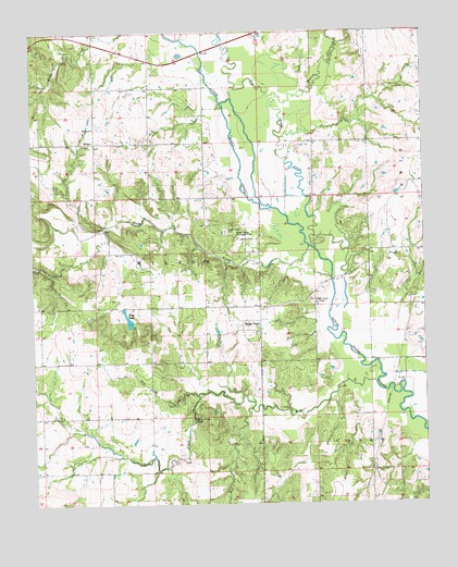
Boggy Depot, OK USGS Topographic Map
Click on map above to begin viewing in our Map Viewer.

This topographic map contains these locations and features:
Feature Name Type Latitude Longitude GNIS ID View Map
Boggy DepotLocaleN34.2987°W96.3025°1090348View Map
Boggy Depot CemeteryCemeteryN34.3219°W96.3133°1090349View Map
Boggy Depot Recreation AreaParkN34.3206°W96.3078°1090350View Map
Dry Boggy CreekStreamN34.3173°W96.2847°1092208View Map
East Boggy Depot Oil FieldOilfieldN34.3026°W96.2839°1092360View Map
Flag LakeReservoirN34.2992°W96.3450°1092867View Map
Lower Clear Boggy Creek Site 10 DamDamN34.2668°W96.3436°1754903View Map
Lower Clear Boggy Creek Site 10 ReservoirReservoirN34.2669°W96.3435°1754904View Map
Lower Clear Boggy Creek Site 12 DamDamN34.2801°W96.2969°1754905View Map
Lower Clear Boggy Creek Site 12 ReservoirReservoirN34.2801°W96.2969°1754906View Map
Lower Clear Boggy Creek Site 20 DamDamN34.3684°W96.3636°1754907View Map
Lower Clear Boggy Creek Site 20 ReservoirReservoirN34.3684°W96.3636°1754908View Map
Lower Clear Boggy Creek Site 24 DamDamN34.3601°W96.2936°1754683View Map
Lower Clear Boggy Creek Site 24 ReservoirReservoirN34.3601°W96.2936°1754684View Map
Lower Clear Boggy Creek Site 27 DamDamN34.3268°W96.2786°1754679View Map
Lower Clear Boggy Creek Site 27 ReservoirReservoirN34.3268°W96.2786°1754680View Map
Lower Clear Boggy Creek Site 5 DamDamN34.2634°W96.2569°1754695View Map
Lower Clear Boggy Creek Site 5 ReservoirReservoirN34.2634°W96.2569°1754696View Map
Lower Clear Boggy Creek Site 6 DamDamN34.2718°W96.2703°1754693View Map
Lower Clear Boggy Creek Site 6 ReservoirReservoirN34.2711°W96.2693°1754694View Map
Lower Clear Boggy Creek Site 7 DamDamN34.2651°W96.2886°1754691View Map
Lower Clear Boggy Creek Site 7 ReservoirReservoirN34.2651°W96.2886°1754692View Map
Lower Clear Boggy Creek Site 8 DamDamN34.2734°W96.3086°1754689View Map
Lower Clear Boggy Creek Site 8 ReservoirReservoirN34.2734°W96.3086°1754690View Map
Lower Clear Boggy Site Number 39 DamDamN34.2784°W96.3286°1756355View Map
Lower Clear Boggy Site Number 39 ReservoirReservoirN34.2784°W96.3286°1756356View Map
Rock CreekStreamN34.2790°W96.3228°1097331View Map
Rock Creek FallsFallsN34.2726°W96.3242°1097345View Map
Salt CreekStreamN34.2815°W96.2664°1097677View Map
Sandy CreekStreamN34.3184°W96.2867°1097820View Map
Sandy CreekStreamN34.3743°W96.3147°1097821View Map
Township of WilsonCivilN34.2918°W96.3419°1824966View Map
Wards Chapel Fire DepartmentBuildingN34.3535°W96.2507°2657505View Map
Watson CreekStreamN34.3581°W96.2967°1099432View Map
West Atoka DivisionCivilN34.2755°W96.2796°1937912View Map
WilsonPopulated PlaceN34.3459°W96.3547°1100941View Map
Wilson CemeteryCemeteryN34.3453°W96.3561°2704470View Map
Wilson ChurchChurchN34.3498°W96.3553°1099889View Map
Wilson Community Volunteer Fire DepartmentBuildingN34.3453°W96.3543°2657294View Map

Note: Coordinates in the location and feature list above are referenced to NAD83 datum.


Copyright (C) 2008-2024 Ryan Niemi / Sunset Dynamics ... All Rights Reserved