TopoQuest Logo
Do you find TopoQuest useful?
Help keep TopoQuest running and adding new maps/features by donating!
Bitcoin:  19c7KJd3qBynnjoSw5npx9KScwjBe4ifkT
Litecoin:  LXs6TkuXGGXo1vDsWCkWVdjQX94eUKd6ui
Home View Maps Find Maps Find Places Resources & Links


Wapanucka South, Oklahoma Topographic Map

USGS Map Title: Wapanucka South, OK
USGS Map MRC: 34096C4
DRG (GeoTIFF) Download: o34096c4.tif


Neighboring USGS Topographic Map Quads:


  Connerville NE, OK  
34096D5
 

  Wapanucka North, OK  
34096D4
 

  Olney, OK  
34096D3
 

  Connerville SE, OK  
34096C5
 

  Wapanucka South, OK  
34096C4
 

  Boggy Depot, OK  
34096C3
 

  Milburn, OK  
34096B5
 

  Caddo NW, OK  
34096B4
 

  Caddo North, OK  
34096B3


Map MRC Location:

N35°
W97°
N35°
W96°
H8 H7 H6 H5 H4 H3 H2 H1
G8 G7 G6 G5 G4 G3 G2 G1
F8 F7 F6 F5 F4 F3 F2 F1
E8 E7 E6 E5 E4 E3 E2 E1
D8 D7 D6 D5 D4 D3 D2 D1
C8 C7 C6 C5 C4 C3 C2 C1
B8 B7 B6 B5 B4 B3 B2 B1
A8 A7 A6 A5 A4 A3 A2 A1
N34°
W97°
N34°
W96°

Wapanucka South, OK USGS 1:24K Topographic Map Preview:
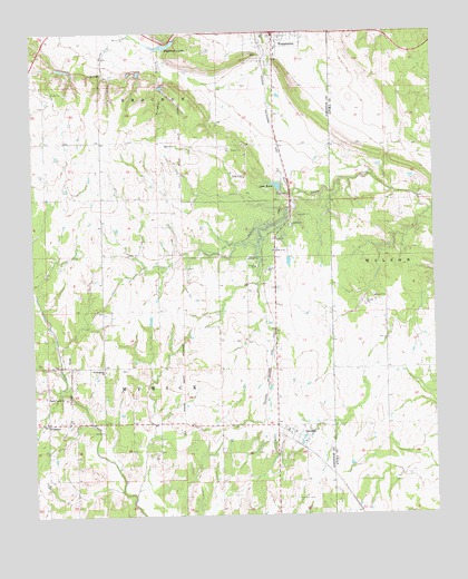
Wapanucka South, OK USGS Topographic Map
Click on map above to begin viewing in our Map Viewer.

This topographic map contains these locations and features:
Feature Name Type Latitude Longitude GNIS ID View Map
ColemanPopulated PlaceN34.2715°W96.4192°1091572View Map
Coleman CemeteryCemeteryN34.2543°W96.4194°1091574View Map
Coleman Census Designated PlaceCensusN34.2635°W96.4194°2629913View Map
Coleman Elementary SchoolSchoolN34.2720°W96.4214°1790610View Map
Coleman Fire DepartmentBuildingN34.2721°W96.4186°2657281View Map
Coleman High SchoolSchoolN34.2720°W96.4214°1790302View Map
Coleman Post OfficePost OfficeN34.2730°W96.4259°1829092View Map
Delaware Creek Site 3 DamDamN34.3734°W96.4136°1754496View Map
Delaware Creek Site 3 ReservoirReservoirN34.3736°W96.4153°1754497View Map
Delaware Creek Site 5 DamDamN34.3618°W96.4586°1750859View Map
Delaware Creek Site 5 ReservoirReservoirN34.3608°W96.4596°1750860View Map
Delaware Creek Site 6 DamDamN34.3651°W96.4669°1750861View Map
Delaware Creek Site 6 ReservoirReservoirN34.3647°W96.4667°1750862View Map
Delaware Creek Site 7 DamDamN34.3668°W96.4903°1750863View Map
Delaware Creek Site 7 ReservoirReservoirN34.3656°W96.4901°1750864View Map
Enterprise CemeteryCemeteryN34.3153°W96.4533°2745647View Map
FillmorePopulated PlaceN34.2743°W96.4961°1092812View Map
Hollow Spring CemeteryCemeteryN34.2692°W96.4889°2724225View Map
Lake ReamReservoirN34.3350°W96.4233°1094477View Map
Lake Ream DamDamN34.3334°W96.4253°1751752View Map
Lake Wapanucka DamDamN34.3684°W96.4569°1750889View Map
Lower Clear Boggy Creek Site 14 DamDamN34.3251°W96.3803°1754687View Map
Lower Clear Boggy Creek Site 14 ReservoirReservoirN34.3251°W96.3803°1754688View Map
Lower Clear Boggy Creek Site 17 DamDamN34.3334°W96.4353°1754677View Map
Lower Clear Boggy Creek Site 17 ReservoirReservoirN34.3334°W96.4353°1754678View Map
Presbyterian ChurchChurchN34.2876°W96.4778°1096921View Map
Sandy Creek ChurchChurchN34.2812°W96.4967°1097824View Map
Smith LakeReservoirN34.2716°W96.4999°1750888View Map
Sulphur BranchStreamN34.3706°W96.4603°1098620View Map
Town of WapanuckaCivilN34.3736°W96.4253°2413448View Map
WapanuckaPopulated PlaceN34.3740°W96.4244°1099353View Map
Wapanucka Elementary SchoolSchoolN34.3706°W96.4238°1790699View Map
Wapanucka Fire DepartmentBuildingN34.3734°W96.4242°2657364View Map
Wapanucka High SchoolSchoolN34.3693°W96.4236°1790498View Map
Wapanucka LakeReservoirN34.3717°W96.4586°1099354View Map

Note: Coordinates in the location and feature list above are referenced to NAD83 datum.


Copyright (C) 2008-2025 Ryan Niemi / Sunset Dynamics ... All Rights Reserved