TopoQuest Logo
Do you find TopoQuest useful?
Help keep TopoQuest running and adding new maps/features by donating!
Bitcoin:  19c7KJd3qBynnjoSw5npx9KScwjBe4ifkT
Litecoin:  LXs6TkuXGGXo1vDsWCkWVdjQX94eUKd6ui
Home View Maps Find Maps Find Places Resources & Links


Villa Creek, California Topographic Map

USGS Map Title: Villa Creek, CA
USGS Map MRC: 35121G4
DRG (GeoTIFF) Download: o35121g4.tif


Neighboring USGS Topographic Map Quads:


  Cape San Martin, CA  
35121H4
 

  Alder Peak, CA  
35121H3


  Villa Creek, CA  
35121G4
 

  Burro Mountain, CA  
35121G3


  Piedras Blancas, CA  
35121F3


Map MRC Location:

N36°
W122°
N36°
W121°
H8 H7 H6 H5 H4 H3 H2 H1
G8 G7 G6 G5 G4 G3 G2 G1
F8 F7 F6 F5 F4 F3 F2 F1
E8 E7 E6 E5 E4 E3 E2 E1
D8 D7 D6 D5 D4 D3 D2 D1
C8 C7 C6 C5 C4 C3 C2 C1
B8 B7 B6 B5 B4 B3 B2 B1
A8 A7 A6 A5 A4 A3 A2 A1
N35°
W122°
N35°
W121°

Villa Creek, CA USGS 1:24K Topographic Map Preview:
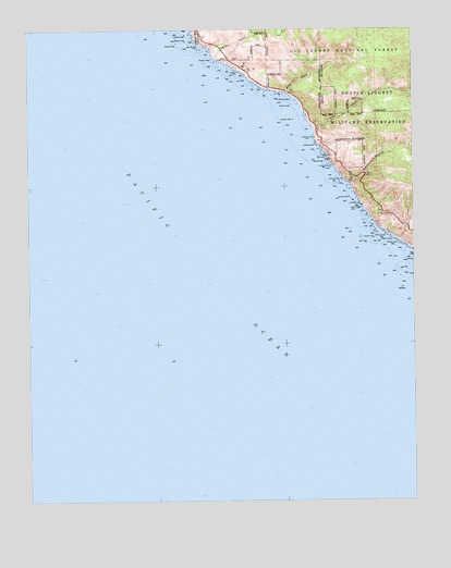
Villa Creek, CA USGS Topographic Map
Click on map above to begin viewing in our Map Viewer.

This topographic map contains these locations and features:
Feature Name Type Latitude Longitude GNIS ID View Map
Alder CreekStreamN35.8580°W121.4174°238493View Map
Buckeye CampgroundLocaleN35.8427°W121.3797°275478View Map
Buckeye SpringSpringN35.8400°W121.3774°1666373View Map
Cruickshank CampgroundLocaleN35.8547°W121.3841°275486View Map
Evans Brothers Cow CampLocaleN35.8422°W121.3960°1666377View Map
Los Burros MineMineN35.8733°W121.3860°1666382View Map
Lower Cruickshank CampgroundLocaleN35.8536°W121.3877°275485View Map
Mud CreekStreamN35.8639°W121.4330°246320View Map
Old Cruikshank Ranch (historical)LocaleN35.8566°W121.3833°1666385View Map
Redwood GulchValleyN35.8336°W121.3955°248103View Map
Silver Creek CampgroundLocaleN35.8589°W121.3752°276021View Map
Silver Creek CampgroundLocaleN35.8594°W121.3758°275469View Map
Soda Spring CreekStreamN35.8169°W121.3766°249639View Map
Spruce CreekStreamN35.8677°W121.4416°249829View Map
Villa CampgroundLocaleN35.8536°W121.3908°275484View Map
Villa CreekStreamN35.8494°W121.4091°251045View Map
Whaleboat RockIslandN35.8727°W121.4477°253328View Map
White Rock Number TwoBarN35.8175°W121.3824°253327View Map

Note: Coordinates in the location and feature list above are referenced to NAD83 datum.


Copyright (C) 2008-2025 Ryan Niemi / Sunset Dynamics ... All Rights Reserved