TopoQuest Logo
Do you find TopoQuest useful?
Help keep TopoQuest running and adding new maps/features by donating!
Bitcoin:  19c7KJd3qBynnjoSw5npx9KScwjBe4ifkT
Litecoin:  LXs6TkuXGGXo1vDsWCkWVdjQX94eUKd6ui
Home View Maps Find Maps Find Places Resources & Links


Burro Mountain, California Topographic Map

USGS Map Title: Burro Mountain, CA
USGS Map MRC: 35121G3
DRG (GeoTIFF) Download: o35121g3.tif


Neighboring USGS Topographic Map Quads:


  Cape San Martin, CA  
35121H4
 

  Alder Peak, CA  
35121H3
 

  Jolon, CA  
35121H2
 

  Villa Creek, CA  
35121G4
 

  Burro Mountain, CA  
35121G3
 

  Burnett Peak, CA  
35121G2


  Piedras Blancas, CA  
35121F3
 

  San Simeon, CA  
35121F2


Map MRC Location:

N36°
W122°
N36°
W121°
H8 H7 H6 H5 H4 H3 H2 H1
G8 G7 G6 G5 G4 G3 G2 G1
F8 F7 F6 F5 F4 F3 F2 F1
E8 E7 E6 E5 E4 E3 E2 E1
D8 D7 D6 D5 D4 D3 D2 D1
C8 C7 C6 C5 C4 C3 C2 C1
B8 B7 B6 B5 B4 B3 B2 B1
A8 A7 A6 A5 A4 A3 A2 A1
N35°
W122°
N35°
W121°

Burro Mountain, CA USGS 1:24K Topographic Map Preview:
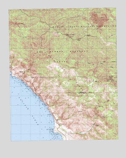
Burro Mountain, CA USGS Topographic Map
Click on map above to begin viewing in our Map Viewer.

This topographic map contains these locations and features:
Feature Name Type Latitude Longitude GNIS ID View Map
Bald TopSummitN35.7766°W121.2971°1660297View Map
Burro MountainSummitN35.8700°W121.2735°270108View Map
Calizona MineMineN35.8414°W121.3435°1666375View Map
Chris Flood CreekStreamN35.7839°W121.2721°270449View Map
Davis CanyonValleyN35.8200°W121.2749°270764View Map
Dutra CreekStreamN35.8002°W121.2844°270957View Map
Dutra Flat CampgroundLocaleN35.8172°W121.3188°276025View Map
Dutra Flat CampgroundLocaleN35.8175°W121.3188°275464View Map
Dutra Place (historical)LocaleN35.8155°W121.3149°1666376View Map
Elk CampgroundLocaleN35.7969°W121.2521°275441View Map
Estrada CreekStreamN35.7725°W121.2746°271082View Map
Estrella CampgroundLocaleN35.8369°W121.3363°276028View Map
Estrella CampgroundLocaleN35.8372°W121.3360°275463View Map
Jones MountainSummitN35.8066°W121.2549°1660819View Map
Lion PeakSummitN35.8516°W121.3222°272062View Map
Lions Den CampgroundLocaleN35.8580°W121.3402°276023View Map
Lions Den CampgroundLocaleN35.8580°W121.3399°275459View Map
Little Burros CreekStreamN35.8630°W121.2699°272073View Map
Lottie Potrero CampgroundLocaleN35.8414°W121.2594°275461View Map
Mount MarsSummitN35.8125°W121.3413°272359View Map
Old Jones Ranch (historical)LocaleN35.7927°W121.2535°1666408View Map
Polar School (historical)SchoolN35.7689°W121.3249°1666409View Map
Polar Star MineMineN35.7633°W121.2785°273069View Map
Ragged PointCapeN35.7597°W121.3277°273163View Map
Ray Evans Ranch (historical)LocaleN35.8105°W121.3685°1666386View Map
Salmon ConeSummitN35.8108°W121.3655°1661367View Map
Salmon CreekStreamN35.8083°W121.3635°273408View Map
Salmon Creek Ranger StationLocaleN35.8158°W121.3652°273412View Map
Salmon HeadSummitN35.8269°W121.3627°253330View Map
San Carpoforo CampgroundLocaleN35.7958°W121.2799°275440View Map
San Carpoforo CreekStreamN35.7647°W121.3247°273448View Map
San Carpoforo ValleyValleyN35.7652°W121.3238°1984617View Map
School SpringSpringN35.7769°W121.2538°273607View Map
Silver Creek CampgroundLocaleN35.8494°W121.3583°275470View Map
Silver PeakSummitN35.8477°W121.3594°273711View Map
Silver Peak CampgroundLocaleN35.8489°W121.3583°276022View Map
Silver Peak WildernessReserveN35.8539°W121.3399°2035304View Map
Spruce CampgroundLocaleN35.8261°W121.3435°276027View Map
Spruce CampgroundLocaleN35.8261°W121.3438°275462View Map
Thorndyke TopSummitN35.8111°W121.3530°253326View Map
Three PeaksSummitN35.8480°W121.3066°274127View Map
Three Peaks CampgroundLocaleN35.8433°W121.3119°275460View Map
Turkey Springs CampgroundLocaleN35.8133°W121.3019°276026View Map
Turkey Springs CampgroundLocaleN35.8136°W121.3021°275439View Map
W R Hearst Foremans Headquarters (historical)LocaleN35.7508°W121.2944°1666410View Map
Wagner CreekStreamN35.8200°W121.2749°274360View Map
White Rock Number OneBarN35.8077°W121.3641°253331View Map
Windy PointCapeN35.7814°W121.2727°274554View Map

Note: Coordinates in the location and feature list above are referenced to NAD83 datum.


Copyright (C) 2008-2025 Ryan Niemi / Sunset Dynamics ... All Rights Reserved