TopoQuest Logo
Do you find TopoQuest useful?
Help keep TopoQuest running and adding new maps/features by donating!
Bitcoin:  19c7KJd3qBynnjoSw5npx9KScwjBe4ifkT
Litecoin:  LXs6TkuXGGXo1vDsWCkWVdjQX94eUKd6ui
Home View Maps Find Maps Find Places Resources & Links


Vincent, Alabama Topographic Map

USGS Map Title: Vincent, AL
USGS Map MRC: 33086D4
DRG (GeoTIFF) Download: o33086d4.tif


Neighboring USGS Topographic Map Quads:


  Leeds, AL  
33086E5
 

  Cooks Springs, AL  
33086E4
 

  Pell City, AL  
33086E3
 

  Vandiver, AL  
33086D5
 

  Vincent, AL  
33086D4
 

  Laniers, AL  
33086D3
 

  Westover, AL  
33086C5
 

  Harpersville, AL  
33086C4
 

  Childersburg, AL  
33086C3


Map MRC Location:

N34°
W87°
N34°
W86°
H8 H7 H6 H5 H4 H3 H2 H1
G8 G7 G6 G5 G4 G3 G2 G1
F8 F7 F6 F5 F4 F3 F2 F1
E8 E7 E6 E5 E4 E3 E2 E1
D8 D7 D6 D5 D4 D3 D2 D1
C8 C7 C6 C5 C4 C3 C2 C1
B8 B7 B6 B5 B4 B3 B2 B1
A8 A7 A6 A5 A4 A3 A2 A1
N33°
W87°
N33°
W86°

Vincent, AL USGS 1:24K Topographic Map Preview:
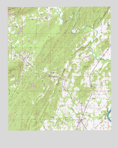
Vincent, AL USGS Topographic Map
Click on map above to begin viewing in our Map Viewer.

This topographic map contains these locations and features:
Feature Name Type Latitude Longitude GNIS ID View Map
Acton LakeReservoirN33.3951°W86.4716°131506View Map
Acton Lake DamDamN33.3951°W86.4716°131505View Map
Allen CemeteryCemeteryN33.4351°W86.4389°149321View Map
Baggetts LakeReservoirN33.4761°W86.4854°131561View Map
Bear CreekStreamN33.4837°W86.4339°113666View Map
Bearden Farms Number 2LocaleN33.4792°W86.3867°2704561View Map
Beulah CemeteryCemeteryN33.4409°W86.4786°146357View Map
Beulah ChurchChurchN33.4412°W86.4783°114188View Map
Black Jack RidgeRidgeN33.4579°W86.4425°114430View Map
Blue Spring BranchStreamN33.3918°W86.4189°114582View Map
Buckhorn BranchStreamN33.4979°W86.4403°115142View Map
Cahaba River Youth CampLocaleN33.4829°W86.4633°146376View Map
CalcisPopulated PlaceN33.4265°W86.4316°115387View Map
Calcis ChurchChurchN33.4254°W86.4308°1805498View Map
Camp CreekStreamN33.4787°W86.3980°164587View Map
Church of GodChurchN33.4809°W86.4911°116142View Map
Church of God of ProphecyChurchN33.4512°W86.4714°146583View Map
CloverdalePopulated PlaceN33.4529°W86.3855°146394View Map
Coosa Lodge Lake DamDamN33.4718°W86.4883°131562View Map
Coosa Valley ChurchChurchN33.4079°W86.3975°116598View Map
Crim Lake DamDamN33.4218°W86.4716°131529View Map
Davis ChapelChurchN33.4896°W86.4550°117120View Map
Deerwood LakeReservoirN33.3758°W86.4742°131491View Map
Duncan ChapelChurchN33.4301°W86.4466°117662View Map
Elliott CemeteryCemeteryN33.3826°W86.4361°117940View Map
First Born ChurchChurchN33.4298°W86.4458°146432View Map
Glade BranchStreamN33.4454°W86.3808°119016View Map
Glover CemeteryCemeteryN33.3923°W86.3875°149332View Map
Glover MountainSummitN33.4379°W86.4033°119059View Map
Glovers Ferry (historical)CrossingN33.3876°W86.3789°144834View Map
Glovers Point ParkParkN33.3898°W86.3778°144835View Map
Gum BranchStreamN33.4354°W86.4675°119472View Map
Hall DamDamN33.4284°W86.4750°131535View Map
Hall LakeReservoirN33.4285°W86.4757°131534View Map
Higdon PointCapeN33.4954°W86.4861°120049View Map
Hot Spur (historical)LocaleN33.4251°W86.4011°146465View Map
Howard BranchStreamN33.4923°W86.4380°120470View Map
Hurricane CreekStreamN33.4590°W86.4619°120582View Map
Jackson LakeLakeN33.4168°W86.4334°120775View Map
Kendrick Mill (historical)LocaleN33.4784°W86.4066°146486View Map
Lake DewittReservoirN33.4208°W86.4697°131530View Map
Ledbetter LakeReservoirN33.4968°W86.4916°131575View Map
Ledbetter Lake Dam Number 1DamN33.4968°W86.4916°131576View Map
Ledbetter Lake Dam Number 2DamN33.4934°W86.4933°131572View Map
Ledbetter Lake Number 2ReservoirN33.4928°W86.4945°131571View Map
Linder MountainSummitN33.4337°W86.4333°121660View Map
Little CreekStreamN33.4621°W86.3989°121756View Map
LoweryLocaleN33.4646°W86.4430°135123View Map
Macedonia CemeteryCemeteryN33.4509°W86.3833°149341View Map
Macedonia ChurchChurchN33.4521°W86.3847°122163View Map
Martin Town LakeReservoirN33.4502°W86.4015°1805499View Map
McGraws Mill (historical)LocaleN33.3904°W86.3825°146507View Map
Mount Canaan ChurchChurchN33.4334°W86.4444°123158View Map
Old Sterrett CemeteryCemeteryN33.4501°W86.4780°146632View Map
Pentecostal ChurchChurchN33.3873°W86.4447°124598View Map
Quarry MountainSummitN33.4171°W86.4425°125376View Map
Raley Family CemeteryCemeteryN33.3770°W86.4166°146543View Map
Rehaboa Church (historical)ChurchN33.4479°W86.4008°146545View Map
Spradley BranchStreamN33.4098°W86.4989°127204View Map
Spring CreekStreamN33.3896°W86.3800°153525View Map
SterrettPopulated PlaceN33.4487°W86.4800°127366View Map
Sterrett CemeteryCemeteryN33.4440°W86.4750°146582View Map
Sterrett Census Designated PlaceCensusN33.4490°W86.4645°2582702View Map
Sterrett Elementary School (historical)SchoolN33.4429°W86.4778°149354View Map
Sterrett Post OfficePost OfficeN33.4468°W86.4812°168845View Map
Tater HillSummitN33.4396°W86.4866°127709View Map
Town of VincentCivilN33.3849°W86.4087°2406802View Map
Vandiver Volunteer Fire and Rescue Department Station 2BuildingN33.4466°W86.4816°2683275View Map
VincentPopulated PlaceN33.3846°W86.4119°153852View Map
Vincent CemeteryCemeteryN33.3804°W86.4069°146608View Map
Vincent High SchoolSchoolN33.3834°W86.4147°146609View Map
Vincent Middle SchoolSchoolN33.3829°W86.4147°149358View Map
Vincent Police DepartmentBuildingN33.3848°W86.4113°2751725View Map
Vincent Post OfficePost OfficeN33.3867°W86.4107°168844View Map
Vincent Volunteer Fire DepartmentBuildingN33.3763°W86.4168°2683030View Map
Wolf CreekStreamN33.4934°W86.4158°164912View Map
Yellow BranchStreamN33.4604°W86.4983°129283View Map

Note: Coordinates in the location and feature list above are referenced to NAD83 datum.


Copyright (C) 2008-2024 Ryan Niemi / Sunset Dynamics ... All Rights Reserved