TopoQuest Logo
Do you find TopoQuest useful?
Help keep TopoQuest running and adding new maps/features by donating!
Bitcoin:  19c7KJd3qBynnjoSw5npx9KScwjBe4ifkT
Litecoin:  LXs6TkuXGGXo1vDsWCkWVdjQX94eUKd6ui
Home View Maps Find Maps Find Places Resources & Links


Laniers, Alabama Topographic Map

USGS Map Title: Laniers, AL
USGS Map MRC: 33086D3
DRG (GeoTIFF) Download: o33086d3.tif


Neighboring USGS Topographic Map Quads:


  Cooks Springs, AL  
33086E4
 

  Pell City, AL  
33086E3
 

  Riverside, AL  
33086E2
 

  Vincent, AL  
33086D4
 

  Laniers, AL  
33086D3
 

  Sleeping Giant, AL  
33086D2
 

  Harpersville, AL  
33086C4
 

  Childersburg, AL  
33086C3
 

  Winterboro, AL  
33086C2


Map MRC Location:

N34°
W87°
N34°
W86°
H8 H7 H6 H5 H4 H3 H2 H1
G8 G7 G6 G5 G4 G3 G2 G1
F8 F7 F6 F5 F4 F3 F2 F1
E8 E7 E6 E5 E4 E3 E2 E1
D8 D7 D6 D5 D4 D3 D2 D1
C8 C7 C6 C5 C4 C3 C2 C1
B8 B7 B6 B5 B4 B3 B2 B1
A8 A7 A6 A5 A4 A3 A2 A1
N33°
W87°
N33°
W86°

Laniers, AL USGS 1:24K Topographic Map Preview:
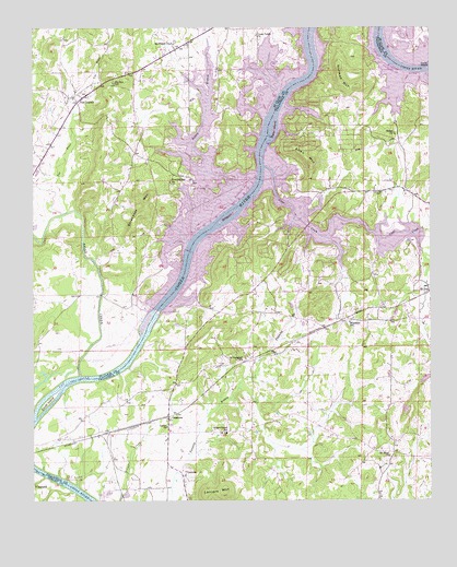
Laniers, AL USGS Topographic Map
Click on map above to begin viewing in our Map Viewer.

This topographic map contains these locations and features:
Feature Name Type Latitude Longitude GNIS ID View Map
Allen MountainSummitN33.4643°W86.2878°113012View Map
Alpine BayPopulated PlaceN33.4482°W86.2953°144710View Map
Arta Post Office (historical)Post OfficeN33.4204°W86.2833°166146View Map
Bakers HarborLocaleN33.4604°W86.2919°144718View Map
Bell IslandIslandN33.4223°W86.3389°165012View Map
Belle VistaPopulated PlaceN33.3765°W86.3269°144719View Map
Bethel Baptist ChurchChurchN33.4076°W86.2625°144723View Map
Birmingham Sailing ClubLocaleN33.4515°W86.3286°165017View Map
BriarfieldPopulated PlaceN33.4229°W86.2769°144735View Map
Briarfield SchoolSchoolN33.4223°W86.2755°114882View Map
Burns MarinaLocaleN33.4479°W86.3319°165312View Map
Camp CosbyLocaleN33.4473°W86.2714°144744View Map
Cartersville Baptist ChurchChurchN33.3821°W86.3269°144753View Map
Cedar Cove EstatesPopulated PlaceN33.4409°W86.3114°144755View Map
Cedar Tree Post Office (historical)Post OfficeN33.4571°W86.2655°166148View Map
Clear CreekStreamN33.4634°W86.3025°116228View Map
Clear Creek EstatesPopulated PlaceN33.4479°W86.2833°144768View Map
Clear Creek HarborLocaleN33.4543°W86.2872°144769View Map
Clear Creek Sinks (historical)BasinN33.4576°W86.2950°144770View Map
Coosa Island MarinaLocaleN33.4646°W86.3236°165314View Map
Coosa Pines Junction (historical)LocaleN33.3932°W86.3508°144781View Map
Coosa Valley Church of ChristChurchN33.4982°W86.3050°164616View Map
Country Club EstatesPopulated PlaceN33.4734°W86.2814°144784View Map
Curry BranchStreamN33.4876°W86.2508°144789View Map
Cyprian (historical)LocaleN33.4509°W86.2950°166150View Map
Cyprian Post Office (historical)Post OfficeN33.4509°W86.2950°169253View Map
Drakes Mill Shoals (historical)BarN33.4793°W86.2972°144796View Map
East BendPopulated PlaceN33.4015°W86.3466°166151View Map
East Bend Post OfficePost OfficeN33.4015°W86.3466°169257View Map
Elliott IslandIslandN33.4009°W86.3711°164644View Map
Evening Star ChurchChurchN33.4593°W86.3319°164647View Map
FeddisburgPopulated PlaceN33.4146°W86.2625°144812View Map
Fountainrun (historical)Populated PlaceN33.4993°W86.3189°1805490View Map
Garrett Schoolhouse (historical)SchoolN33.3857°W86.2614°144832View Map
General Lee MarinaLocaleN33.4907°W86.3041°165315View Map
GrasmerePopulated PlaceN33.3971°W86.3328°156427View Map
Grissom Ferry (historical)CrossingN33.4501°W86.3130°165274View Map
Grissom IslandIslandN33.4501°W86.3130°119431View Map
Hannah Mallory Elementary SchoolSchoolN33.4093°W86.2625°165631View Map
Haw BranchStreamN33.4365°W86.2503°119860View Map
Howells Mill (historical)LocaleN33.4668°W86.3019°144856View Map
Hubbard CemeteryCemeteryN33.4565°W86.2650°120493View Map
Kelly CreekStreamN33.4076°W86.3605°164722View Map
Kelly Creek LandingLocaleN33.4084°W86.3597°165109View Map
Kings ChapelPopulated PlaceN33.3929°W86.3144°144871View Map
Kings Chapel Church of ChristChurchN33.3929°W86.3147°144872View Map
Kings Chapel SchoolSchoolN33.3926°W86.3144°121236View Map
Kitson (historical)LocaleN33.3834°W86.2666°166155View Map
Kitson Post Office (historical)Post OfficeN33.3834°W86.2666°169275View Map
Lanier ChurchChurchN33.3943°W86.3330°151991View Map
Lanier Volunteer Fire DepartmentBuildingN33.3930°W86.3142°2683244View Map
LaniersPopulated PlaceN33.3815°W86.3275°156581View Map
Laniers BranchStreamN33.3898°W86.3241°144879View Map
Laniers MountainSummitN33.3771°W86.3150°151993View Map
Logan Martin DamDamN33.4250°W86.3360°164742View Map
Logan Martin PinesPopulated PlaceN33.4946°W86.2930°165120View Map
Merkl IslandIslandN33.4729°W86.2986°122662View Map
Mount Pisgah Baptist ChurchChurchN33.4959°W86.3316°164771View Map
Mount Pisgah CemeteryCemeteryN33.4965°W86.3300°1805654View Map
Mount Sinai Baptist ChurchChurchN33.3865°W86.2628°152511View Map
Mount Zion CemeteryCemeteryN33.4854°W86.3494°1805529View Map
Mount Zion ChurchChurchN33.4854°W86.3497°165146View Map
Mount Zion SchoolSchoolN33.4857°W86.3494°164775View Map
New Hope ChurchChurchN33.4184°W86.3730°165153View Map
New LondonPopulated PlaceN33.4818°W86.3594°164782View Map
New London ChurchChurchN33.4809°W86.3597°165154View Map
New London Volunteer Fire Department Station 1BuildingN33.4807°W86.3431°2682659View Map
Norman MountainRidgeN33.4859°W86.2786°123973View Map
Pier Fiftynine MarinaLocaleN33.4573°W86.3194°165324View Map
Pineview (historical)LocaleN33.4571°W86.2639°166161View Map
Pineview Post Office (historical)Post OfficeN33.4571°W86.2639°169299View Map
Rabbit BranchStreamN33.4543°W86.3100°164824View Map
Rabbit Branch MarinaLocaleN33.4884°W86.3180°165326View Map
Ratcliffes Shoals (historical)BarN33.4662°W86.3036°144946View Map
Redstone MarinaLocaleN33.4862°W86.2639°144948View Map
Renfroe Volunteer Fire Department Station 1BuildingN33.4566°W86.2645°2683368View Map
Renfroe-Laniers DivisionCivilN33.3893°W86.2792°165962View Map
Rocky RidgePopulated PlaceN33.4968°W86.2839°144960View Map
Saint Campbells Baptist ChurchChurchN33.4121°W86.3105°153244View Map
Saint Clair ShoresPopulated PlaceN33.4959°W86.3036°165190View Map
Saint Clair Shores MarinaLocaleN33.4907°W86.2947°165327View Map
Saint IvesPopulated PlaceN33.4301°W86.2503°157006View Map
Salem ChurchChurchN33.4337°W86.3030°144969View Map
Shiloh Methodist ChurchChurchN33.4718°W86.2608°153424View Map
Stracener MountainSummitN33.4515°W86.3405°164874View Map
Surfside MarinaLocaleN33.4826°W86.3178°165329View Map
Toe RiverStreamN33.4512°W86.3641°164890View Map
Treasure IslandIslandN33.4821°W86.3055°165212View Map
Willingham EstatesPopulated PlaceN33.4529°W86.2866°145035View Map
Willinghams Ferry (historical)CrossingN33.4823°W86.2955°165235View Map

Note: Coordinates in the location and feature list above are referenced to NAD83 datum.


Copyright (C) 2008-2024 Ryan Niemi / Sunset Dynamics ... All Rights Reserved