TopoQuest Logo
Do you find TopoQuest useful?
Help keep TopoQuest running and adding new maps/features by donating!
Bitcoin:  19c7KJd3qBynnjoSw5npx9KScwjBe4ifkT
Litecoin:  LXs6TkuXGGXo1vDsWCkWVdjQX94eUKd6ui
Home View Maps Find Maps Find Places Resources & Links


Vipond Park, Montana Topographic Map

USGS Map Title: Vipond Park, MT
USGS Map MRC: 45112F8
DRG (GeoTIFF) Download: o45112f8.tif


Neighboring USGS Topographic Map Quads:


  Dickie Hills, MT  
45113G1
 

  Wise River, MT  
45112G8
 

  Dewey, MT  
45112G7
 

  Stine Mountain, MT  
45113F1
 

  Vipond Park, MT  
45112F8
 

  Cattle Gulch, MT  
45112F7
 

  Maurice Mountain, MT  
45113E1
 

  Mount Tahepia, MT  
45112E8
 

  Storm Peak, MT  
45112E7


Map MRC Location:

N46°
W113°
N46°
W112°
H8 H7 H6 H5 H4 H3 H2 H1
G8 G7 G6 G5 G4 G3 G2 G1
F8 F7 F6 F5 F4 F3 F2 F1
E8 E7 E6 E5 E4 E3 E2 E1
D8 D7 D6 D5 D4 D3 D2 D1
C8 C7 C6 C5 C4 C3 C2 C1
B8 B7 B6 B5 B4 B3 B2 B1
A8 A7 A6 A5 A4 A3 A2 A1
N45°
W113°
N45°
W112°

Vipond Park, MT USGS 1:24K Topographic Map Preview:
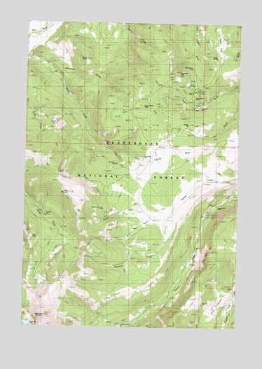
Vipond Park, MT USGS Topographic Map
Click on map above to begin viewing in our Map Viewer.

This topographic map contains these locations and features:
Feature Name Type Latitude Longitude GNIS ID View Map
Black Lion LakeLakeN45.6262°W112.9984°780003View Map
Black Lion MountainSummitN45.6294°W112.9878°780004View Map
Blue Bell MineMineN45.6708°W112.9884°806758View Map
Bobs LakeLakeN45.6618°W112.9968°780187View Map
Boner KnobSummitN45.7352°W112.9659°780217View Map
Buffalo Head GulchValleyN45.6699°W112.9186°780544View Map
Burnt Pine Post Office (historical)Post OfficeN45.6471°W112.9064°1797096View Map
Cannivan GulchValleyN45.6666°W112.9167°780885View Map
Canyon Creek CampLocaleN45.6263°W112.9445°780906View Map
Canyon Creek CampgroundLocaleN45.6260°W112.9423°794816View Map
Canyon Creek Guard StationLocaleN45.6749°W112.8895°780907View Map
Daisy Vein MineMineN45.7224°W112.9045°782059View Map
Echo GulchValleyN45.7174°W112.8750°782968View Map
Gray Jockey MineMineN45.6944°W112.9314°802297View Map
Gray Jockey MineMineN45.6941°W112.9314°784239View Map
Gray Jockey PeakSummitN45.7166°W112.9339°784240View Map
Great Western MineMineN45.7191°W112.9031°784261View Map
Greenwood (historical)LocaleN45.6388°W112.9156°1797350View Map
Knoby MineMineN45.7208°W112.9036°785806View Map
Knoby ParkFlatN45.7449°W112.8884°785807View Map
Knoby SpringSpringN45.7363°W112.8895°785808View Map
Log Cabin LodeMineN45.7002°W112.9559°786444View Map
Log Cabin MineMineN45.6952°W112.9473°802398View Map
Lone Pine (historical)LocaleN45.7166°W112.8981°1797361View Map
Lone Pine MineMineN45.7149°W112.8995°786485View Map
Mammoth GulchValleyN45.7408°W112.9906°786810View Map
Marmot MineMineN45.7108°W112.9370°802389View Map
Mewonitoc MineMineN45.6985°W112.9342°802422View Map
Monte Cristo MineMineN45.7310°W112.9034°802475View Map
Monte Cristo MineMineN45.7316°W112.9034°787579View Map
Old Faithful MineMineN45.6921°W112.9481°788412View Map
Polaris MineMineN45.7124°W112.9314°802433View Map
Ponsonby PeakSummitN45.7285°W112.9134°789073View Map
Quartz HillSummitN45.7091°W112.9053°789276View Map
Quartz Hill (historical)LocaleN45.7166°W112.9009°1797287View Map
Queen of the Hills MineMineN45.6721°W112.9545°802392View Map
Queen of the Hills MineMineN45.6735°W112.9542°789289View Map
Queens GulchValleyN45.6696°W112.9192°789294View Map
Sheep MountainSummitN45.6805°W112.9750°790366View Map
SW NE Section 3 MineMineN45.6958°W112.9481°802298View Map
Tuxedo MineMineN45.7110°W112.9356°802390View Map
Vega MineMineN45.7096°W112.9370°802434View Map
Vipond (historical)LocaleN45.6994°W112.8981°1797258View Map
Vipond ParkFlatN45.6974°W112.9106°792722View Map
Vipond Post Office (historical)Post OfficeN45.6994°W112.8981°1797257View Map
West Lone Pine MineMineN45.6999°W112.8981°802300View Map
Yanks PastureFlatN45.6274°W112.8867°793597View Map

Note: Coordinates in the location and feature list above are referenced to NAD83 datum.


Copyright (C) 2008-2025 Ryan Niemi / Sunset Dynamics ... All Rights Reserved