TopoQuest Logo
Do you find TopoQuest useful?
Help keep TopoQuest running and adding new maps/features by donating!
Bitcoin:  19c7KJd3qBynnjoSw5npx9KScwjBe4ifkT
Litecoin:  LXs6TkuXGGXo1vDsWCkWVdjQX94eUKd6ui
Home View Maps Find Maps Find Places Resources & Links


Cattle Gulch, Montana Topographic Map

USGS Map Title: Cattle Gulch, MT
USGS Map MRC: 45112F7
DRG (GeoTIFF) Download: o45112f7.tif


Neighboring USGS Topographic Map Quads:


  Wise River, MT  
45112G8
 

  Dewey, MT  
45112G7
 

  Tucker Creek, MT  
45112G6
 

  Vipond Park, MT  
45112F8
 

  Cattle Gulch, MT  
45112F7
 

  Melrose, MT  
45112F6
 

  Mount Tahepia, MT  
45112E8
 

  Storm Peak, MT  
45112E7
 

  Earls Gulch, MT  
45112E6


Map MRC Location:

N46°
W113°
N46°
W112°
H8 H7 H6 H5 H4 H3 H2 H1
G8 G7 G6 G5 G4 G3 G2 G1
F8 F7 F6 F5 F4 F3 F2 F1
E8 E7 E6 E5 E4 E3 E2 E1
D8 D7 D6 D5 D4 D3 D2 D1
C8 C7 C6 C5 C4 C3 C2 C1
B8 B7 B6 B5 B4 B3 B2 B1
A8 A7 A6 A5 A4 A3 A2 A1
N45°
W113°
N45°
W112°

Cattle Gulch, MT USGS 1:24K Topographic Map Preview:
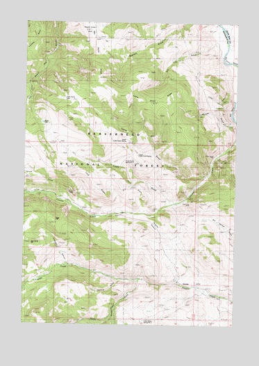
Cattle Gulch, MT USGS Topographic Map
Click on map above to begin viewing in our Map Viewer.

This topographic map contains these locations and features:
Feature Name Type Latitude Longitude GNIS ID View Map
Canyon Creek Charcoal KilnsLocaleN45.6805°W112.8692°794591View Map
Canyon Creek Point of InterestLocaleN45.6794°W112.8664°794592View Map
Cattle GulchValleyN45.6871°W112.7673°781064View Map
Cattle Gulch LakeLakeN45.7186°W112.8532°781065View Map
Cattle Gulch RidgeRidgeN45.7163°W112.8006°781066View Map
Devils HoleBendN45.6794°W112.8425°782333View Map
Divide CreekStreamN45.7327°W112.7500°782406View Map
Dry GulchValleyN45.7413°W112.7625°782628View Map
GlendalePopulated PlaceN45.6419°W112.7731°783987View Map
Glendale Post Office (historical)Post OfficeN45.6419°W112.7731°1797239View Map
Glendale School (historical)SchoolN45.6419°W112.7731°1797342View Map
Happy CampLocaleN45.7430°W112.8570°784534View Map
Happy Camp ParkParkN45.7480°W112.8509°784535View Map
Joyce RanchLocaleN45.6721°W112.8114°794593View Map
LaMarche GulchValleyN45.7083°W112.7523°785876View Map
Letter GulchValleyN45.7224°W112.7534°786061View Map
Lockridge CanyonValleyN45.6505°W112.8509°786417View Map
Long SlopeCliffN45.6821°W112.8242°786542View Map
Lower Cattle Gulch SpringSpringN45.6955°W112.8092°786662View Map
Nez Perce RidgeRidgeN45.7410°W112.8384°787983View Map
North Central MineMineN45.6952°W112.7623°788073View Map
NW NW Section 18 MineMineN45.6691°W112.8342°804371View Map
Ore Camp HillSummitN45.6583°W112.8723°806961View Map
Picketts PastureFlatN45.6641°W112.7953°793899View Map
Sage FlatFlatN45.6702°W112.8567°789914View Map
Short Shift MineMineN45.6863°W112.8342°804376View Map
Short SlopeCliffN45.6830°W112.8103°790446View Map
Siria RanchLocaleN45.6713°W112.8114°790556View Map
Sucker CreekStreamN45.6441°W112.8070°791624View Map
Sucker GulchValleyN45.6438°W112.8070°793901View Map
Trusty GulchValleyN45.6758°W112.7889°792421View Map
Trusty Gulch Spring OneSpringN45.6783°W112.7948°792422View Map
Trusty Gulch Spring TwoSpringN45.6933°W112.8156°792423View Map
Trusty LakeLakeN45.7085°W112.8654°792424View Map
Twomile GulchValleyN45.6435°W112.8181°793897View Map
Twomile GulchValleyN45.6435°W112.8181°792295View Map
Upper Cattle Gulch SpringSpringN45.7008°W112.8156°792619View Map
Vipond CreekStreamN45.6760°W112.8517°792721View Map
West Limb MineMineN45.6749°W112.7770°793113View Map

Note: Coordinates in the location and feature list above are referenced to NAD83 datum.


Copyright (C) 2008-2025 Ryan Niemi / Sunset Dynamics ... All Rights Reserved