TopoQuest Logo
Do you find TopoQuest useful?
Help keep TopoQuest running and adding new maps/features by donating!
Bitcoin:  19c7KJd3qBynnjoSw5npx9KScwjBe4ifkT
Litecoin:  LXs6TkuXGGXo1vDsWCkWVdjQX94eUKd6ui
Home View Maps Find Maps Find Places Resources & Links


Virgin, Utah Topographic Map

USGS Map Title: Virgin, UT
USGS Map MRC: 37113B2
DRG (GeoTIFF) Download: o37113b2.tif


Neighboring USGS Topographic Map Quads:


  Pintura, UT  
37113C3
 

  Smith Mesa, UT  
37113C2
 

  The Guardian Angels, UT  
37113C1
 

  Hurricane, UT  
37113B3
 

  Virgin, UT  
37113B2
 

  Springdale West, UT  
37113B1
 

  The Divide, UT  
37113A3
 

  Little Creek Mountain, UT  
37113A2
 

  Smithsonian Butte, UT  
37113A1


Map MRC Location:

N38°
W114°
N38°
W113°
H8 H7 H6 H5 H4 H3 H2 H1
G8 G7 G6 G5 G4 G3 G2 G1
F8 F7 F6 F5 F4 F3 F2 F1
E8 E7 E6 E5 E4 E3 E2 E1
D8 D7 D6 D5 D4 D3 D2 D1
C8 C7 C6 C5 C4 C3 C2 C1
B8 B7 B6 B5 B4 B3 B2 B1
A8 A7 A6 A5 A4 A3 A2 A1
N37°
W114°
N37°
W113°

Virgin, UT USGS 1:24K Topographic Map Preview:
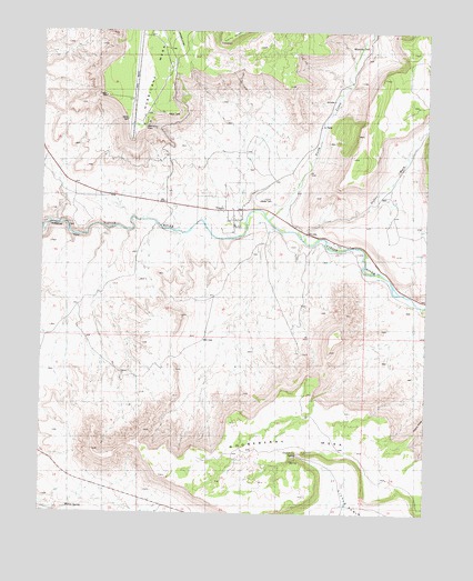
Virgin, UT USGS Topographic Map
Click on map above to begin viewing in our Map Viewer.

This topographic map contains these locations and features:
Feature Name Type Latitude Longitude GNIS ID View Map
Cornelius WashValleyN37.1989°W113.1755°1437254View Map
Dalton WashValleyN37.1958°W113.1658°1427193View Map
Dry CreekStreamN37.2489°W113.1444°1427529View Map
Duncan's RetreatCemeteryN37.1839°W113.1350°2769304View Map
Gooseberry MesaSummitN37.1348°W113.2112°1428259View Map
Gooseberry SpringSpringN37.1400°W113.1677°1428260View Map
Hurricane DivisionCivilN37.2277°W113.1407°1939379View Map
Hurricane Mesa Airport (historical)AirportN37.2497°W113.2086°1434542View Map
Mountain DellBasinN37.2461°W113.1447°1430526View Map
North CreekStreamN37.2014°W113.1774°1430767View Map
Pastry RidgeRidgeN37.1470°W113.1281°1431132View Map
The Church of Jesus Christ of Latter Day SaintsChurchN37.2014°W113.1897°1455678View Map
Town of VirginCivilN37.2083°W113.2086°2413435View Map
VirginPopulated PlaceN37.2083°W113.1883°1433898View Map
Virgin CanalCanalN37.2180°W113.1691°1433899View Map
Virgin CemeteryCemeteryN37.2069°W113.1910°1436577View Map
Virgin Oil FieldOilfieldN37.2219°W113.1572°1433901View Map
Virgin Post OfficePost OfficeN37.2038°W113.1889°2769118View Map
Willow SpringSpringN37.1267°W113.2419°1434335View Map

Note: Coordinates in the location and feature list above are referenced to NAD83 datum.


Copyright (C) 2008-2024 Ryan Niemi / Sunset Dynamics ... All Rights Reserved