TopoQuest Logo
Do you find TopoQuest useful?
Help keep TopoQuest running and adding new maps/features by donating!
Bitcoin:  19c7KJd3qBynnjoSw5npx9KScwjBe4ifkT
Litecoin:  LXs6TkuXGGXo1vDsWCkWVdjQX94eUKd6ui
Home View Maps Find Maps Find Places Resources & Links


Virtue Flat, Oregon Topographic Map

USGS Map Title: Virtue Flat, OR
USGS Map MRC: 44117G6
DRG (GeoTIFF) Download: o44117g6.tif


Neighboring USGS Topographic Map Quads:


  Magpie Peak, OR  
44117H7
 

  Keating NW, OR  
44117H6
 

  Sawtooth Ridge, OR  
44117H5
 

  Baker City, OR  
44117G7
 

  Virtue Flat, OR  
44117G6
 

  Keating, OR  
44117G5
 

  Bowen Valley, OR  
44117F7
 

  Encina, OR  
44117F6
 

  Oxman, OR  
44117F5


Map MRC Location:

N45°
W118°
N45°
W117°
H8 H7 H6 H5 H4 H3 H2 H1
G8 G7 G6 G5 G4 G3 G2 G1
F8 F7 F6 F5 F4 F3 F2 F1
E8 E7 E6 E5 E4 E3 E2 E1
D8 D7 D6 D5 D4 D3 D2 D1
C8 C7 C6 C5 C4 C3 C2 C1
B8 B7 B6 B5 B4 B3 B2 B1
A8 A7 A6 A5 A4 A3 A2 A1
N44°
W118°
N44°
W117°

Virtue Flat, OR USGS 1:24K Topographic Map Preview:
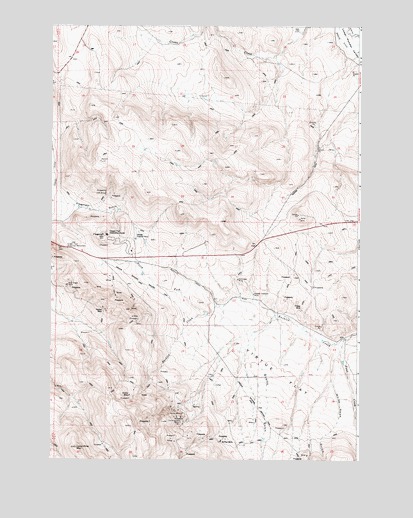
Virtue Flat, OR USGS Topographic Map
Click on map above to begin viewing in our Map Viewer.

This topographic map contains these locations and features:
Feature Name Type Latitude Longitude GNIS ID View Map
Baker City DivisionCivilN44.7590°W117.7140°1937960View Map
Bureau of Land Management Wastewater Treatment LagoonsLocaleN44.8136°W117.7159°2697197View Map
Cliff MineMineN44.8263°W117.7283°1119019View Map
Columbia MineMineN44.8018°W117.6752°1119168View Map
Con-Virginia MineMineN44.7613°W117.6980°1119191View Map
Emma MineMineN44.7685°W117.7185°1120503View Map
First CreekStreamN44.7846°W117.6313°1120747View Map
Flagstaff GulchValleyN44.8235°W117.7441°1120818View Map
Flagstaff HillSummitN44.8143°W117.7288°1120819View Map
Flagstaff MineMineN44.8140°W117.7258°1120821View Map
Friday MineMineN44.7932°W117.6494°1120995View Map
Gray Eagle MineMineN44.8004°W117.7441°1121346View Map
Hidden Treasure MineMineN44.7977°W117.6685°1121796View Map
Leo Adler TheatreBuildingN44.8148°W117.7286°2700419View Map
Lone Pine MountainSummitN44.7535°W117.7397°1123382View Map
National Historic Oregon Trail Interpretive CenterBuildingN44.8148°W117.7287°2699645View Map
North Fork Ruckles CreekStreamN44.7921°W117.6877°1124806View Map
Oregon Trail Historic Interpretive Center AmphitheaterLocaleN44.8140°W117.7294°2700418View Map
Oregon Trail Historical MonumentParkN44.8107°W117.7438°1125035View Map
Quartz GulchValleyN44.7918°W117.6597°1125734View Map
Rachel MineMineN44.7938°W117.7291°1125768View Map
Saint Paul MineMineN44.7552°W117.6822°1126488View Map
Virtue FlatFlatN44.7738°W117.6569°1128552View Map
Virtue MineMineN44.7635°W117.6972°1128553View Map
White Swan GulchValleyN44.7813°W117.6330°1129001View Map

Note: Coordinates in the location and feature list above are referenced to NAD83 datum.


Copyright (C) 2008-2024 Ryan Niemi / Sunset Dynamics ... All Rights Reserved