TopoQuest Logo
Do you find TopoQuest useful?
Help keep TopoQuest running and adding new maps/features by donating!
Bitcoin:  19c7KJd3qBynnjoSw5npx9KScwjBe4ifkT
Litecoin:  LXs6TkuXGGXo1vDsWCkWVdjQX94eUKd6ui
Home View Maps Find Maps Find Places Resources & Links


Volborg, Montana Topographic Map

USGS Map Title: Volborg, MT
USGS Map MRC: 45105G6
DRG (GeoTIFF) Download: o45105g6.tif


Neighboring USGS Topographic Map Quads:


  Carey-Malone School, MT  
45105H7
 

  Kirkpatrick Hill, MT  
45105H6
 

  Harris Buttes, MT  
45105H5
 

  Foster Creek School, MT  
45105G7
 

  Volborg, MT  
45105G6
 

  Divide School, MT  
45105G5
 

  Elk Ridge, MT  
45105F7
 

  Box Elder Creek, MT  
45105F6
 

  Coalwood, MT  
45105F5


Map MRC Location:

N46°
W106°
N46°
W105°
H8 H7 H6 H5 H4 H3 H2 H1
G8 G7 G6 G5 G4 G3 G2 G1
F8 F7 F6 F5 F4 F3 F2 F1
E8 E7 E6 E5 E4 E3 E2 E1
D8 D7 D6 D5 D4 D3 D2 D1
C8 C7 C6 C5 C4 C3 C2 C1
B8 B7 B6 B5 B4 B3 B2 B1
A8 A7 A6 A5 A4 A3 A2 A1
N45°
W106°
N45°
W105°

Volborg, MT USGS 1:24K Topographic Map Preview:
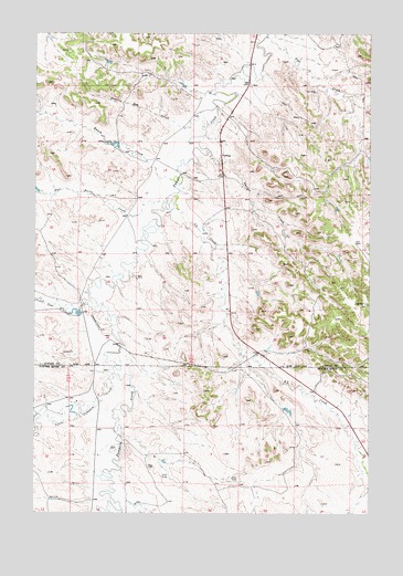
Volborg, MT USGS Topographic Map
Click on map above to begin viewing in our Map Viewer.

This topographic map contains these locations and features:
Feature Name Type Latitude Longitude GNIS ID View Map
01N48E22ACBB01 WellWellN45.8186°W105.7442°812401View Map
01N49E18BDAA01 WellWellN45.8431°W105.6817°812668View Map
01N49E30DBBC01 WellWellN45.8006°W105.6803°812167View Map
01S48E13ACAB01 WellWellN45.7536°W105.7442°811683View Map
01S48E20DCAC01 WellWellN45.8272°W105.7303°812519View Map
01S49E09CBAD01 WellWellN45.7639°W105.6894°811775View Map
01S49E14ADCD01 WellWellN45.7506°W105.6333°811654View Map
01S49E18ADAC01 WellWellN45.7533°W105.7289°811678View Map
Allen Number 6 DamDamN45.7783°W105.6555°796928View Map
Deer CreekStreamN45.8742°W105.6647°770575View Map
Flat Butte CreekStreamN45.8308°W105.7025°771433View Map
Little Pumpkin CreekStreamN45.7864°W105.7205°786346View Map
Lone Tree CreekStreamN45.8061°W105.7294°773592View Map
Prairie Dog CreekStreamN45.8517°W105.6864°775437View Map
Ranch CreekStreamN45.8361°W105.6975°775545View Map
S L CreekStreamN45.8314°W105.7011°776049View Map
Sand CouleeStreamN45.7611°W105.7178°1689989View Map
Shelter CreekStreamN45.8439°W105.6864°776469View Map
VolborgPopulated PlaceN45.8428°W105.6811°778042View Map
Volborg Post OfficePost OfficeN45.8432°W105.6815°1716836View Map

Note: Coordinates in the location and feature list above are referenced to NAD83 datum.


Copyright (C) 2008-2025 Ryan Niemi / Sunset Dynamics ... All Rights Reserved