TopoQuest Logo
Do you find TopoQuest useful?
Help keep TopoQuest running and adding new maps/features by donating!
Bitcoin:  19c7KJd3qBynnjoSw5npx9KScwjBe4ifkT
Litecoin:  LXs6TkuXGGXo1vDsWCkWVdjQX94eUKd6ui
Home View Maps Find Maps Find Places Resources & Links


Elk Ridge, Montana Topographic Map

USGS Map Title: Elk Ridge, MT
USGS Map MRC: 45105F7
DRG (GeoTIFF) Download: o45105f7.tif


Neighboring USGS Topographic Map Quads:


  North Stacey School, MT  
45105G8
 

  Foster Creek School, MT  
45105G7
 

  Volborg, MT  
45105G6
 

  Stacey, MT  
45105F8
 

  Elk Ridge, MT  
45105F7
 

  Box Elder Creek, MT  
45105F6
 

  Home Creek Butte, MT  
45105E8
 

  Samuelson Ranch, MT  
45105E7
 

  Leslie Creek, MT  
45105E6


Map MRC Location:

N46°
W106°
N46°
W105°
H8 H7 H6 H5 H4 H3 H2 H1
G8 G7 G6 G5 G4 G3 G2 G1
F8 F7 F6 F5 F4 F3 F2 F1
E8 E7 E6 E5 E4 E3 E2 E1
D8 D7 D6 D5 D4 D3 D2 D1
C8 C7 C6 C5 C4 C3 C2 C1
B8 B7 B6 B5 B4 B3 B2 B1
A8 A7 A6 A5 A4 A3 A2 A1
N45°
W106°
N45°
W105°

Elk Ridge, MT USGS 1:24K Topographic Map Preview:
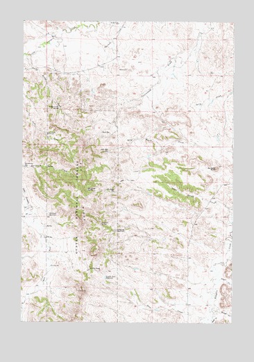
Elk Ridge, MT USGS Topographic Map
Click on map above to begin viewing in our Map Viewer.

This topographic map contains these locations and features:
Feature Name Type Latitude Longitude GNIS ID View Map
01S48E17DDDD01 WellWellN45.7342°W105.8206°811523View Map
02S48E18BCDB01 WellWellN45.6628°W105.8572°810930View Map
02S48E19BCCA01 WellWellN45.6483°W105.8581°810798View Map
02S48E22CAAD01 WellWellN45.6453°W105.7872°810775View Map
02S48E27BDCA01 WellWellN45.6331°W105.7903°810693View Map
02S49E28CBDC01 WellWellN45.6303°W105.8417°810681View Map
Bridge CreekStreamN45.7356°W105.8706°780392View Map
Bridge Creek SpringSpringN45.7138°W105.8543°780399View Map
Buckberry ReservoirReservoirN45.6894°W105.8735°780522View Map
Cameron ReservoirReservoirN45.6631°W105.8190°780830View Map
Cameron SpringSpringN45.6655°W105.8283°780831View Map
Coal Creek ReservoirReservoirN45.7035°W105.8616°781445View Map
Corner CreekStreamN45.7464°W105.8331°1689993View Map
Dwyer CreekStreamN45.6433°W105.7581°782744View Map
East Fork Little Pumpkin CreekStreamN45.6700°W105.8706°782869View Map
East Prong Cottonwood CreekStreamN45.7356°W105.7844°1689992View Map
Elk RidgeRidgeN45.6781°W105.8397°783117View Map
Elk Ridge ReservoirReservoirN45.6790°W105.8213°783121View Map
Elk Ridge SpringSpringN45.6803°W105.8367°783122View Map
Gold WellWellN45.6597°W105.8608°784071View Map
Gould CreekStreamN45.6269°W105.7619°784136View Map
Griffin PassGapN45.6472°W105.8350°784338View Map
Griffin Pass ReservoirReservoirN45.6437°W105.8254°784339View Map
Horkan Creek SchoolSchoolN45.7492°W105.8194°785013View Map
John Gold ReservoirReservoirN45.6957°W105.8246°785511View Map
Manning WellWellN45.6478°W105.8583°786819View Map
Marvell CreekStreamN45.6292°W105.8747°786900View Map
Pass CreekStreamN45.6264°W105.7644°788672View Map
Rough CreekStreamN45.6300°W105.7603°789804View Map
Sandefer ButteSummitN45.6894°W105.7603°790006View Map
Shell ReservoirReservoirN45.7038°W105.8283°790391View Map
Starvation CreekStreamN45.7458°W105.8528°791456View Map
West Fork Little Pumpkin CreekStreamN45.6700°W105.8703°793038View Map
Williams ReservoirReservoirN45.6691°W105.8596°793333View Map

Note: Coordinates in the location and feature list above are referenced to NAD83 datum.


Copyright (C) 2008-2024 Ryan Niemi / Sunset Dynamics ... All Rights Reserved