TopoQuest Logo
Do you find TopoQuest useful?
Help keep TopoQuest running and adding new maps/features by donating!
Bitcoin:  19c7KJd3qBynnjoSw5npx9KScwjBe4ifkT
Litecoin:  LXs6TkuXGGXo1vDsWCkWVdjQX94eUKd6ui
Home View Maps Find Maps Find Places Resources & Links


Box Elder Creek, Montana Topographic Map

USGS Map Title: Box Elder Creek, MT
USGS Map MRC: 45105F6
DRG (GeoTIFF) Download: o45105f6.tif


Neighboring USGS Topographic Map Quads:


  Foster Creek School, MT  
45105G7
 

  Volborg, MT  
45105G6
 

  Divide School, MT  
45105G5
 

  Elk Ridge, MT  
45105F7
 

  Box Elder Creek, MT  
45105F6
 

  Coalwood, MT  
45105F5
 

  Samuelson Ranch, MT  
45105E7
 

  Leslie Creek, MT  
45105E6
 

  Olive, MT  
45105E5


Map MRC Location:

N46°
W106°
N46°
W105°
H8 H7 H6 H5 H4 H3 H2 H1
G8 G7 G6 G5 G4 G3 G2 G1
F8 F7 F6 F5 F4 F3 F2 F1
E8 E7 E6 E5 E4 E3 E2 E1
D8 D7 D6 D5 D4 D3 D2 D1
C8 C7 C6 C5 C4 C3 C2 C1
B8 B7 B6 B5 B4 B3 B2 B1
A8 A7 A6 A5 A4 A3 A2 A1
N45°
W106°
N45°
W105°

Box Elder Creek, MT USGS 1:24K Topographic Map Preview:
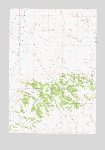
Box Elder Creek, MT USGS Topographic Map
Click on map above to begin viewing in our Map Viewer.

This topographic map contains these locations and features:
Feature Name Type Latitude Longitude GNIS ID View Map
01S48E24CACD01 WellWellN45.7339°W105.7480°811517View Map
01S49E16DDBC01 WellWellN45.7461°W105.6789°811624View Map
01S49E23CACD01 WellWellN45.7328°W105.6461°811504View Map
01S49E29DADA01 WellWellN45.7181°W105.6886°811377View Map
01S49E30ABBA01 WellWellN45.7281°W105.7239°811473View Map
01S49E31BDCC01 WellWellN45.7069°W105.7308°811304View Map
02S49E18BABB01 WellWellN45.6694°W105.7297°810979View Map
02S49E19CADA01 WellWellN45.6458°W105.7264°810781View Map
02S49E22CBAA01 WellWellN45.6478°W105.6700°810794View Map
02S49E22DCCA01 WellWellN45.6422°W105.6614°810752View Map
02S49E22DCCA02 WellWellN45.6422°W105.6614°810753View Map
02S49E22DCCA03 WellWellN45.6422°W105.6614°810754View Map
02S49E22DCCA04 WellWellN45.6422°W105.6614°810755View Map
02S49E22DCCA05 WellWellN45.6422°W105.6614°810756View Map
02S49E26AACA01 WellWellN45.6383°W105.6353°810728View Map
02S49E26AADA01 WellWellN45.6394°W105.6330°810732View Map
02S51E11ADBB01 WellWellN45.6811°W105.6397°811088View Map
Box Elder CreekStreamN45.6769°W105.7458°769161View Map
Camp CreekStreamN45.7178°W105.7269°769532View Map
Kiwah CreekStreamN45.6997°W105.7292°785781View Map
Rough CreekStreamN45.7258°W105.6758°1689991View Map
Salty CreekStreamN45.7442°W105.7269°789980View Map
Spring CreekStreamN45.7369°W105.7208°777017View Map
Tilton Spring CreekStreamN45.6731°W105.7483°792175View Map
Two Moons CreekStreamN45.7281°W105.6886°1689990View Map

Note: Coordinates in the location and feature list above are referenced to NAD83 datum.


Copyright (C) 2008-2025 Ryan Niemi / Sunset Dynamics ... All Rights Reserved