TopoQuest Logo
Do you find TopoQuest useful?
Help keep TopoQuest running and adding new maps/features by donating!
Bitcoin:  19c7KJd3qBynnjoSw5npx9KScwjBe4ifkT
Litecoin:  LXs6TkuXGGXo1vDsWCkWVdjQX94eUKd6ui
Home View Maps Find Maps Find Places Resources & Links


Wachita Mountain, Missouri Topographic Map

USGS Map Title: Wachita Mountain, MO
USGS Map MRC: 37090F4
DRG (GeoTIFF) Download: o37090f4.tif


Neighboring USGS Topographic Map Quads:


  Flat River, MO  
37090G5
 

  Farmington, MO  
37090G4
 

  Sprott, MO  
37090G3
 

  Iron Mountain Lake, MO  
37090F5
 

  Wachita Mountain, MO  
37090F4
 

  Knob Lick, MO  
37090F3
 

  Lake Killarney, MO  
37090E5
 

  Rhodes Mountain, MO  
37090E4
 

  Fredericktown, MO  
37090E3


Map MRC Location:

N38°
W91°
N38°
W90°
H8 H7 H6 H5 H4 H3 H2 H1
G8 G7 G6 G5 G4 G3 G2 G1
F8 F7 F6 F5 F4 F3 F2 F1
E8 E7 E6 E5 E4 E3 E2 E1
D8 D7 D6 D5 D4 D3 D2 D1
C8 C7 C6 C5 C4 C3 C2 C1
B8 B7 B6 B5 B4 B3 B2 B1
A8 A7 A6 A5 A4 A3 A2 A1
N37°
W91°
N37°
W90°

Wachita Mountain, MO USGS 1:24K Topographic Map Preview:
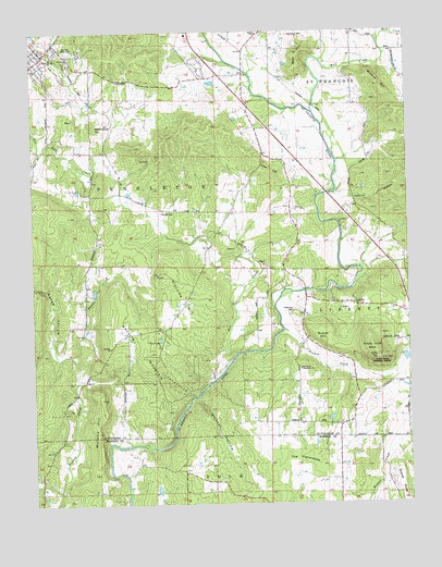
Wachita Mountain, MO USGS Topographic Map
Click on map above to begin viewing in our Map Viewer.

This topographic map contains these locations and features:
Feature Name Type Latitude Longitude GNIS ID View Map
Alexander and Burks Granite Quarry (historical)MineN37.7031°W90.3951°757939View Map
Allen BranchStreamN37.7178°W90.4976°755679View Map
Asplof Granite QuarryMineN37.6698°W90.3846°757940View Map
Back CreekStreamN37.7470°W90.3837°755710View Map
Barnhouse HillSummitN37.7251°W90.4793°757044View Map
Beck MountainSummitN37.7431°W90.4110°755738View Map
Black Oak FlatFlatN37.6720°W90.4562°757941View Map
Brewer Creek School (historical)SchoolN37.6309°W90.4985°736392View Map
Brewers CreekStreamN37.6284°W90.4918°736391View Map
Brightstone Community ChurchChurchN37.6607°W90.4116°756975View Map
Brightstone School (historical)SchoolN37.6603°W90.4121°755818View Map
Butler HillSummitN37.6678°W90.4035°755837View Map
Cartee SchoolSchoolN37.7017°W90.4446°755862View Map
Doe RunPopulated PlaceN37.7428°W90.4976°755991View Map
Doe Run Census Designated PlaceCensusN37.7454°W90.4995°2587064View Map
Doe Run CreekStreamN37.6642°W90.4321°755992View Map
Doe Run Fire Protection DistrictBuildingN37.7442°W90.4951°2621091View Map
Doe Run Memorial CemeteryCemeteryN37.7448°W90.4882°757046View Map
Fredericktown Ranger DistrictForestN37.6614°W90.3835°757132View Map
Gruner HillSummitN37.7223°W90.4551°757944View Map
Hamilton TownPopulated PlaceN37.7414°W90.4837°757945View Map
Herbst CemeteryCemeteryN37.7022°W90.4569°757042View Map
Hildebright SchoolSchoolN37.7317°W90.4612°756180View Map
Hill-O'Mera Construction Company Granite QuarryMineN37.7031°W90.4104°757946View Map
Klondike HillSummitN37.6867°W90.4557°757040View Map
Knob Lick LookoutLocaleN37.6623°W90.3848°756956View Map
Knob Lick MountainSummitN37.6639°W90.3848°756257View Map
Kollmeyer CemeteryCemeteryN37.7490°W90.4137°756262View Map
Lick BranchStreamN37.7437°W90.3823°757956View Map
Limel LakeReservoirN37.7034°W90.4435°765049View Map
Masda SchoolSchoolN37.7495°W90.4246°757047View Map
Milne and Gordon Granite QuarryMineN37.6823°W90.3976°757947View Map
Missouri Granite Construction Company Quarry (historical)MineN37.6539°W90.4004°757948View Map
Mononame 662 DamDamN37.6801°W90.4785°764724View Map
Mononame 826 DamDamN37.6634°W90.3751°764731View Map
Murphy HillSummitN37.6512°W90.4771°756433View Map
O'Bannon CemeteryCemeteryN37.6762°W90.4139°755725View Map
O'Bannon CreekStreamN37.6709°W90.4165°757038View Map
Pendleton ChurchChurchN37.7426°W90.4876°757045View Map
Pinnacle HollowValleyN37.6581°W90.4854°757949View Map
Polecat CreekStreamN37.6642°W90.4882°757041View Map
Possum HollowValleyN37.7078°W90.3993°738117View Map
Possum Hollow School (historical)SchoolN37.7012°W90.3879°757938View Map
Rickus HillSummitN37.7348°W90.3835°756581View Map
Seego HollowValleyN37.6576°W90.4860°756701View Map
Shannon DamDamN37.7034°W90.4435°765048View Map
SyenitePopulated PlaceN37.6767°W90.3918°756776View Map
Tetley HillSummitN37.7131°W90.4223°757043View Map
The FlatwoodsGapN37.6365°W90.4135°727551View Map
Township of PendletonCivilN37.7065°W90.4876°767333View Map
Wachita ChurchSchoolN37.6664°W90.4743°755833View Map
Wachita MountainSummitN37.6703°W90.4721°756861View Map
Wildcat CreekStreamN37.6581°W90.4857°757953View Map
Wildcat HollowValleyN37.6523°W90.4462°756907View Map
Wolf CreekStreamN37.7276°W90.4060°756920View Map
Wolf Creek (historical)LocaleN37.7303°W90.4062°757954View Map
Zeran Gregory Granite Company Quarry (historical)MineN37.6989°W90.4432°757955View Map

Note: Coordinates in the location and feature list above are referenced to NAD83 datum.


Copyright (C) 2008-2024 Ryan Niemi / Sunset Dynamics ... All Rights Reserved