TopoQuest Logo
Do you find TopoQuest useful?
Help keep TopoQuest running and adding new maps/features by donating!
Bitcoin:  19c7KJd3qBynnjoSw5npx9KScwjBe4ifkT
Litecoin:  LXs6TkuXGGXo1vDsWCkWVdjQX94eUKd6ui
Home View Maps Find Maps Find Places Resources & Links


Walker Flat, Utah Topographic Map

USGS Map Title: Walker Flat, UT
USGS Map MRC: 38111G3
DRG (GeoTIFF) Download: o38111g3.tif


Neighboring USGS Topographic Map Quads:


  Acord Lakes, UT  
38111H4
 

  Emery West, UT  
38111H3
 

  Emery East, UT  
38111H2
 

  Old Woman Plateau, UT  
38111G4
 

  Walker Flat, UT  
38111G3
 

  Mesa Butte, UT  
38111G2
 

  Johns Peak, UT  
38111F4
 

  Willow Springs, UT  
38111F3
 

  Mussentuchit Flat, UT  
38111F2


Map MRC Location:

N39°
W112°
N39°
W111°
H8 H7 H6 H5 H4 H3 H2 H1
G8 G7 G6 G5 G4 G3 G2 G1
F8 F7 F6 F5 F4 F3 F2 F1
E8 E7 E6 E5 E4 E3 E2 E1
D8 D7 D6 D5 D4 D3 D2 D1
C8 C7 C6 C5 C4 C3 C2 C1
B8 B7 B6 B5 B4 B3 B2 B1
A8 A7 A6 A5 A4 A3 A2 A1
N38°
W112°
N38°
W111°

Walker Flat, UT USGS 1:24K Topographic Map Preview:
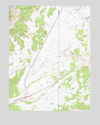
Walker Flat, UT USGS Topographic Map
Click on map above to begin viewing in our Map Viewer.

This topographic map contains these locations and features:
Feature Name Type Latitude Longitude GNIS ID View Map
Browning MineMineN38.8605°W111.2560°1439170View Map
Christiansen WashValleyN38.8597°W111.2574°1439728View Map
Coal WashValleyN38.8208°W111.2899°1439850View Map
Dog Valley MineMineN38.7716°W111.2710°1440509View Map
Dog Valley WashValleyN38.8111°W111.2563°1440512View Map
Gilson ValleyValleyN38.8036°W111.3499°1441325View Map
Ivie Creek BenchBenchN38.7811°W111.3224°1442076View Map
Jensen Place (historical)LocaleN38.8208°W111.3274°1448519View Map
Oak Spring CreekStreamN38.8053°W111.3249°1444038View Map
Peacocks Place (historical)LocaleN38.7958°W111.3377°1448822View Map
Post HollowValleyN38.7589°W111.3727°1444597View Map
Saleratus BenchesBenchN38.8336°W111.3735°1445265View Map
Saleratus CreekStreamN38.8100°W111.3160°1445266View Map
Trough HollowValleyN38.8133°W111.3457°1446732View Map
Trough Hollow CreekStreamN38.8133°W111.3452°1449113View Map
Walker FlatFlatN38.8375°W111.3002°1446961View Map
Windy PeakSummitN38.7586°W111.3105°1447470View Map

Note: Coordinates in the location and feature list above are referenced to NAD83 datum.


Copyright (C) 2008-2024 Ryan Niemi / Sunset Dynamics ... All Rights Reserved