TopoQuest Logo
Do you find TopoQuest useful?
Help keep TopoQuest running and adding new maps/features by donating!
Bitcoin:  19c7KJd3qBynnjoSw5npx9KScwjBe4ifkT
Litecoin:  LXs6TkuXGGXo1vDsWCkWVdjQX94eUKd6ui
Home View Maps Find Maps Find Places Resources & Links


Walnut Springs West, Texas Topographic Map

USGS Map Title: Walnut Springs West, TX
USGS Map MRC: 32097A7
DRG (GeoTIFF) Download: o32097a7.tif


Neighboring USGS Topographic Map Quads:


  Chalk Mountain, TX  
32097B8
 

  Glen Rose West, TX  
32097B7
 

  Glen Rose East, TX  
32097B6
 

  Camp Branch, TX  
32097A8
 

  Walnut Springs West, TX  
32097A7
 

  Walnut Springs East, TX  
32097A6
 

  Spring Creek Gap, TX  
31097H8
 

  Iredell, TX  
31097H7
 

  Meridian, TX  
31097H6


Map MRC Location:

N33°
W98°
N33°
W97°
H8 H7 H6 H5 H4 H3 H2 H1
G8 G7 G6 G5 G4 G3 G2 G1
F8 F7 F6 F5 F4 F3 F2 F1
E8 E7 E6 E5 E4 E3 E2 E1
D8 D7 D6 D5 D4 D3 D2 D1
C8 C7 C6 C5 C4 C3 C2 C1
B8 B7 B6 B5 B4 B3 B2 B1
A8 A7 A6 A5 A4 A3 A2 A1
N32°
W98°
N32°
W97°

Walnut Springs West, TX USGS 1:24K Topographic Map Preview:
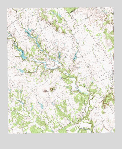
Walnut Springs West, TX USGS Topographic Map
Click on map above to begin viewing in our Map Viewer.

This topographic map contains these locations and features:
Feature Name Type Latitude Longitude GNIS ID View Map
Arena LakeReservoirN32.1008°W97.8518°1329663View Map
Arena Lake DamDamN32.0968°W97.8486°1862372View Map
Barry BranchStreamN32.0032°W97.7917°1330101View Map
Barry CemeteryCemeteryN32.0135°W97.7917°1330102View Map
Beecherl DamDamN32.0385°W97.7820°1861038View Map
Beecherl LakeReservoirN32.0385°W97.7820°1861039View Map
Big LakeReservoirN32.0794°W97.8579°1330619View Map
Big Lake DamDamN32.0751°W97.8520°1861028View Map
Canyon LakeReservoirN32.0962°W97.8400°1863249View Map
Canyon Lake DamDamN32.0951°W97.8403°1863248View Map
Cedar MountainSummitN32.0421°W97.8320°1332464View Map
City of Walnut SpringsCivilN32.0562°W97.7507°2412175View Map
Dinner HillSummitN32.0201°W97.7636°1334374View Map
Drechsel LakeReservoirN32.1151°W97.8120°1862381View Map
Drechsel Lake DamDamN32.1151°W97.8120°1862380View Map
East Bosque RiverStreamN32.0038°W97.7781°1334881View Map
East Flat Top LakeReservoirN32.0554°W97.8134°1334909View Map
Flag BranchStreamN32.0701°W97.8373°1335867View Map
Flag Branch DamDamN32.0618°W97.8553°1861026View Map
Flag Branch LakeReservoirN32.0624°W97.8587°1335869View Map
Flat Top MountainSummitN32.0440°W97.8239°1335930View Map
Flat Top RanchLocaleN32.0790°W97.8200°1335933View Map
Flat Top Ranch AirportAirportN32.0577°W97.7959°1387709View Map
Fulton CemeteryCemeteryN32.0288°W97.7828°1336304View Map
Irrigation DamDamN32.0651°W97.8303°1861030View Map
Irrigation LakeReservoirN32.0686°W97.8312°1338506View Map
Mustang CreekStreamN32.0585°W97.8036°1342310View Map
Mustang LakeReservoirN32.0764°W97.7956°1342322View Map
Mustang Lake DamDamN32.0735°W97.7970°1861036View Map
Old LakeReservoirN32.0746°W97.8148°1343175View Map
Old Lake DamDamN32.0751°W97.8136°1861034View Map
Ownsby LakeReservoirN32.0398°W97.7889°1343385View Map
Polnac DamDamN32.0851°W97.8386°1861032View Map
Polnac LakeReservoirN32.0878°W97.8391°1344331View Map
Rough CreekStreamN32.0676°W97.8120°1345641View Map
South Flat Top DamDamN32.0251°W97.8353°1861040View Map
South Flat Top LakeReservoirN32.0269°W97.8354°1347437View Map
Twin Arena LakeReservoirN32.1023°W97.8483°1348938View Map
Twin Arena Lake DamDamN32.1018°W97.8470°1862374View Map

Note: Coordinates in the location and feature list above are referenced to NAD83 datum.


Copyright (C) 2008-2025 Ryan Niemi / Sunset Dynamics ... All Rights Reserved