TopoQuest Logo
Do you find TopoQuest useful?
Help keep TopoQuest running and adding new maps/features by donating!
Bitcoin:  19c7KJd3qBynnjoSw5npx9KScwjBe4ifkT
Litecoin:  LXs6TkuXGGXo1vDsWCkWVdjQX94eUKd6ui
Home View Maps Find Maps Find Places Resources & Links


Bolton, Kansas Topographic Map

USGS Map Title: Bolton, KS
USGS Map MRC: 37095B7
DRG (GeoTIFF) Download: o37095b7.tif


Neighboring USGS Topographic Map Quads:


  Elk City, KS  
37095C8
 

  Table Mound, KS  
37095C7
 

  Sycamore, KS  
37095C6
 

  Caney NW, KS  
37095B8
 

  Bolton, KS  
37095B7
 

  Independence, KS  
37095B6
 

  Caney, KS  
37095A8
 

  Tyro, KS  
37095A7
 

  Coffeyville West, KS  
37095A6


Map MRC Location:

N38°
W96°
N38°
W95°
H8 H7 H6 H5 H4 H3 H2 H1
G8 G7 G6 G5 G4 G3 G2 G1
F8 F7 F6 F5 F4 F3 F2 F1
E8 E7 E6 E5 E4 E3 E2 E1
D8 D7 D6 D5 D4 D3 D2 D1
C8 C7 C6 C5 C4 C3 C2 C1
B8 B7 B6 B5 B4 B3 B2 B1
A8 A7 A6 A5 A4 A3 A2 A1
N37°
W96°
N37°
W95°

Bolton, KS USGS 1:24K Topographic Map Preview:
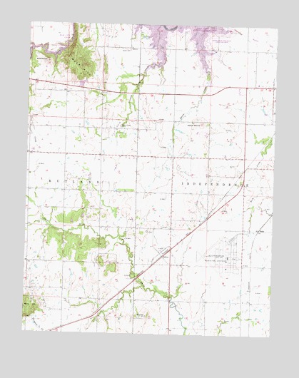
Bolton, KS USGS Topographic Map
Click on map above to begin viewing in our Map Viewer.

This topographic map contains these locations and features:
Feature Name Type Latitude Longitude GNIS ID View Map
Bald MoundSummitN37.2351°W95.8661°469385View Map
BlakePopulated PlaceN37.1676°W95.7572°484442View Map
BoltonPopulated PlaceN37.1567°W95.8055°484441View Map
Chetopa CreekStreamN37.2498°W95.8083°469382View Map
Christian Church (historical)ChurchN37.2359°W95.7830°483846View Map
Coon CreekStreamN37.2401°W95.8730°469389View Map
Fairview SchoolSchoolN37.1895°W95.7833°469379View Map
Four Corners SchoolSchoolN37.2223°W95.8008°469383View Map
Frontline Baptist ChurchChurchN37.2243°W95.7534°2690160View Map
Grass (historical)LocaleN37.2217°W95.8364°482384View Map
Harrisonville (historical)LocaleN37.1348°W95.8191°481896View Map
Harrisonville CemeteryCemeteryN37.1321°W95.8139°469376View Map
Harrisonville School (historical)SchoolN37.1384°W95.8189°483854View Map
Highland Center CemeteryCemeteryN37.2089°W95.8285°469381View Map
Highland Center School (historical)SchoolN37.2120°W95.8380°483856View Map
Independence Army Air Field (historical)MilitaryN37.1597°W95.7764°1989691View Map
Independence Municipal AirportAirportN37.1596°W95.7737°469377View Map
James School (historical)SchoolN37.1476°W95.8550°483859View Map
Oak Ridge SchoolSchoolN37.1826°W95.8466°469378View Map
Patterson Farms AirportAirportN37.1651°W95.8734°2651070View Map
Pleasant Prairie Church (historical)ChurchN37.2406°W95.7766°483866View Map
Pleasant Valley School (historical)SchoolN37.1534°W95.7836°483868View Map
Quaker CemeteryCemeteryN37.2401°W95.8241°469387View Map
Quaker Church (historical)ChurchN37.2392°W95.8239°483870View Map
Squaw Creek Cove South Public Use AreaParkN37.2445°W95.7836°481129View Map
Township of IndependenceCivilN37.1852°W95.7508°469243View Map
Walker MoundSummitN37.2101°W95.7875°469380View Map
White Post SchoolSchoolN37.2406°W95.7789°469386View Map

Note: Coordinates in the location and feature list above are referenced to NAD83 datum.


Copyright (C) 2008-2025 Ryan Niemi / Sunset Dynamics ... All Rights Reserved