TopoQuest Logo
Do you find TopoQuest useful?
Help keep TopoQuest running and adding new maps/features by donating!
Bitcoin:  19c7KJd3qBynnjoSw5npx9KScwjBe4ifkT
Litecoin:  LXs6TkuXGGXo1vDsWCkWVdjQX94eUKd6ui
Home View Maps Find Maps Find Places Resources & Links


Washington, North Carolina Topographic Map

USGS Map Title: Washington, NC
USGS Map MRC: 35077E1
DRG (GeoTIFF) Download: o35077e1.tif


Neighboring USGS Topographic Map Quads:


  Leggetts Crossroads, NC  
35077F2
 

  Old Ford, NC  
35077F1
 

  Farmlife, NC  
35076F8
 

  Grimesland, NC  
35077E2
 

  Washington, NC  
35077E1
 

  Bunyan, NC  
35076E8
 

  Wilmar, NC  
35077D2
 

  Hackney, NC  
35077D1
 

  Blounts Bay, NC  
35076D8


Map MRC Location:

N36°
W78°
N36°
W77°
H8 H7 H6 H5 H4 H3 H2 H1
G8 G7 G6 G5 G4 G3 G2 G1
F8 F7 F6 F5 F4 F3 F2 F1
E8 E7 E6 E5 E4 E3 E2 E1
D8 D7 D6 D5 D4 D3 D2 D1
C8 C7 C6 C5 C4 C3 C2 C1
B8 B7 B6 B5 B4 B3 B2 B1
A8 A7 A6 A5 A4 A3 A2 A1
N35°
W78°
N35°
W77°

Washington, NC USGS 1:24K Topographic Map Preview:
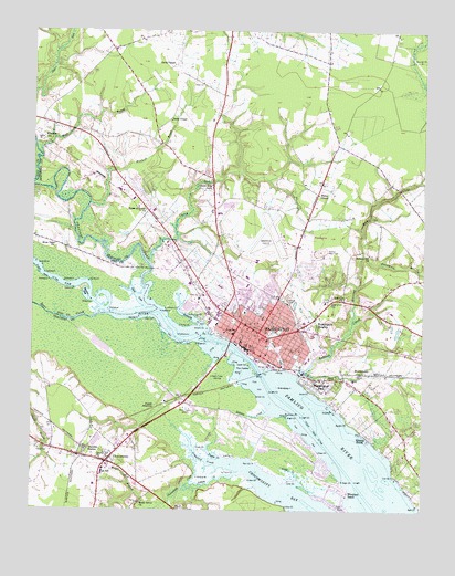
Washington, NC USGS Topographic Map
Click on map above to begin viewing in our Map Viewer.

This topographic map contains these locations and features:
Feature Name Type Latitude Longitude GNIS ID View Map
Austin PointCapeN35.5232°W77.0236°980375View Map
Bear CreekStreamN35.5513°W77.1011°1023808View Map
Beaufort County Developmental CenterBuildingN35.5586°W77.0693°2505724View Map
Beaufort County Sheriff's OfficeBuildingN35.5438°W77.0543°2130950View Map
Beebe ChapelChurchN35.6018°W77.0813°980898View Map
Beech Grove ChurchChurchN35.5024°W77.0894°980906View Map
Britthaven of WashingtonBuildingN35.5510°W77.0358°2505748View Map
Cedar CreekStreamN35.5079°W77.0394°982811View Map
Cedar Grove CemeteryCemeteryN35.5557°W77.0291°982830View Map
Cherry RunStreamN35.5643°W77.0872°1008012View Map
Cherry Run ChurchChurchN35.5849°W77.0677°983089View Map
ChocowinityPopulated PlaceN35.5127°W77.1005°1019670View Map
Chocowinity BayBayN35.5052°W77.0450°983161View Map
Chocowinity CreekStreamN35.5135°W77.0716°1019671View Map
Chocowinity Emergency Medical ServicesBuildingN35.5086°W77.0930°2720602View Map
Chocowinity High SchoolSchoolN35.5107°W77.1016°1003652View Map
Chocowinity Police DepartmentBuildingN35.5144°W77.0975°2131043View Map
Chocowinity Post OfficePost OfficeN35.5164°W77.0968°2774326View Map
Chocowinity Volunteer Fire DepartmentBuildingN35.5086°W77.0931°2638544View Map
City of WashingtonCivilN35.5579°W77.0543°2405682View Map
Clarks Neck Volunteer Fire Department Station 2BuildingN35.6055°W77.1183°2638605View Map
Coastal Medical Transport - WashingtonBuildingN35.5473°W77.0530°2720427View Map
Crawford CreekStreamN35.5116°W77.0588°983724View Map
Cypress Landing MarinaHarborN35.5022°W77.0463°2506039View Map
Davis ChapelChurchN35.6163°W77.0805°983999View Map
Eastern Elementary SchoolSchoolN35.5448°W77.0363°1006853View Map
Elks Mobile Home ParkPopulated PlaceN35.5226°W77.1207°2505467View Map
Grandpap IslandIslandN35.5321°W77.0463°985918View Map
Harvey Street BuildingSchoolN35.5463°W77.0472°1006856View Map
Herring RunStreamN35.5491°W77.0225°986662View Map
HootentownPopulated PlaceN35.5363°W77.0197°987035View Map
House of Prayer ChurchChurchN35.5785°W77.0888°987166View Map
Howard Hill ChurchChurchN35.5671°W77.0169°987181View Map
J H Small Elementary SchoolSchoolN35.5446°W77.0494°1006854View Map
Jacks CreekStreamN35.5368°W77.0438°987480View Map
John C Tayloe Elementary SchoolSchoolN35.5587°W77.0637°1006859View Map
Kennedy CreekStreamN35.5485°W77.0711°1008013View Map
Keysville ChurchChurchN35.5552°W77.0252°987948View Map
Kugler FieldSchoolN35.5404°W77.0400°1006855View Map
Maple BranchStreamN35.5018°W77.0883°989298View Map
Maple BranchStreamN35.5927°W77.1222°989299View Map
Marsden StationLocaleN35.5163°W77.1066°989363View Map
Martin BayBayN35.5568°W77.1069°1000760View Map
Maryanna Mobile EstatesPopulated PlaceN35.5650°W77.0733°2505493View Map
Mimosa Manor Mobile Home ParkPopulated PlaceN35.5248°W77.0081°2505529View Map
Mimosa ShoresPopulated PlaceN35.5196°W77.0174°1021481View Map
Mitchell BranchStreamN35.5799°W77.1063°990089View Map
North Carolina State Highway Patrol Troop A District 4BuildingN35.5735°W77.0649°2131042View Map
Oakdale CemeteryCemeteryN35.5560°W77.0424°991455View Map
P S Jones Junior High SchoolSchoolN35.5527°W77.0558°1006858View Map
Pamlico Race TrackLocaleN35.5674°W77.0336°991814View Map
Pineygrove BranchStreamN35.5668°W77.0188°992399View Map
PorterPopulated PlaceN35.5004°W77.0780°1008141View Map
Porter JunctionPopulated PlaceN35.5268°W77.0850°1022049View Map
River View ChurchChurchN35.5693°W77.1177°993381View Map
Rodman CreekStreamN35.5257°W77.0483°993636View Map
Rodman PointCapeN35.5246°W77.0433°993637View Map
RosedalePopulated PlaceN35.5849°W77.0891°1005233View Map
Runyon CreekStreamN35.5357°W77.0394°993806View Map
Shop CoveBayN35.5560°W77.0911°994764View Map
Sidney CreekStreamN35.5096°W77.0577°994788View Map
SmallwoodPopulated PlaceN35.5629°W77.0327°1018720View Map
Tar RiverStreamN35.5524°W77.0847°1024343View Map
Taylor CreekStreamN35.5138°W77.0633°995888View Map
The CastleIslandN35.5382°W77.0555°995963View Map
Tideland Mental Health Center of WashingtonBuildingN35.5501°W77.0352°2505730View Map
Town of ChocowinityCivilN35.5147°W77.1017°2406267View Map
Town of Washington ParkCivilN35.5329°W77.0316°2406836View Map
Tranters CreekStreamN35.5524°W77.0847°1024361View Map
Trinity CemeteryCemeteryN35.5160°W77.1197°996230View Map
Trinity ChurchChurchN35.5135°W77.1033°996244View Map
Twin Lakes ResortPopulated PlaceN35.5199°W77.0537°2505680View Map
Vidant Beaufort HospitalHospitalN35.5492°W77.0379°2094857View Map
Wares ChapelChurchN35.5827°W77.0338°1008015View Map
WashingtonPopulated PlaceN35.5466°W77.0522°996823View Map
Washington City HallBuildingN35.5427°W77.0550°1003653View Map
Washington Fire Rescue and Emergency Medical Services Station 1BuildingN35.5464°W77.0527°2638258View Map
Washington HeightsPopulated PlaceN35.5496°W77.0355°1023122View Map
Washington High SchoolSchoolN35.5463°W77.0605°1003654View Map
Washington High SchoolSchoolN35.5573°W77.0122°1006857View Map
Washington ParkPopulated PlaceN35.5327°W77.0325°1023123View Map
Washington Plaza Shopping CenterLocaleN35.5602°W77.0641°2505201View Map
Washington Police DepartmentBuildingN35.5567°W77.0369°2131044View Map
Washington Police DepartmentBuildingN35.5451°W77.0559°2130868View Map
Washington Post OfficePost OfficeN35.5447°W77.0567°2774030View Map
Washington Square Mall Shopping CenterLocaleN35.5596°W77.0584°2505202View Map
Washington Wastewater Treatment PlantLocaleN35.5522°W77.0724°2506336View Map
Washington-Warren FieldAirportN35.5708°W77.0453°997940View Map
WEEW-AM (Washington)TowerN35.5354°W77.0675°1018459View Map
Wharton StationLocaleN35.5971°W77.1219°997099View Map
Wharton Trinity ChurchChurchN35.5979°W77.1216°1008167View Map
Whichard BeachPopulated PlaceN35.5043°W77.0230°1023194View Map
Whichards MarinaHarborN35.5043°W77.0237°2506064View Map
WITN-AM (Washington)TowerN35.5263°W77.0783°1018455View Map

Note: Coordinates in the location and feature list above are referenced to NAD83 datum.


Copyright (C) 2008-2025 Ryan Niemi / Sunset Dynamics ... All Rights Reserved