TopoQuest Logo
Do you find TopoQuest useful?
Help keep TopoQuest running and adding new maps/features by donating!
Bitcoin:  19c7KJd3qBynnjoSw5npx9KScwjBe4ifkT
Litecoin:  LXs6TkuXGGXo1vDsWCkWVdjQX94eUKd6ui
Home View Maps Find Maps Find Places Resources & Links


Bonanza, Colorado Topographic Map

USGS Map Title: Bonanza, CO
USGS Map MRC: 38106C2
DRG (GeoTIFF) Download: o38106c2.tif


Neighboring USGS Topographic Map Quads:


  Pahlone Peak, CO  
38106D3
 

  Mount Ouray, CO  
38106D2
 

  Poncha Pass, CO  
38106D1
 

  Chester, CO  
38106C3
 

  Bonanza, CO  
38106C2
 

  Whale Hill, CO  
38106C1
 

  Lake Mountain NE, CO  
38106B3
 

  Klondike Mine, CO  
38106B2
 

  Graveyard Gulch, CO  
38106B1


Map MRC Location:

N39°
W107°
N39°
W106°
H8 H7 H6 H5 H4 H3 H2 H1
G8 G7 G6 G5 G4 G3 G2 G1
F8 F7 F6 F5 F4 F3 F2 F1
E8 E7 E6 E5 E4 E3 E2 E1
D8 D7 D6 D5 D4 D3 D2 D1
C8 C7 C6 C5 C4 C3 C2 C1
B8 B7 B6 B5 B4 B3 B2 B1
A8 A7 A6 A5 A4 A3 A2 A1
N38°
W107°
N38°
W106°

Bonanza, CO USGS 1:24K Topographic Map Preview:
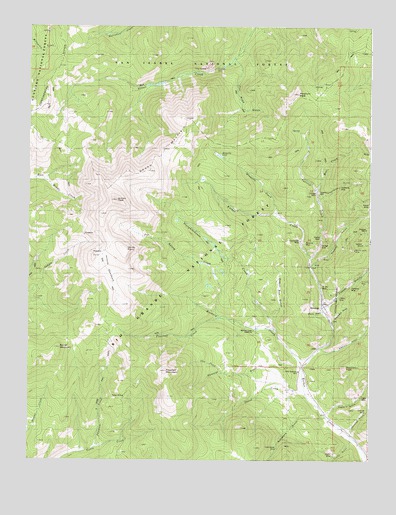
Bonanza, CO USGS Topographic Map
Click on map above to begin viewing in our Map Viewer.

This topographic map contains these locations and features:
Feature Name Type Latitude Longitude GNIS ID View Map
American Mammoth MineMineN38.2956°W106.1328°1745889View Map
American Revenue MineMineN38.3133°W106.1445°1745890View Map
Antora CreekStreamN38.2922°W106.1817°196530View Map
Antora MeadowsFlatN38.3111°W106.2214°189911View Map
Antora PeakSummitN38.3250°W106.2181°189910View Map
Antoro ShaftMineN38.3297°W106.1253°189898View Map
Arkansas MineMineN38.3133°W106.1445°1745891View Map
Atlantic MineMineN38.3136°W106.1331°1745892View Map
Baxter MountainSummitN38.2814°W106.2392°189907View Map
Bear CreekStreamN38.3283°W106.1453°189973View Map
Black Bess MineMineN38.3133°W106.1445°1745893View Map
BonanzaPopulated PlaceN38.2947°W106.1422°189929View Map
Bonanza Fire DepartmentBuildingN38.2941°W106.1424°2695548View Map
Bonanza MineMineN38.3128°W106.1489°189917View Map
Brewery CreekStreamN38.2767°W106.1497°189913View Map
Brewery Creek Guard StationLocaleN38.2875°W106.1681°189926View Map
Brighton MineMineN38.3253°W106.1309°1745894View Map
Burlington MineMineN38.3133°W106.1445°1745895View Map
Chief MineMineN38.2956°W106.1328°1745896View Map
Chloride GulchValleyN38.2578°W106.1321°189941View Map
Chloride MineMineN38.2639°W106.1261°189920View Map
Cliff MineMineN38.2956°W106.1328°1745897View Map
Cocomongo MineMineN38.3133°W106.1509°189916View Map
Commander MineMineN38.2542°W106.1584°189933View Map
Copper GulchValleyN38.2943°W106.1410°189945View Map
Cora MineMineN38.3225°W106.1331°1745899View Map
Coronet MineMineN38.3225°W106.1331°1745900View Map
Cow CreekStreamN38.2747°W106.1761°189950View Map
Defiance MineMineN38.2953°W106.1442°1745901View Map
Demming MineMineN38.3225°W106.1331°1745902View Map
Divide TrailTrailN38.2672°W106.2236°189849View Map
Eagle GulchValleyN38.2634°W106.1408°189942View Map
Eagle MineMineN38.2669°W106.1289°189928View Map
Eagle MineMineN38.2658°W106.1264°1735950View Map
Elkhorn GulchValleyN38.2825°W106.1429°189943View Map
Empress Josephine MineMineN38.2972°W106.1317°1745903View Map
Erie Number Twenty-eight MineMineN38.3078°W106.2414°1745904View Map
Essie MineMineN38.3044°W106.1328°1745905View Map
Euclid GulchValleyN38.2559°W106.1318°189886View Map
Euclid MineMineN38.2519°W106.1384°189918View Map
Exchequer MineMineN38.3133°W106.1445°1745906View Map
Flagstaff CreekStreamN38.2908°W106.1795°189912View Map
Flagstaff MountainSummitN38.2753°W106.1995°189905View Map
Gem City MineMineN38.3225°W106.1331°1745907View Map
Graveyard GulchValleyN38.2905°W106.1387°189944View Map
Gypsy Queen MineMineN38.3286°W106.1375°1745909View Map
Hanover MineMineN38.3136°W106.1331°1745911View Map
Hortense MineMineN38.2992°W106.1317°189922View Map
Ignacio MineMineN38.3261°W106.1309°1745913View Map
Josephine MineMineN38.2956°W106.1328°1745914View Map
Jupiter MineMineN38.3225°W106.1309°1745915View Map
Kerber CityLocaleN38.2894°W106.1389°196945View Map
Kerper CityPopulated PlaceN38.2828°W106.1422°189936View Map
Keystone MineMineN38.3133°W106.1445°1745916View Map
Kismuth MineMineN38.3731°W106.1831°1745885View Map
Kismuth MineMineN38.3619°W106.1820°189976View Map
Liberty MineMineN38.2975°W106.1361°189921View Map
Little Bonanza MillLocaleN38.2756°W106.1511°189938View Map
Little Bonanza MineMineN38.2864°W106.1486°1745917View Map
Little Jennie MineMineN38.3294°W106.1292°1745918View Map
Marine Lode MineMineN38.3089°W106.1445°1745920View Map
May Queen MineMineN38.3278°W106.1384°1745921View Map
Minnie Lynch MineMineN38.3106°W106.1311°189931View Map
Mosquito CreekStreamN38.3206°W106.1589°189948View Map
Mosquito LakeReservoirN38.3377°W106.1805°189909View Map
Mount KIA/MIASummitN38.3667°W106.2056°2355690View Map
Mountain Lake DamDamN38.2633°W106.2109°201570View Map
New York MineMineN38.3042°W106.1556°1745922View Map
Paragon Tunnel MineMineN38.3319°W106.1259°1745923View Map
Payson MineMineN38.3325°W106.1253°1745924View Map
Phantom CreekStreamN38.2536°W106.2256°189915View Map
Picnic GulchValleyN38.2929°W106.1422°189953View Map
Porphyry PeakSummitN38.3556°W106.1520°189971View Map
Radcliff Shaft MineMineN38.3339°W106.1253°1745925View Map
Raspberry PeakSummitN38.2772°W106.1339°189939View Map
Rawley GulchValleyN38.3066°W106.1473°189946View Map
Rawley MineMineN38.3153°W106.1372°189932View Map
Saint Joe MineMineN38.3000°W106.1425°189930View Map
Saint Louis MineMineN38.3014°W106.1284°189923View Map
Sarah D MineMineN38.3133°W106.1445°1745926View Map
Sawmill GulchValleyN38.2696°W106.1499°189951View Map
Sedgewick (historical)Populated PlaceN38.2792°W106.1478°189937View Map
Senator MineMineN38.3125°W106.1267°189903View Map
Sheep MountainSummitN38.3336°W106.2142°189974View Map
Sheep Mountain TrailTrailN38.3297°W106.1889°189852View Map
Simmons GulchValleyN38.2623°W106.1419°189887View Map
Skunk CreekStreamN38.2692°W106.1484°189949View Map
Slaughterhouse CreekStreamN38.2869°W106.1600°189914View Map
Sosthenes GulchValleyN38.3244°W106.1439°189982View Map
Sosthenes MineMineN38.3292°W106.1364°189899View Map
Squirrel CreekStreamN38.3081°W106.1472°189947View Map
Superior MillLocaleN38.3278°W106.1464°189882View Map
Superior MineMineN38.3169°W106.1261°189902View Map
The GateGapN38.3631°W106.1836°189975View Map
Toll Road GulchValleyN38.3649°W106.1750°189884View Map
Town of BonanzaCivilN38.2966°W106.1419°2411706View Map
Twins MineMineN38.2686°W106.2159°189906View Map
Vallejo MineMineN38.3283°W106.1370°1745928View Map
Veni-vidi-vici MineMineN38.3406°W106.1311°1745929View Map
Wagon Box GulchValleyN38.2901°W106.1614°189952View Map
Wainright MineMineN38.3136°W106.1317°1745930View Map
Warwick MineMineN38.2953°W106.1442°1745931View Map
Washakee MineMineN38.3253°W106.1309°1745932View Map
Whale MineMineN38.3189°W106.1250°189901View Map
Wheel of Fortune MineMineN38.2953°W106.1442°1745933View Map
Wide Awake MineMineN38.2964°W106.1442°1745934View Map
Windy PointCliffN38.3111°W106.2150°189908View Map
Yellow Type MineMineN38.3406°W106.1322°1745935View Map

Note: Coordinates in the location and feature list above are referenced to NAD83 datum.


Copyright (C) 2008-2025 Ryan Niemi / Sunset Dynamics ... All Rights Reserved