TopoQuest Logo
Do you find TopoQuest useful?
Help keep TopoQuest running and adding new maps/features by donating!
Bitcoin:  19c7KJd3qBynnjoSw5npx9KScwjBe4ifkT
Litecoin:  LXs6TkuXGGXo1vDsWCkWVdjQX94eUKd6ui
Home View Maps Find Maps Find Places Resources & Links


Pahlone Peak, Colorado Topographic Map

USGS Map Title: Pahlone Peak, CO
USGS Map MRC: 38106D3
DRG (GeoTIFF) Download: o38106d3.tif


Neighboring USGS Topographic Map Quads:


  Whitepine, CO  
38106E4
 

  Garfield, CO  
38106E3
 

  Maysville, CO  
38106E2
 

  Sargents, CO  
38106D4
 

  Pahlone Peak, CO  
38106D3
 

  Mount Ouray, CO  
38106D2
 

  Sargents Mesa, CO  
38106C4
 

  Chester, CO  
38106C3
 

  Bonanza, CO  
38106C2


Map MRC Location:

N39°
W107°
N39°
W106°
H8 H7 H6 H5 H4 H3 H2 H1
G8 G7 G6 G5 G4 G3 G2 G1
F8 F7 F6 F5 F4 F3 F2 F1
E8 E7 E6 E5 E4 E3 E2 E1
D8 D7 D6 D5 D4 D3 D2 D1
C8 C7 C6 C5 C4 C3 C2 C1
B8 B7 B6 B5 B4 B3 B2 B1
A8 A7 A6 A5 A4 A3 A2 A1
N38°
W107°
N38°
W106°

Pahlone Peak, CO USGS 1:24K Topographic Map Preview:
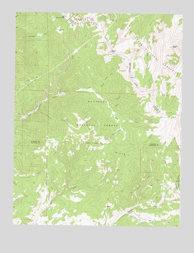
Pahlone Peak, CO USGS Topographic Map
Click on map above to begin viewing in our Map Viewer.

This topographic map contains these locations and features:
Feature Name Type Latitude Longitude GNIS ID View Map
Apache Number Four MineMineN38.4014°W106.3406°1745825View Map
Big Indian Group MineMineN38.3978°W106.3414°1745886View Map
Bulls CreekStreamN38.3903°W106.3464°189733View Map
Burned Timber CreekStreamN38.4525°W106.3139°189725View Map
D and J MineMineN38.4000°W106.2503°1745884View Map
Erie Number Thirty-three MineMineN38.4136°W106.2903°1745826View Map
Harry CreekStreamN38.3872°W106.2822°189732View Map
Hidden CreekStreamN38.4547°W106.3195°197474View Map
Indian Creek Bog Iron MineMineN38.4194°W106.3350°1745827View Map
Jasper MineMineN38.4833°W106.2617°1745848View Map
Larkspur DitchCanalN38.4067°W106.2617°203403View Map
Lime CreekStreamN38.4325°W106.2945°189728View Map
Lime RidgeRidgeN38.4356°W106.3222°189730View Map
Little Indian Number Six MineMineN38.4069°W106.3256°1745828View Map
Lookout Number Twenty-two MineMineN38.3992°W106.2900°1745822View Map
Marshall Pass Group MineMineN38.3822°W106.2909°1745823View Map
Millswitch CreekStreamN38.3828°W106.2909°189736View Map
Mine Wastewater Treatment ReservoirReservoirN38.4000°W106.3072°201731View Map
Monarch PassGapN38.4967°W106.3256°189720View Map
Mount PeckSummitN38.4772°W106.3036°189719View Map
North Fork Agate CreekStreamN38.4514°W106.3422°189723View Map
Old Monarch PassGapN38.4967°W106.3381°189721View Map
Pahlone PeakSummitN38.4806°W106.2581°189718View Map
Park CreekStreamN38.4783°W106.3278°189724View Map
Peel PointSummitN38.4619°W106.2889°189726View Map
Pinnacle MineMineN38.4069°W106.2986°189731View Map
Pitch MineMineN38.4075°W106.3009°1745824View Map
Pitch Wastewater Treatment Reservoir DamDamN38.4000°W106.3072°201730View Map
Porphyry ParkFlatN38.4900°W106.3431°189722View Map
Taylor Mining Syndicate MineMineN38.5000°W106.3006°1745793View Map
Treasure CreekStreamN38.4403°W106.3625°189729View Map
Uncompahgre Number One MineMineN38.3933°W106.2534°1745927View Map

Note: Coordinates in the location and feature list above are referenced to NAD83 datum.


Copyright (C) 2008-2024 Ryan Niemi / Sunset Dynamics ... All Rights Reserved