TopoQuest Logo
Do you find TopoQuest useful?
Help keep TopoQuest running and adding new maps/features by donating!
Bitcoin:  19c7KJd3qBynnjoSw5npx9KScwjBe4ifkT
Litecoin:  LXs6TkuXGGXo1vDsWCkWVdjQX94eUKd6ui
Home View Maps Find Maps Find Places Resources & Links


Whale Hill, Colorado Topographic Map

USGS Map Title: Whale Hill, CO
USGS Map MRC: 38106C1
DRG (GeoTIFF) Download: o38106c1.tif


Neighboring USGS Topographic Map Quads:


  Mount Ouray, CO  
38106D2
 

  Poncha Pass, CO  
38106D1
 

  Wellsville, CO  
38105D8
 

  Bonanza, CO  
38106C2
 

  Whale Hill, CO  
38106C1
 

  Bushnell Peak, CO  
38105C8
 

  Klondike Mine, CO  
38106B2
 

  Graveyard Gulch, CO  
38106B1
 

  Villa Grove, CO  
38105B8


Map MRC Location:

N39°
W107°
N39°
W106°
H8 H7 H6 H5 H4 H3 H2 H1
G8 G7 G6 G5 G4 G3 G2 G1
F8 F7 F6 F5 F4 F3 F2 F1
E8 E7 E6 E5 E4 E3 E2 E1
D8 D7 D6 D5 D4 D3 D2 D1
C8 C7 C6 C5 C4 C3 C2 C1
B8 B7 B6 B5 B4 B3 B2 B1
A8 A7 A6 A5 A4 A3 A2 A1
N38°
W107°
N38°
W106°

Whale Hill, CO USGS 1:24K Topographic Map Preview:
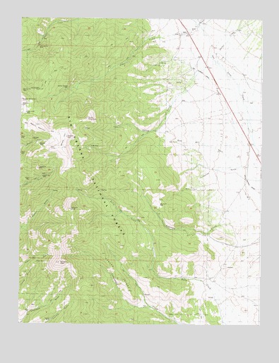
Whale Hill, CO USGS Topographic Map
Click on map above to begin viewing in our Map Viewer.

This topographic map contains these locations and features:
Feature Name Type Latitude Longitude GNIS ID View Map
Ajax MineMineN38.3228°W106.1103°1745888View Map
AlderPopulated PlaceN38.3694°W106.0395°189960View Map
Alder CreekStreamN38.3717°W106.0320°189962View Map
Antoro TunnelMineN38.3264°W106.1242°189881View Map
Burnt MountainSummitN38.3339°W106.0900°189963View Map
Center RidgeRidgeN38.2681°W106.0720°189954View Map
Chicago MineMineN38.3231°W106.0886°189891View Map
Clover Creek District MineMineN38.3678°W106.1109°1745898View Map
Colorado Belle MineMineN38.3458°W106.1147°189965View Map
Davidson RanchLocaleN38.3489°W106.0356°189959View Map
Decker CreekStreamN38.3594°W106.0242°189987View Map
Elkhorn PeakFlatN38.2978°W106.0981°189934View Map
Express MineMineN38.2517°W106.1092°189919View Map
Gladstone ShaftMineN38.3261°W106.1009°189892View Map
Great Mogul MineMineN38.3264°W106.1103°1745908View Map
Greenback GulchValleyN38.2504°W106.1243°189940View Map
Hall Turquoise MineMineN38.2961°W106.0525°1745910View Map
Hayden PeakSummitN38.2750°W106.1036°189935View Map
Hornet Manganese MineMineN38.3683°W106.0650°1745912View Map
Joe Wheeler MineMineN38.3542°W106.0989°189970View Map
Legal Tender MineMineN38.3364°W106.1209°189966View Map
Little Darling MineMineN38.3636°W106.1167°189972View Map
Little Manitou MineMineN38.3244°W106.1103°1745919View Map
Manitou Sunlight MineMineN38.3464°W106.1003°189964View Map
Merkt CreekStreamN38.3725°W106.0339°191635View Map
Michigan ShaftMineN38.3258°W106.1192°189897View Map
Morning Star MineMineN38.3453°W106.1242°189969View Map
Mount ManitouSummitN38.3306°W106.1142°189896View Map
Oregon MineMineN38.2722°W106.1175°1735951View Map
Oregon TunnelMineN38.2756°W106.1175°189927View Map
Queen City MineMineN38.3106°W106.1131°189925View Map
Rainbow MineMineN38.3233°W106.1153°189895View Map
Rosalie MineMineN38.3092°W106.1203°189924View Map
Round MountainSummitN38.3414°W106.1242°189968View Map
Round Mountain TrailTrailN38.3014°W106.0867°189850View Map
Shawmut MineMineN38.3392°W106.1242°189967View Map
Spring CreekStreamN38.3567°W106.0231°189958View Map
Stemwinder MinneMineN38.3136°W106.1167°189904View Map
Turquoise GulchValleyN38.3161°W106.0006°189956View Map
Villa Grove MineMineN38.2986°W106.0531°189955View Map
Whale HillSummitN38.3217°W106.1072°189894View Map
Wild Bill GulchValleyN38.3150°W106.0102°189957View Map
Zero Tunnel MineMineN38.3228°W106.1103°1735976View Map

Note: Coordinates in the location and feature list above are referenced to NAD83 datum.


Copyright (C) 2008-2024 Ryan Niemi / Sunset Dynamics ... All Rights Reserved