TopoQuest Logo
Do you find TopoQuest useful?
Help keep TopoQuest running and adding new maps/features by donating!
Bitcoin:  19c7KJd3qBynnjoSw5npx9KScwjBe4ifkT
Litecoin:  LXs6TkuXGGXo1vDsWCkWVdjQX94eUKd6ui
Home View Maps Find Maps Find Places Resources & Links


Waterflow, New Mexico Topographic Map

USGS Map Title: Waterflow, NM
USGS Map MRC: 36108G4
DRG (GeoTIFF) Download: o36108g4.tif


Neighboring USGS Topographic Map Quads:


  Palmer Mesa, NM  
36108H5
 

  Heifer Point, NM  
36108H4
 

  Purgatory Canyon, NM  
36108H3
 

  Chimney Rock, NM  
36108G5
 

  Waterflow, NM  
36108G4
 

  Youngs Lake, NM  
36108G3
 

  The Hogback North, NM  
36108F5
 

  Fruitland, NM  
36108F4
 

  Kirtland, NM  
36108F3


Map MRC Location:

N37°
W109°
N37°
W108°
H8 H7 H6 H5 H4 H3 H2 H1
G8 G7 G6 G5 G4 G3 G2 G1
F8 F7 F6 F5 F4 F3 F2 F1
E8 E7 E6 E5 E4 E3 E2 E1
D8 D7 D6 D5 D4 D3 D2 D1
C8 C7 C6 C5 C4 C3 C2 C1
B8 B7 B6 B5 B4 B3 B2 B1
A8 A7 A6 A5 A4 A3 A2 A1
N36°
W109°
N36°
W108°

Waterflow, NM USGS 1:24K Topographic Map Preview:
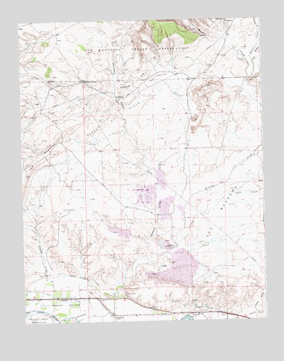
Waterflow, NM USGS Topographic Map
Click on map above to begin viewing in our Map Viewer.

This topographic map contains these locations and features:
Feature Name Type Latitude Longitude GNIS ID View Map
Abbe Young MineMineN36.7533°W108.4104°937206View Map
Adamson MinesMineN36.7694°W108.4317°885559View Map
Beechatuda DrawValleyN36.8467°W108.4509°886167View Map
Black Diamond MinesMineN36.7572°W108.4209°886408View Map
Brimhall MineMineN36.7556°W108.4326°916371View Map
CottonwoodPopulated PlaceN36.8739°W108.3931°899594View Map
Cottonwood CanyonValleyN36.8711°W108.3756°887905View Map
Farmers Mutual DitchCanalN36.7678°W108.4656°888976View Map
Hendrickson MineMineN36.7572°W108.4142°889905View Map
Hutch CanyonValleyN36.7814°W108.4204°890277View Map
Jack BoydMineN36.8481°W108.3990°916329View Map
Jewett Valley CemeteryCemeteryN36.7699°W108.4902°890457View Map
Jewett Valley DitchCanalN36.7608°W108.4842°890458View Map
Mine Pit SpringSpringN36.7778°W108.4195°914322View Map
Narrows WashStreamN36.8219°W108.3756°892372View Map
Navajo CanyonValleyN36.8497°W108.3815°892385View Map
PS A Water WellWellN36.8216°W108.3960°923407View Map
PS B Water WellWellN36.7847°W108.3959°927142View Map
Sacred Heart AcademySchoolN36.7522°W108.4531°894246View Map
San Juan County Fire District 1 Valley Station 3BuildingN36.7603°W108.4763°2658006View Map
San Juan Power Generation DamDamN36.7833°W108.4423°924125View Map
San Juan Power Generation ReservoirReservoirN36.7833°W108.4423°924126View Map
San Juan Underground Test MineMineN36.7697°W108.4395°916385View Map
Scanlon MineMineN36.7928°W108.4140°939850View Map
Shiprock SubstationLocaleN36.7969°W108.4765°929052View Map
Shumway ArroyoStreamN36.7511°W108.4823°897477View Map
SJ-23-4 Water WellWellN36.7956°W108.3812°926983View Map
Smouse MinesMineN36.7539°W108.4095°894962View Map
Stalling MineMineN36.7928°W108.4140°916315View Map
The MeadowsAreaN36.7914°W108.3998°898178View Map
Ute CanyonValleyN36.8572°W108.3792°896058View Map
Verde Oil FieldOilfieldN36.8317°W108.4517°929086View Map
Walker MineMineN36.7625°W108.4654°916390View Map
WaterflowPopulated PlaceN36.7597°W108.4817°902386View Map
Waterflow CemeteryCemeteryN36.7597°W108.4823°931305View Map
Waterflow Census Designated PlaceCensusN36.7574°W108.4710°2584234View Map
Waterflow PitMineN36.7625°W108.4654°916391View Map
Waterflow Post OfficePost OfficeN36.7606°W108.4928°937622View Map
Waughan ArroyoStreamN36.7578°W108.4962°896292View Map
West Water SpringSpringN36.8497°W108.4670°914377View Map
Westwater ArroyoStreamN36.7778°W108.4334°896463View Map
Westwater SpringSpringN36.8500°W108.4673°896464View Map
Zia Trading PostLocaleN36.7531°W108.4104°896847View Map

Note: Coordinates in the location and feature list above are referenced to NAD83 datum.


Copyright (C) 2008-2025 Ryan Niemi / Sunset Dynamics ... All Rights Reserved