TopoQuest Logo
Do you find TopoQuest useful?
Help keep TopoQuest running and adding new maps/features by donating!
Bitcoin:  19c7KJd3qBynnjoSw5npx9KScwjBe4ifkT
Litecoin:  LXs6TkuXGGXo1vDsWCkWVdjQX94eUKd6ui
Home View Maps Find Maps Find Places Resources & Links


Wattsville, Alabama Topographic Map

USGS Map Title: Wattsville, AL
USGS Map MRC: 33086F3
DRG (GeoTIFF) Download: o33086f3.tif


Neighboring USGS Topographic Map Quads:


  Springville, AL  
33086G4
 

  Ashville, AL  
33086G3
 

  Cox Gap, AL  
33086G2
 

  Odenville, AL  
33086F4
 

  Wattsville, AL  
33086F3
 

  Ragland, AL  
33086F2
 

  Cooks Springs, AL  
33086E4
 

  Pell City, AL  
33086E3
 

  Riverside, AL  
33086E2


Map MRC Location:

N34°
W87°
N34°
W86°
H8 H7 H6 H5 H4 H3 H2 H1
G8 G7 G6 G5 G4 G3 G2 G1
F8 F7 F6 F5 F4 F3 F2 F1
E8 E7 E6 E5 E4 E3 E2 E1
D8 D7 D6 D5 D4 D3 D2 D1
C8 C7 C6 C5 C4 C3 C2 C1
B8 B7 B6 B5 B4 B3 B2 B1
A8 A7 A6 A5 A4 A3 A2 A1
N33°
W87°
N33°
W86°

Wattsville, AL USGS 1:24K Topographic Map Preview:
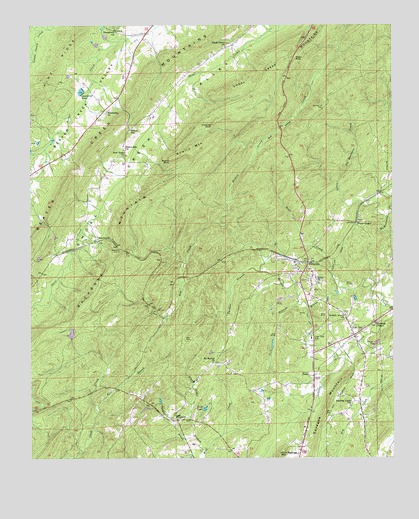
Wattsville, AL USGS Topographic Map
Click on map above to begin viewing in our Map Viewer.

This topographic map contains these locations and features:
Feature Name Type Latitude Longitude GNIS ID View Map
Backbone MountainRidgeN33.6837°W86.3489°164545View Map
Baker Zion ChurchChurchN33.7143°W86.3428°164546View Map
Beaver Valley (historical)LocaleN33.7243°W86.3516°166066View Map
Beaver Valley Post Office (historical)Post OfficeN33.7243°W86.3516°169235View Map
Black Ankle BranchStreamN33.6268°W86.3147°164563View Map
Bowlin BluffCliffN33.7113°W86.3282°164570View Map
Bowlin MountainSummitN33.7134°W86.3194°164571View Map
Brewer Slope MineMineN33.6668°W86.2819°165018View Map
Broken Arrow CemeteryCemeteryN33.6668°W86.2669°1805662View Map
Broken Arrow ChurchChurchN33.6662°W86.2664°164578View Map
Chimney RockPillarN33.7214°W86.3123°164602View Map
Coal (historical)LocaleN33.6729°W86.2819°165034View Map
Coal CityPopulated PlaceN33.6607°W86.2633°164607View Map
Coal City SchoolSchoolN33.6598°W86.2783°164608View Map
Cold BranchStreamN33.6693°W86.2830°164610View Map
Evergreen ChurchChurchN33.7487°W86.3464°164648View Map
Fox CreekStreamN33.6926°W86.3103°164657View Map
Friendship ChurchChurchN33.7254°W86.3489°164660View Map
Friendship Volunteer Fire DepartmentBuildingN33.7260°W86.3478°2682874View Map
Guiding Light ChurchChurchN33.6412°W86.2644°164678View Map
Gulf HollowValleyN33.7154°W86.2950°164680View Map
HardwickPopulated PlaceN33.6884°W86.3525°164690View Map
Hardwick TunnelTunnelN33.6854°W86.3436°164691View Map
Harkeys Chapel CemeteryCemeteryN33.6645°W86.2555°1805544View Map
Harkeys Chapel United Methodist ChurchChurchN33.6640°W86.2564°164692View Map
Karr BranchStreamN33.6384°W86.3514°164718View Map
Karr CemeteryCemeteryN33.6590°W86.3211°164719View Map
Laymans PondReservoirN33.7310°W86.3574°164726View Map
Little No Business CreekStreamN33.6943°W86.2525°164738View Map
Moon RockSummitN33.7395°W86.2847°164760View Map
Mount Calvary ChurchChurchN33.6809°W86.2822°165141View Map
Mount Moriah ChurchChurchN33.6526°W86.3125°164768View Map
New Harmony Church (historical)ChurchN33.7090°W86.2544°165151View Map
New Hope ChurchChurchN33.7123°W86.3433°164779View Map
Piney Grove ChurchChurchN33.7437°W86.3089°164808View Map
Popes Chapel CemeteryCemeteryN33.6929°W86.2619°1805540View Map
Popes Chapel First Congregational Methodist ChurchChurchN33.6929°W86.2628°164819View Map
Saint Clair CountyCivilN33.7157°W86.3147°164997View Map
Saint Clair Memorial GardensCemeteryN33.6520°W86.2766°165189View Map
Sand BranchStreamN33.6268°W86.3572°164845View Map
Savages CrossingLocaleN33.6570°W86.2680°165192View Map
Shiloh ChurchChurchN33.6757°W86.2761°164851View Map
Spring Hill CemeteryCemeteryN33.7256°W86.2744°164862View Map
Suck CreekStreamN33.6740°W86.2683°164877View Map
Tabb LakeLakeN33.6394°W86.3150°164880View Map
TanyardPopulated PlaceN33.6357°W86.3247°164881View Map
Tanyard BranchStreamN33.6309°W86.3194°164882View Map
Thomas BranchStreamN33.6790°W86.2961°164889View Map
Truitt School (historical)SchoolN33.6365°W86.3272°165214View Map
Watkins DamDamN33.6601°W86.3600°164951View Map
Watkins LakeReservoirN33.6612°W86.3610°164950View Map
Watson GapGapN33.7204°W86.3414°164903View Map
WattsvillePopulated PlaceN33.6815°W86.2797°164904View Map
Wattsville ChurchChurchN33.6715°W86.2797°165222View Map
Wattsville Post OfficePost OfficeN33.6522°W86.2779°167289View Map
Wattsville Volunteer Fire DepartmentBuildingN33.6612°W86.2616°2683352View Map
Wrights School (historical)SchoolN33.6993°W86.2814°165230View Map

Note: Coordinates in the location and feature list above are referenced to NAD83 datum.


Copyright (C) 2008-2024 Ryan Niemi / Sunset Dynamics ... All Rights Reserved