TopoQuest Logo
Do you find TopoQuest useful?
Help keep TopoQuest running and adding new maps/features by donating!
Bitcoin:  19c7KJd3qBynnjoSw5npx9KScwjBe4ifkT
Litecoin:  LXs6TkuXGGXo1vDsWCkWVdjQX94eUKd6ui
Home View Maps Find Maps Find Places Resources & Links


Wautoma, Wisconsin Topographic Map

USGS Map Title: Wautoma, WI
USGS Map MRC: 44089A3
DRG (GeoTIFF) Download: o44089a3.tif


Neighboring USGS Topographic Map Quads:


  Plainfield, WI  
44089B4
 

  Wautoma NE, WI  
44089B3
 

  Wild Rose, WI  
44089B2
 

  Richford, WI  
44089A4
 

  Wautoma, WI  
44089A3
 

  Spring Lake, WI  
44089A2
 

  Westfield East, WI  
43089H4
 

  Germania, WI  
43089H3
 

  Neshkoro, WI  
43089H2


Map MRC Location:

N45°
W90°
N45°
W89°
H8 H7 H6 H5 H4 H3 H2 H1
G8 G7 G6 G5 G4 G3 G2 G1
F8 F7 F6 F5 F4 F3 F2 F1
E8 E7 E6 E5 E4 E3 E2 E1
D8 D7 D6 D5 D4 D3 D2 D1
C8 C7 C6 C5 C4 C3 C2 C1
B8 B7 B6 B5 B4 B3 B2 B1
A8 A7 A6 A5 A4 A3 A2 A1
N44°
W90°
N44°
W89°

Wautoma, WI USGS 1:24K Topographic Map Preview:
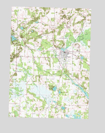
Wautoma, WI USGS Topographic Map
Click on map above to begin viewing in our Map Viewer.

This topographic map contains these locations and features:
Feature Name Type Latitude Longitude GNIS ID View Map
2 ReservoirReservoirN44.0011°W89.2672°1793250View Map
Alan Wilcox Flowage 2ReservoirN44.0011°W89.2672°1792521View Map
Bass LakeLakeN44.0030°W89.2837°1561228View Map
Bass Lake Fen State Natural AreaParkN44.0055°W89.2818°2060885View Map
Bird CreekStreamN44.0605°W89.2915°1561820View Map
Blader School (historical)SchoolN44.0111°W89.3179°1845689View Map
Bowers CreekStreamN44.0725°W89.3037°1562097View Map
Bughs LakeLakeN44.0692°W89.2623°1562380View Map
Calvary CemeteryCemeteryN44.0695°W89.3080°1562544View Map
City of WautomaCivilN44.0670°W89.2920°1584383View Map
East Branch Little Pine CreekStreamN44.0241°W89.3523°1564291View Map
Faith Christian AcademySchoolN44.0745°W89.2950°2716630View Map
Fox Valley Technical College Wautoma Regional CenterSchoolN44.0738°W89.2848°2635486View Map
Hope CemeteryCemeteryN44.0761°W89.2690°1566679View Map
Lower White River Pond 83ReservoirN44.0310°W89.2590°1791773View Map
Lunch Creek Wetlands State Natural AreaParkN44.0269°W89.3243°2061061View Map
Meilke LakeLakeN44.0296°W89.2962°1569322View Map
Mud LakeLakeN44.1078°W89.3352°1569921View Map
North Dakota CemeteryCemeteryN44.0472°W89.3273°1570417View Map
Parkside SchoolSchoolN44.0737°W89.3093°2716483View Map
Pickerel LakeLakeN44.0119°W89.2900°1571315View Map
Progressive School (historical)SchoolN44.1122°W89.2576°1845695View Map
Raymond CemeteryCemeteryN44.0197°W89.2501°1572112View Map
Raymond Church (historical)ChurchN44.0189°W89.2510°1845696View Map
Riverview Elementary SchoolSchoolN44.0701°W89.2910°1845699View Map
Round LakeLakeN44.1007°W89.3582°1572641View Map
Soules CreekStreamN44.0811°W89.2851°1574381View Map
Tamarack School (historical)SchoolN44.0686°W89.3621°1845706View Map
Town of DakotaCivilN44.0244°W89.3064°1583043View Map
Town of WautomaCivilN44.1137°W89.3068°1584384View Map
Turtle LakeLakeN44.0975°W89.3416°1575737View Map
Upper White River DamDamN44.0883°W89.3668°1792102View Map
Upper White River Millpond 1ReservoirN44.0892°W89.3714°1792103View Map
Waushara County Emergency Medical Services Wautoma DivisionBuildingN44.0742°W89.2896°2698263View Map
Waushara County JailBuildingN44.0698°W89.2794°2759899View Map
Waushara County Sheriff's OfficeBuildingN44.0694°W89.2794°2759605View Map
Waushara County Waterfowl Production AreaParkN44.0325°W89.2749°2765554View Map
WautomaPopulated PlaceN44.0747°W89.2879°1576330View Map
Wautoma Area Fire and RescueBuildingN44.0649°W89.2879°2697566View Map
Wautoma CemeteryCemeteryN44.0769°W89.2696°1576331View Map
Wautoma DamDamN44.0750°W89.2918°1792308View Map
Wautoma High SchoolSchoolN44.0706°W89.2992°1845708View Map
Wautoma Millpond 23ReservoirN44.0750°W89.2918°1792309View Map
Wautoma Municipal AirportAirportN44.0464°W89.3054°1582264View Map
Wautoma Police DepartmentBuildingN44.0746°W89.2845°2759900View Map
Wautoma PondLakeN44.0781°W89.2919°1576332View Map
West Branch Little Pine CreekStreamN44.0241°W89.3523°1576468View Map
West Branch Mill PondReservoirN44.0892°W89.3714°1569490View Map
West Branch White RiverStreamN44.0500°W89.2898°1576483View Map
Wilcox LakeLakeN44.0313°W89.2721°2784728View Map
Witters LakeLakeN44.0334°W89.3041°1576925View Map

Note: Coordinates in the location and feature list above are referenced to NAD83 datum.


Copyright (C) 2008-2024 Ryan Niemi / Sunset Dynamics ... All Rights Reserved