TopoQuest Logo
Do you find TopoQuest useful?
Help keep TopoQuest running and adding new maps/features by donating!
Bitcoin:  19c7KJd3qBynnjoSw5npx9KScwjBe4ifkT
Litecoin:  LXs6TkuXGGXo1vDsWCkWVdjQX94eUKd6ui
Home View Maps Find Maps Find Places Resources & Links


Waverly, New York Topographic Map

USGS Map Title: Waverly, NY
USGS Map MRC: 42076A5
DRG (GeoTIFF) Download: o42076a5.tif


Neighboring USGS Topographic Map Quads:


  Erin, NY  
42076B6
 

  Van Etten, NY  
42076B5
 

  Spencer, NY  
42076B4
 

  Wellsburg, NY  
42076A6
 

  Waverly, NY  
42076A5
 

  Barton, NY  
42076A4
 

  Bentley Creek, PA  
41076H6
 

  Sayre, PA  
41076H5
 

  Litchfield, PA  
41076H4


Map MRC Location:

N43°
W77°
N43°
W76°
H8 H7 H6 H5 H4 H3 H2 H1
G8 G7 G6 G5 G4 G3 G2 G1
F8 F7 F6 F5 F4 F3 F2 F1
E8 E7 E6 E5 E4 E3 E2 E1
D8 D7 D6 D5 D4 D3 D2 D1
C8 C7 C6 C5 C4 C3 C2 C1
B8 B7 B6 B5 B4 B3 B2 B1
A8 A7 A6 A5 A4 A3 A2 A1
N42°
W77°
N42°
W76°

Waverly, NY USGS 1:24K Topographic Map Preview:
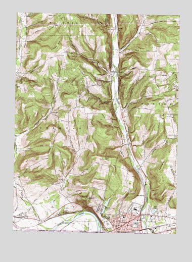
Waverly, NY USGS Topographic Map
Click on map above to begin viewing in our Map Viewer.

This topographic map contains these locations and features:
Feature Name Type Latitude Longitude GNIS ID View Map
Baldwin Volunteer Fire Company Station 2BuildingN42.1230°W76.6169°2734682View Map
Barton Gravel PitMineN42.0072°W76.5053°2633289View Map
Bogart HillSummitN42.0898°W76.5188°944393View Map
Cedar Park TerracePopulated PlaceN42.0139°W76.5192°2507638View Map
ChemungPopulated PlaceN42.0084°W76.6238°946477View Map
Chemung CemeteryCemeteryN42.0103°W76.6147°2514424View Map
Chemung Elementary SchoolSchoolN42.0108°W76.6175°2507541View Map
Chemung Fire StationBuildingN42.0076°W76.6179°2700895View Map
Chemung Golf CourseLocaleN42.0141°W76.5946°2598565View Map
Chemung Post OfficePost OfficeN42.0080°W76.6231°2598528View Map
Chemung United Methodist ChurchChurchN42.0083°W76.6201°2597504View Map
Christian And Missionary ChurchChurchN42.0031°W76.5450°2504698View Map
Christian Life ChurchChurchN42.0011°W76.5433°2504699View Map
Church of the NazareneChurchN42.0042°W76.5386°2504700View Map
Dean CreekStreamN42.1048°W76.5502°948134View Map
Dodge PondLakeN42.0132°W76.5168°948526View Map
Dry BrookStreamN42.0067°W76.5836°948666View Map
Dry Brook ChurchChurchN42.0287°W76.5869°948687View Map
Drybrook CemeteryCemeteryN42.0302°W76.5859°2514425View Map
East WaverlyPopulated PlaceN42.0106°W76.5180°949268View Map
Elm Street Elementary SchoolSchoolN42.0059°W76.5313°949555View Map
Factoryville CemeteryCemeteryN42.0108°W76.5292°2504708View Map
Faith Southern Baptist ChurchChurchN42.0094°W76.5344°2504701View Map
First Baptist ChurchChurchN42.0042°W76.5389°2504702View Map
Forest Home CemeteryCemeteryN42.0041°W76.5322°950404View Map
French CemeteryCemeteryN42.0052°W76.5790°2514427View Map
Gentle Creek Horse FarmLocaleN42.1228°W76.5250°2507675View Map
Glenwood CemeteryCemeteryN42.0095°W76.5515°951236View Map
Glory HillSummitN42.0198°W76.5672°951263View Map
Guthrie Nursing CenterHospitalN42.0131°W76.5281°2504711View Map
HicksPopulated PlaceN42.1237°W76.6169°972614View Map
Hicks CemeteryCemeteryN42.1101°W76.6177°952694View Map
Hicks ChurchChurchN42.1167°W76.6169°952695View Map
Ithaca Street SchoolSchoolN42.0073°W76.5288°953858View Map
King HollowValleyN42.0705°W76.5423°954637View Map
Lincoln Street Elementary SchoolSchoolN42.0092°W76.5397°955382View Map
LockwoodPopulated PlaceN42.0912°W76.5499°955788View Map
Lockwood CemeteryCemeteryN42.0903°W76.5515°2514426View Map
Lockwood Post OfficePost OfficeN42.1027°W76.5462°2618006View Map
Lockwood RunStreamN42.0806°W76.5472°955792View Map
North WaverlyPopulated PlaceN42.0217°W76.5236°958943View Map
North Waverly ChapelChurchN42.0547°W76.5378°2504703View Map
Owens MillsPopulated PlaceN42.0687°W76.5972°972903View Map
Porter HillSummitN42.1173°W76.5952°960991View Map
Price-Simcoe CemeteryCemeteryN42.0967°W76.5881°2514428View Map
Putnam HillSummitN42.1051°W76.5938°962009View Map
ReniffPopulated PlaceN42.1165°W76.5461°972996View Map
Reniff RunStreamN42.1170°W76.5474°962382View Map
Saint James Catholic ChurchChurchN42.0036°W76.5436°2504704View Map
Saint James Roman Catholic CemeteryCemeteryN42.0044°W76.5305°963557View Map
Saint James SchoolSchoolN42.0045°W76.5441°963568View Map
Saint John of the Cross MonasteryChurchN42.0198°W76.5669°963580View Map
Shephard ParkParkN42.0036°W76.5481°2504712View Map
Spring BrookStreamN42.0376°W76.5322°966050View Map
Tallmadge HillSummitN42.0387°W76.5113°967007View Map
Tallmadge Hill CemeteryCemeteryN42.0552°W76.5022°967008View Map
The Club at Shepard HillsLocaleN42.0088°W76.5570°2504713View Map
Tilman HillSummitN42.0448°W76.5974°967530View Map
Town of ChemungCivilN42.0493°W76.6189°978818View Map
United Methodist Church of WaverlyChurchN42.0039°W76.5414°2504705View Map
Village of WaverlyCivilN42.0120°W76.5404°2391201View Map
WaverlyPopulated PlaceN42.0104°W76.5272°968940View Map
Waverly Barton Fire District Station 1BuildingN42.0083°W76.5211°2700835View Map
Waverly Free LibraryBuildingN42.0017°W76.5414°2504707View Map
Waverly Memorial ParkParkN42.0078°W76.5244°2504709View Map
Waverly ReservoirsReservoirN42.0129°W76.5555°968943View Map
Waverly Senior High SchoolSchoolN42.0139°W76.5311°2504706View Map
Waverly StadiumLocaleN42.0058°W76.5289°2504710View Map
WAVR-FM (Waverly)TowerN42.0634°W76.5241°978619View Map
West HillSummitN42.0423°W76.5549°969253View Map
Wynkoop CreekStreamN42.0020°W76.5944°971785View Map

Note: Coordinates in the location and feature list above are referenced to NAD83 datum.


Copyright (C) 2008-2024 Ryan Niemi / Sunset Dynamics ... All Rights Reserved