TopoQuest Logo
Do you find TopoQuest useful?
Help keep TopoQuest running and adding new maps/features by donating!
Bitcoin:  19c7KJd3qBynnjoSw5npx9KScwjBe4ifkT
Litecoin:  LXs6TkuXGGXo1vDsWCkWVdjQX94eUKd6ui
Home View Maps Find Maps Find Places Resources & Links


Litchfield, Pennsylvania Topographic Map

USGS Map Title: Litchfield, PA
USGS Map MRC: 41076H4
DRG (GeoTIFF) Download: o41076h4.tif


Neighboring USGS Topographic Map Quads:


  Waverly, NY  
42076A5
 

  Barton, NY  
42076A4
 

  Owego, NY  
42076A3
 

  Sayre, PA  
41076H5
 

  Litchfield, PA  
41076H4
 

  Windham, PA  
41076H3
 

  Ulster, PA  
41076G5
 

  Towanda, PA  
41076G4
 

  Rome, PA  
41076G3


Map MRC Location:

N42°
W77°
N42°
W76°
H8 H7 H6 H5 H4 H3 H2 H1
G8 G7 G6 G5 G4 G3 G2 G1
F8 F7 F6 F5 F4 F3 F2 F1
E8 E7 E6 E5 E4 E3 E2 E1
D8 D7 D6 D5 D4 D3 D2 D1
C8 C7 C6 C5 C4 C3 C2 C1
B8 B7 B6 B5 B4 B3 B2 B1
A8 A7 A6 A5 A4 A3 A2 A1
N41°
W77°
N41°
W76°

Litchfield, PA USGS 1:24K Topographic Map Preview:
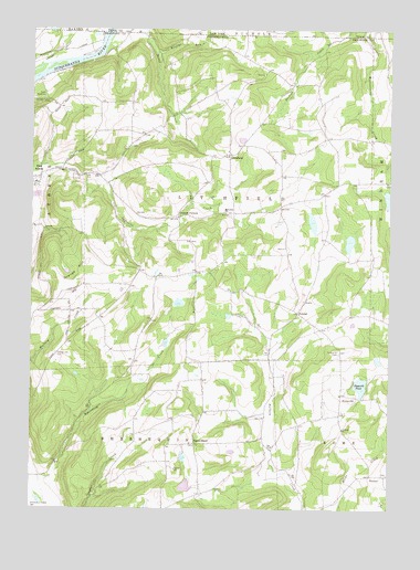
Litchfield, PA USGS Topographic Map
Click on map above to begin viewing in our Map Viewer.

This topographic map contains these locations and features:
Feature Name Type Latitude Longitude GNIS ID View Map
Bayards PondReservoirN41.9073°W76.3845°1168826View Map
Browns RunStreamN41.9937°W76.4555°1170400View Map
BumpvillePopulated PlaceN41.9042°W76.3858°1203186View Map
Bumpville CemeteryCemeteryN41.9158°W76.3920°1170666View Map
Campbell School (historical)SchoolN41.9367°W76.4630°1197334View Map
Chapman School (historical)SchoolN41.9273°W76.4855°1197335View Map
Cottonhollow School (historical)SchoolN41.9526°W76.4488°1197331View Map
Cottons CornersLocaleN41.9512°W76.4477°1172492View Map
Lars/Private AirportAirportN41.9494°W76.4807°1194315View Map
LitchfieldPopulated PlaceN41.9676°W76.4302°1204032View Map
Litchfield Township Volunteer Fire Company Station 26BuildingN41.9833°W76.4366°2653193View Map
Merrill Family CemeteryCemeteryN41.9698°W76.4650°2776461View Map
Merrill School (historical)SchoolN41.9737°W76.4655°1197333View Map
North GhentPopulated PlaceN41.8920°W76.4419°1204300View Map
Orange HillSummitN41.9392°W76.4799°1198294View Map
Orange Hill CemeteryCemeteryN41.9154°W76.4907°1183015View Map
Perry SchoolSchoolN41.9356°W76.4427°1197332View Map
Randolph School (historical)SchoolN41.9104°W76.4147°1197330View Map
Rossi Family CemeteryCemeteryN41.9984°W76.4254°2776486View Map
Sayre ReservoirReservoirN41.9821°W76.4959°1187053View Map
State Line CemeteryCemeteryN41.9989°W76.4670°2776502View Map
Tioga ValleyPopulated PlaceN41.9617°W76.4780°1202034View Map
TownerPopulated PlaceN41.8840°W76.3805°1204823View Map
Towner Hill CemeteryCemeteryN41.8842°W76.3756°2776507View Map
Township of LitchfieldCivilN41.9559°W76.4306°1215983View Map
Trinket CemeteryCemeteryN41.8922°W76.4436°2776508View Map
Trinket Old CemeteryCemeteryN41.8921°W76.4422°2776509View Map
VawterPopulated PlaceN41.9262°W76.4063°1204868View Map
White School (historical)SchoolN41.9573°W76.3988°1197329View Map

Note: Coordinates in the location and feature list above are referenced to NAD83 datum.


Copyright (C) 2008-2025 Ryan Niemi / Sunset Dynamics ... All Rights Reserved