TopoQuest Logo
Do you find TopoQuest useful?
Help keep TopoQuest running and adding new maps/features by donating!
Bitcoin:  19c7KJd3qBynnjoSw5npx9KScwjBe4ifkT
Litecoin:  LXs6TkuXGGXo1vDsWCkWVdjQX94eUKd6ui
Home View Maps Find Maps Find Places Resources & Links


Sayre, Pennsylvania Topographic Map

USGS Map Title: Sayre, PA
USGS Map MRC: 41076H5
DRG (GeoTIFF) Download: o41076h5.tif


Neighboring USGS Topographic Map Quads:


  Wellsburg, NY  
42076A6
 

  Waverly, NY  
42076A5
 

  Barton, NY  
42076A4
 

  Bentley Creek, PA  
41076H6
 

  Sayre, PA  
41076H5
 

  Litchfield, PA  
41076H4
 

  East Troy, PA  
41076G6
 

  Ulster, PA  
41076G5
 

  Towanda, PA  
41076G4


Map MRC Location:

N42°
W77°
N42°
W76°
H8 H7 H6 H5 H4 H3 H2 H1
G8 G7 G6 G5 G4 G3 G2 G1
F8 F7 F6 F5 F4 F3 F2 F1
E8 E7 E6 E5 E4 E3 E2 E1
D8 D7 D6 D5 D4 D3 D2 D1
C8 C7 C6 C5 C4 C3 C2 C1
B8 B7 B6 B5 B4 B3 B2 B1
A8 A7 A6 A5 A4 A3 A2 A1
N41°
W77°
N41°
W76°

Sayre, PA USGS 1:24K Topographic Map Preview:
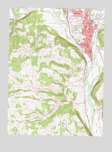
Sayre, PA USGS Topographic Map
Click on map above to begin viewing in our Map Viewer.

This topographic map contains these locations and features:
Feature Name Type Latitude Longitude GNIS ID View Map
Apple CreekStreamN41.8959°W76.5722°1168350View Map
AthensPopulated PlaceN41.9573°W76.5180°1168483View Map
Athens Borough Fire - Diahoga Hose Company 6BuildingN41.9644°W76.5205°2652600View Map
Athens Borough Fire Company Department 1BuildingN41.9651°W76.5168°2653483View Map
Athens Police DepartmentBuildingN41.9650°W76.5167°2777180View Map
Athens Post OfficePost OfficeN41.9576°W76.5182°2772580View Map
Athens Township Police DepartmentBuildingN41.9728°W76.5390°2777075View Map
Athens Township Volunteer Fire Company - Department 24BuildingN41.9726°W76.5356°2653339View Map
Athens Township Volunteer Fire Company SubstationBuildingN41.9604°W76.5053°2653403View Map
Athens-Sayre ReservoirsReservoirN41.9760°W76.5067°1168484View Map
Balsam PondReservoirN41.8867°W76.5503°1168675View Map
Blue Swan Airport (historical)AirportN41.9862°W76.5649°1194320View Map
Borough of AthensCivilN41.9376°W76.5133°1214949View Map
Borough of SayreCivilN41.9855°W76.5207°1214956View Map
Borough of South WaverlyCivilN41.9955°W76.5442°1214957View Map
Buck CreekStreamN41.9117°W76.5191°1170510View Map
Cayuta CreekStreamN41.9834°W76.5066°1200068View Map
Chemung RiverStreamN41.9220°W76.5155°946479View Map
Chemung ValleyValleyN41.9594°W76.5290°1171627View Map
Chemung Valley Landing Strip (historical)AirportN41.9876°W76.5413°1206957View Map
Church of the Redeemer ColumbariumCemeteryN41.9801°W76.5184°2776412View Map
Desmond Street ParkParkN41.9820°W76.5163°1994550View Map
Dry BrookStreamN41.9859°W76.5486°948679View Map
East AthensPopulated PlaceN41.9601°W76.5055°1173719View Map
East Side SchoolSchoolN41.9831°W76.5108°1173873View Map
Elmer Avenue SchoolSchoolN41.9906°W76.5238°1174175View Map
Elmer ParkParkN41.9806°W76.5174°1174176View Map
Epiphany CemeteryCemeteryN41.9809°W76.5276°2776424View Map
Epiphany SchoolSchoolN41.9851°W76.5188°1174291View Map
Fourth Ward SchoolSchoolN41.9773°W76.5211°1175075View Map
Franklin - Flower CemeteryCemeteryN41.9500°W76.5013°2776430View Map
Greater Valley Emergency Medical ServicesBuildingN41.9928°W76.5232°2722247View Map
Greenes LandingPopulated PlaceN41.9309°W76.5249°1203718View Map
Greens Landing Census Designated PlaceCensusN41.9312°W76.5403°2634232View Map
Harris IslandIslandN41.9540°W76.5116°1176575View Map
Hiland FarmLocaleN41.9364°W76.6008°2708343View Map
Huffs CornerPopulated PlaceN41.8879°W76.6066°1203853View Map
Island LakeLakeN41.9839°W76.5211°1177881View Map
Macham DamDamN41.9201°W76.6197°1195859View Map
Macham LakeReservoirN41.9186°W76.6239°1195858View Map
Mallory CreekStreamN41.8987°W76.5124°1180242View Map
McDuffy SchoolSchoolN41.9784°W76.5405°1180703View Map
MilanPopulated PlaceN41.9076°W76.5233°1204170View Map
Milan CemeteryCemeteryN41.8980°W76.5223°1181093View Map
Milan Post OfficePost OfficeN41.9076°W76.5234°2773207View Map
MilltownPopulated PlaceN41.9929°W76.5086°1204185View Map
Murray CreekStreamN41.9298°W76.5216°1182105View Map
Old Athens CemeteryCemeteryN41.9546°W76.5162°2776473View Map
Orcutt CreekStreamN41.9898°W76.6163°1183025View Map
Page SchoolSchoolN41.9695°W76.5199°1183188View Map
Paines IslandIslandN41.9490°W76.5111°1183195View Map
Queen Esther FlatsFlatN41.9154°W76.5202°1184540View Map
Rest CemeteryCemeteryN41.9955°W76.5240°2776481View Map
Robert Packer HospitalHospitalN41.9803°W76.5207°1185202View Map
Round Top Recreation AreaParkN41.9559°W76.5369°1185554View Map
Satterlee CreekStreamN41.9637°W76.5138°1193291View Map
SayrePopulated PlaceN41.9790°W76.5155°1187050View Map
Sayre Fire Department Engine Company 1BuildingN41.9808°W76.5162°2653434View Map
Sayre Fire Department Howard Elmer Hose Company 4BuildingN41.9768°W76.5239°2653435View Map
Sayre Fire Department J E Wheelock Hose Company 5BuildingN41.9924°W76.5094°2652774View Map
Sayre Police DepartmentBuildingN41.9809°W76.5161°2777086View Map
Sayre Post OfficePost OfficeN41.9793°W76.5159°2772961View Map
South WaverlyPopulated PlaceN41.9976°W76.5372°1188119View Map
South Waverly Borough Police DepartmentBuildingN41.9974°W76.5381°2776893View Map
South Waverly Fire Department Station 14BuildingN41.9975°W76.5385°2653398View Map
Spanish HillSummitN41.9959°W76.5494°1188153View Map
State Game Lands Number 239ParkN41.9126°W76.6163°1208333View Map
Stone Lick CreekStreamN41.9901°W76.6174°1188727View Map
Tioga PointCapeN41.9251°W76.5161°1189591View Map
Tioga Point CemeteryCemeteryN41.9725°W76.5275°1189592View Map
Township of AthensCivilN41.9532°W76.5632°1215974View Map
Tutelow CreekStreamN41.9645°W76.5394°1189990View Map
Ukrainian Catholic CemeteryCemeteryN41.9726°W76.5326°2776511View Map
WATS-AM (Sayre)TowerN41.9967°W76.5005°1200519View Map
West AthensPopulated PlaceN41.9487°W76.5222°1204921View Map
WilawanaPopulated PlaceN41.9876°W76.6172°1204949View Map
Wilawana CemeteryCemeteryN41.9879°W76.6190°2776520View Map
Willow Street SchoolSchoolN41.9640°W76.5252°1191511View Map
Wolcott CreekStreamN41.9273°W76.5205°1191646View Map

Note: Coordinates in the location and feature list above are referenced to NAD83 datum.


Copyright (C) 2008-2025 Ryan Niemi / Sunset Dynamics ... All Rights Reserved