TopoQuest Logo
Do you find TopoQuest useful?
Help keep TopoQuest running and adding new maps/features by donating!
Bitcoin:  19c7KJd3qBynnjoSw5npx9KScwjBe4ifkT
Litecoin:  LXs6TkuXGGXo1vDsWCkWVdjQX94eUKd6ui
Home View Maps Find Maps Find Places Resources & Links


Waxhaw, North Carolina Topographic Map

USGS Map Title: Waxhaw, NC
USGS Map MRC: 34080H6
DRG (GeoTIFF) Download: o34080h6.tif


Neighboring USGS Topographic Map Quads:


  Weddington, NC  
35080A7
 

  Matthews, NC  
35080A6
 

  Bakers, NC  
35080A5
 

  Catawba NE, SC  
34080H7
 

  Waxhaw, NC  
34080H6
 

  Monroe, NC  
34080H5
 

  Van Wyck, SC  
34080G7
 

  Unity, SC  
34080G6
 

  Tradesville, SC  
34080G5


Map MRC Location:

N35°
W81°
N35°
W80°
H8 H7 H6 H5 H4 H3 H2 H1
G8 G7 G6 G5 G4 G3 G2 G1
F8 F7 F6 F5 F4 F3 F2 F1
E8 E7 E6 E5 E4 E3 E2 E1
D8 D7 D6 D5 D4 D3 D2 D1
C8 C7 C6 C5 C4 C3 C2 C1
B8 B7 B6 B5 B4 B3 B2 B1
A8 A7 A6 A5 A4 A3 A2 A1
N34°
W81°
N34°
W80°

Waxhaw, NC USGS 1:24K Topographic Map Preview:
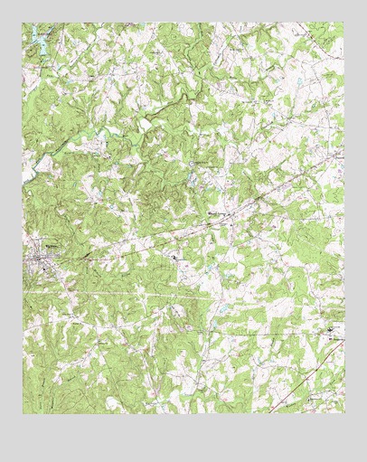
Waxhaw, NC USGS Topographic Map
Click on map above to begin viewing in our Map Viewer.

This topographic map contains these locations and features:
Feature Name Type Latitude Longitude GNIS ID View Map
Aero Plantation AirportAirportN34.9930°W80.7462°997871View Map
Aero Plantation Lake Dam Number OneDamN34.9951°W80.7448°998281View Map
Aero Plantation Lake Dam Number TwoDamN34.9901°W80.7415°998272View Map
Aero Plantation Lake Number OneReservoirN34.9966°W80.7450°998280View Map
Aero Plantation Lake Number TwoReservoirN34.9927°W80.7418°998271View Map
Bates BranchStreamN34.9610°W80.7051°980617View Map
Bethlehem ChurchChurchN34.8793°W80.6387°981203View Map
Bethlehem Church CemeteryCemeteryN34.8801°W80.6390°2776582View Map
Blythe CreekStreamN34.9443°W80.7470°981652View Map
Culvert BranchStreamN34.9979°W80.7206°983838View Map
Eastside Community CemeteryCemeteryN34.9280°W80.7355°2778867View Map
Ebenezer ChurchChurchN34.8974°W80.7206°984585View Map
Ebenezer Church CemeteryCemeteryN34.8973°W80.7208°2776587View Map
Efirds LakeReservoirN34.9901°W80.7448°998274View Map
Efirds Lake DamDamN34.9901°W80.7448°998273View Map
Full Gospel ChurchChurchN34.9535°W80.6781°985489View Map
Glen BranchStreamN34.8793°W80.6651°985723View Map
HoustonPopulated PlaceN34.9574°W80.6281°987173View Map
Howie ChurchChurchN34.9579°W80.7190°987193View Map
Lee BranchStreamN34.9329°W80.6773°988286View Map
Liberty Hill ChurchChurchN34.9899°W80.6962°988433View Map
Little Twelvemile CreekStreamN34.9646°W80.7017°988793View Map
Machine BranchStreamN34.9596°W80.7345°989206View Map
McNeely BranchStreamN34.9251°W80.7242°989632View Map
McWorter CemeteryCemeteryN34.8829°W80.6798°989657View Map
Mineral SpringsPopulated PlaceN34.9379°W80.6687°990047View Map
Mineral Springs Post OfficePost OfficeN34.9381°W80.6701°2774209View Map
Mineral Springs United Methodist Church CemeteryCemeteryN34.9377°W80.6665°2778830View Map
Molly BranchStreamN34.9857°W80.6773°990130View Map
Mount Zion ChurchChurchN34.9740°W80.6545°990631View Map
Mount Zion Church CemeteryCemeteryN34.9741°W80.6546°2778828View Map
Mundys RunStreamN34.9824°W80.7420°990797View Map
Oak Grove ChurchChurchN34.9746°W80.6598°991364View Map
Oak Grove Church CemeteryCemeteryN34.9747°W80.6590°2778829View Map
Parkwood High SchoolSchoolN34.9015°W80.6306°1024852View Map
Piney Grove ChurchChurchN34.9063°W80.7301°992337View Map
Piney Grove Church CemeteryCemeteryN34.9064°W80.7312°2776589View Map
Pleasant Grove ChurchChurchN34.9551°W80.6837°992467View Map
Price Mill CreekStreamN34.9846°W80.6803°992812View Map
Secrest Grove ChurchChurchN34.9960°W80.6392°994474View Map
Thompson ChapelChurchN34.9357°W80.6734°996051View Map
Town of Mineral SpringsCivilN34.9412°W80.6842°2406168View Map
Town of WaxhawCivilN34.9363°W80.7431°2406844View Map
Township of JacksonCivilN34.8764°W80.7242°1027243View Map
Township of Sandy RidgeCivilN34.9884°W80.7343°1027248View Map
Underwood CreekStreamN34.9651°W80.6745°996413View Map
UnionPopulated PlaceN34.9815°W80.7234°996415View Map
Union Emergency Medical ServicesBuildingN34.9308°W80.7441°2720488View Map
Walker CemeteryCemeteryN34.9013°W80.6820°996694View Map
WaxhawPopulated PlaceN34.9246°W80.7434°996880View Map
Waxhaw ChurchChurchN34.9038°W80.7262°996882View Map
Waxhaw Church CemeteryCemeteryN34.9037°W80.7254°2776588View Map
Waxhaw City CemeteryCemeteryN34.9182°W80.7380°2776590View Map
Waxhaw Post OfficePost OfficeN34.9327°W80.7483°2774379View Map
Waxhaw Volunteer Fire Department and Rescue Station 18BuildingN34.9255°W80.7433°2639708View Map
Wesley Chapel CemeteryCemeteryN34.9910°W80.6640°996970View Map
Wesley Chapel Volunteer Fire Department Station 26BuildingN34.9952°W80.6996°2638641View Map
Western Union SchoolSchoolN34.9249°W80.6909°997063View Map

Note: Coordinates in the location and feature list above are referenced to NAD83 datum.


Copyright (C) 2008-2024 Ryan Niemi / Sunset Dynamics ... All Rights Reserved